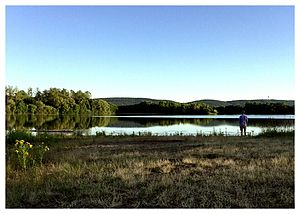
Gevattersee
| Gevattersee | ||
|---|---|---|

|
||
| recorded on June 30, 2015 by MB90 | ||
| Geographical location | Bückeburg , Schaumburg district , Lower Saxony | |
| Location close to the shore | Minden , Porta Westfalica , Bückeburg | |
| Data | ||
| Coordinates | 52 ° 16 '45 " N , 8 ° 58' 47" E | |
|
|
||
| length | 1.2 km | |
| width | 500 m | |
| Maximum depth | 6 m | |
| Middle deep | 3.5 m | |
|
particularities |
||
The Gevattersee is a quarry pond near Bückeburg , Schaumburg district , Lower Saxony . The lake is located about 3 km northwest of Bückeburg near Dankersen , a district of Minden . They are two lakes separated by a narrow dam. The border with North Rhine-Westphalia runs directly along the northern bank.
The western lake is called Gevattersee or Gevattersee I, the eastern and with 19 hectares somewhat smaller lake Gevattersee II or Gevattersee 2. Until 2010 the lake was used extensively for bathing, but bathing was forbidden due to the excessive waste problem.
The Gevattersee II is used by the Fischereiverein Schaumburg-Lippe eV. The surf club Gevattersee operates a surf school.
See also
Web links
- Fischereiverein Schaumburg-Lippe eV
- Surf club Gevattersee
- www.anglermap.de: Water profile Gevattersee II
Individual evidence
- ↑ Schaumburger Nachrichten of July 6, 2010
