Gottwollshausen
|
Gottwollshausen
City of Schwäbisch Hall
Coordinates: 49 ° 7 ′ 26 ″ N , 9 ° 43 ′ 5 ″ E
|
|
|---|---|
| Height : | approx. 350 m |
| Residents : | 930 |
| Postal code : | 74523 |
| Area code : | 0791 |
Gottwollshausen ( center Gottwollshausen ) is a district in the Schwäbisch Hall district of Gailenkirchen .
geography
The hamlet of Gottwollshausen is located about one and a half kilometers northwest of the town center of Schwäbisch Hall on the left hilly edge of the Kochertal and partly in the valley of the Schleifbach , which is already noticeably deepened here and drains the nearby south-east step edge of the Waldenburg mountains in the west of the village. East of today's outskirts, an abandoned quarry opens up the local shell limestone at the smaller incision in the ear blade . The older districts lie along an east loop of the old K 2576 route (Brunnenteichstraße), which leads down here via a small path into the Schleifbach valley; in the meantime the Haller western bypass, which runs some distance west of the hamlet, bears this name. The Heilbronn – Crailsheim railway touches the northern edge of the town and then descends in its east partly through a tunnel into the Kocher valley; Gottwollshausen has no breakpoint.
history
In the past, the name of the place Gottwollshausen experienced more or less strong changes. He appeared as Gottwaltzhusin in 1277 , as Gutewoldeshusen in 1285 and as Gotboldeshausen in 1304 (after the first settler Gotebold). The current spelling is obviously distorted. Gottwolshausen was written in the 19th century and into the 20th century .
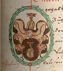
Gottwollshausen used to be the seat of the von Gottwollshausen, who were occupied in 1270 and whose line ended in 1431. Her coat of arms shows a golden male head on a black background.
At Gottwollshausen, during the Peasants' War, a contingent from Hall on April 4, 1525 drove a peasant army apart in a bloodless battle. In 1838 Gottwollshausen had 194 inhabitants. In 1847 Gottwollshausen was named as a “hamlet with 199 Protestant inhabitants”.
After the Second World War , many refugees were taken in and settled in Gottwollshausen .
In the course of the following decades the place expanded more and more and developed into a residential area that can be reached without a car thanks to the good bus connection from Schwäbisch Hall. You can walk to the city in a good quarter of an hour via the Gottwollshaus Steige .
Gottwollshausen was part of the old community of Gailenkirchen until it was incorporated in 1972 . The current population is around 930 people.
Worth seeing
Village church
In the village, on a small hill next to the thoroughfare, stands the late Gothic church of St. George .
Streiflesberg
About one and a half kilometers southwest of the village on the other side of the Breiteichsee lies the Burgstall Streiflesberg in the lower hillside forest.
Breiteich
⊙ West of the village is close to the forest's edgenatural monumentbroad gauge(ND no. 81270760011), also called "Big wide oak". It is one of the few oaks whose branches are supported. The monumental tree veteran has a chest circumference of 7 meters and a height of 19 meters.
⊙ About half a kilometer to the south is the "Kleine Breiteiche" (small broad oak), also designated as a natural monument (ND no. 81270760004).
Individual evidence
- ^ Albert Fischer: Geography, statistics and topography of the Kingdom of Würtemberg and the principalities of Hohenzollern-Hechingen and Simaringen . Pech and Fränkel, Stuttgart 1838, p. 124.
- ↑ Gottwollshausen on the site of the city of Schwäbisch Hall
- ^ Entry in the directory of monumental oaks . Retrieved January 22, 2016
literature
- Eugen Gradmann : The art and antiquity monuments of the city and the Oberamt Schwäbisch-Hall . Paul Neff Verlag, Esslingen a. N. 1907, OCLC 31518382 , pp. 96-97 ( archive.org ).
Web links
- Portrait of Gottwollshausen on the Gottwollshausen primary school website
- Map of Gottwollshausen on: State Institute for the Environment Baden-Württemberg (LUBW) ( Notes )


