Gouin reservoir
| Reservoir Gouin / Barrage Gouin | |||||
|---|---|---|---|---|---|
|
|||||
|
|
|||||
| Coordinates | 48 ° 38 '1 " N , 74 ° 54' 23" W | ||||
| Data on the structure | |||||
| Construction time: | 1916-1918 | ||||
| Height of the barrier structure : | 26 m | ||||
| Crown length: | 502 m | ||||
| Power plant output: | 0.6 MW | ||||
| Operator: | Hydro Quebec | ||||
| Data on the reservoir | |||||
| Altitude (at congestion destination ) | 404 m | ||||
| Water surface | 1 302 km² | ||||
| Reservoir length | 102 km | ||||
| Reservoir width | 48 km | ||||
| Storage space | 8570 million m³ | ||||
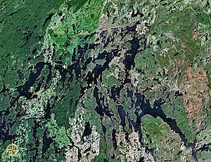
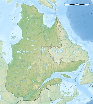
The Gouin Reservoir (French Réservoir Gouin , English Gouin Reservoir ) is a large reservoir in the Canadian province of Québec . It is roughly equidistant from Ottawa , Montréal and the city of Québec .
The reservoir is widely branched and has many islands, peninsulas and bays. The shoreline is more than 5600 km long, the average water depth is only 5.5 m. The water surface is about 1302 km² with normal damming. The Saint-Maurice river rises from the reservoir. It was named after Lomer Gouin , Prime Minister of Québec from 1905 to 1920.
The Barrage Gouin ( ⊙ ) has a height of 26 m and a length of 502 m. It was completed in 1918. At the reservoir there is a small hydroelectric power station with two turbines of 300 kW each . From 1918 the Shawinigan Water and Power Company used the reservoir to regulate the flow of water to the power plants further downstream. All plants have been operated by Hydro-Québec since 1963 .
The “La Loutre” dam, a gravity dam, located further down , is rather small at 16 m high. There are no paved roads to the reservoir, only forest roads and the possibility to get there by plane. The reservoir is very rich in fish and popular with anglers.
See also
Web links
- Réservoir Gouin ( English, French ) In: The Canadian Encyclopedia .
- Le barrage de la Loutre: l'ambition de la démesure
- Teneurs en mercure dans les poissons du réservoir Gouin en 2002 (with site plans)
- Saint-Maurice Water Resource System
- World Lakes
Individual evidence
- ^ A b Commission de toponymie du Québec - Réservoir Gouin
- ^ Commission de toponymie du Québec - Barrage Gouin

