Grapenwerder
| Grapenwerder | |
|---|---|
|
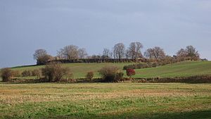
View to the castle wall |
|
| Creation time : | 7th to 9th centuries |
| Castle type : | Hilltop castle |
| Conservation status: | Castle plateau, access gate |
| Place: | Penzlin |
| Geographical location | 53 ° 31 '5 " N , 13 ° 5' 25" E |
The Grapenwerder castle wall is located a good kilometer north of the small town of Penzlin in the Mecklenburg Lake District .
The one-part Slavic rampart lies on a prominent hill in the surrounding lowlands. You can call it a hilltop castle . The diameter of the oval system is up to 160 m. The castle no longer has any visible ramparts, but an access gate in the northeast. There was also an outer bailey here . The inner area of the castle has been used for agriculture for a long time. Finds from Grapen gave the castle its current name. Coins are also said to have been found here. Judging by the pottery found, the castle existed in the Old to Middle Slavic period from the 8th to 11th centuries. Early German shards suggest that the old castle complex was resettled in the Christian Middle Ages . Just a few hundred meters to the northeast is another Slavic castle, the so-called Fischerwall .
literature
- Joachim Herrmann and Peter Donat : Corpus of archaeological sources on early history in the area of the German Democratic Republic. 2. Delivery, Textband, Berlin 1979, pp. 566-567.
