
Great holy lake
| Great holy lake | ||
|---|---|---|

|
||
| Großer Heiliger See - swimming area on the south bank | ||
| Geographical location | Central Europe , Germany , Brandenburg | |
| Tributaries | two nameless streams | |
| Drain | to the ragose | |
| Places on the shore | Sand pitcher (Chorin) | |
| Location close to the shore | Chorin | |
| Data | ||
| Coordinates | 52 ° 52 '53 " N , 13 ° 52' 1" E | |
|
||
| surface | 0.112 | |
| scope | 1.2 | |
| Maximum depth | 11 m | |

The Great Sacred Lake is located in the village of Sandkrug , which belongs to the Britz-Chorin-Oderberg office . It is located in the Schorfheide-Chorin Biosphere Reserve . The Heilige See is part of the Eberswalder Stadtseerinne on the edge of the Choriner terminal moraine . The lake has a maximum depth of 11 meters and is about 11.2 hectares in size. The lake was bought by NABU in December 2008 .
See also

The lake is dammed up by beavers, trees near the banks die

Beaver feeding on the bank
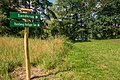
Signposted hiking trail around the lake


Web link
Commons : Great Sacred Lake - Collection of Images