Grotto de la Cascade
| Grotte de la Cascade (Grotte de Môtiers)
|
||
|---|---|---|
| Location: | Canton of Neuchâtel , Switzerland | |
|
Geographic location: |
537 608 / 195.27 thousand | |
|
|
||
| Type: | Karst cave system | |
| Particularities: | one of the longest caves in the canton of Neuchâtel | |
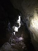
The Grotte de la Cascade (also: Grotte de Môtiers ) is a cave located in Môtiers in the municipality of Val-de-Travers in the Swiss canton of Neuchâtel . The name comes from the waterfall of the Riaux stream in front of the entrance to the cave. The grotto is one of the longest caves in the canton of Neuchâtel. A plaque at the entrance to the grotto reminds that it was already visited by Jean-Jacques Rousseau between 1762 and 1765.
Cave system
The cave has two main entrances at the waterfall and at the exit of the Sourde River. The two cave galleries are connected by two siphons . The cave system was formed by underground rivers in the limestone .
Parts of the cave have not yet been explored as further exploration requires diving. Cables and conductors are therefore permanently installed inside the cave in order to transport the material for the dives to the large siphon after the so-called mud lake. In the spring of 2013, a cave explorer was locked in the cave for 48 hours due to strong water ingress and had to be rescued with an extensive rescue operation. The galleries at the entrance to the cave are not flooded even in heavy rainfall.
Individual evidence
- ↑ Val-de-Travers: Môtiers waterfall. Retrieved February 15, 2017 .
- ^ Rousseau in Môtiers on neuchateltourisme.ch. Retrieved March 11, 2017 .
- ^ Cave explorers saved , article from April 13, 2013 on Swiss radio and television


