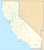
Oakland Harbor
| Oakland Harbor | |||
|---|---|---|---|
| Data | |||
| UN / LOCODE | USOAK | ||
| Port type | seaport | ||
| website | Port website | ||
| Geographic information | |||
| place | Oakland | ||
| State | California | ||
| Country | United States | ||
| Oakland Harbor | |||
| Coordinates | 37 ° 47 '44 " N , 122 ° 17' 5" W | ||
|
|||
The port of Oakland ( English Port of Oakland ) is an American seaport in Oakland (California) in the Bay of San Francisco . The port facilities with 20 piers are located in the northwest of the city and were officially opened in 1927. The deepwater port provides 50,000 jobs in Northern California .
In 2014, 18.9 million tn. sh. Goods handled. In 2014 it was 33rd in the United States. In 2008, the throughput of ships was 1,928 vehicles and the volume of containers handled was 2.24 million TEU .
Web links
Commons : Port of Oakland - Collection of Images, Videos and Audio Files
Individual evidence
- ↑ Port of Oakland ( Memento of the original from June 15, 2003 in the Internet Archive ) Info: The archive link was inserted automatically and has not yet been checked. Please check the original and archive link according to the instructions and then remove this notice. About Us. Accessed May 7, 2012.
- ^ Tonnage of Top 50 US Water Ports, Ranked by Total Tons. United States Department of Transportation. Retrieved August 29, 2017 (American English).

