
Half Moon Island
| Half Moon Island | ||
|---|---|---|
 |
||
| Waters | McFarlane Strait | |
| Archipelago | South Shetland Islands | |
| Geographical location | 62 ° 35 '24 " S , 59 ° 54' 36" W | |
|
||
| length | 1.9 km | |
| width | 1.9 km | |
| surface | 51 ha | |
| Highest elevation |
Gabriel Hill 101 m |
|
| Residents | uninhabited | |
| main place |
Cámara station ( Argentine summer station) |
|
 |
||

Half Moon Island ( German "Halbmondinsel" ) is a small, sub-Antarctic island in the archipelago of the South Shetland Islands . It is located 1,300 meters northwest of Livingston Island in the McFarlane Strait , which separates Livingston from Greenwich Island . Half Moon Island is about 120 km away from the Antarctic Peninsula .
The crescent-shaped island represents the crater rim of a former volcano . While the southern and northern areas of the island are mountainous and rise up to a height of 101 m, the central part extends only a few meters above sea level. In this area, at Meguante Cove , Argentina has been operating an Antarctic research base, the Cámara station, since 1955 .
Half Moon Island is home to numerous sea birds such as the chinstrap penguin ( Pygoscelis antarctica ), the Dominican gull ( Larus dominicanus ) and the arctic tern ( Sterna paradisaea ).
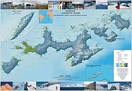
Topographic map

South Shetland Islands

Penguins with M / S Discovery


.jpg)
map
- LL Ivanov: Antarctica: Livingston Island and Greenwich, Robert, Snow and Smith Islands . Topographic map on a scale of 1: 120,000. Manfred Wörner Foundation, Troyan, 2009. ISBN 978-954-92032-6-4