Hargreaves Peak
| Hargreaves Peak | ||
|---|---|---|
|
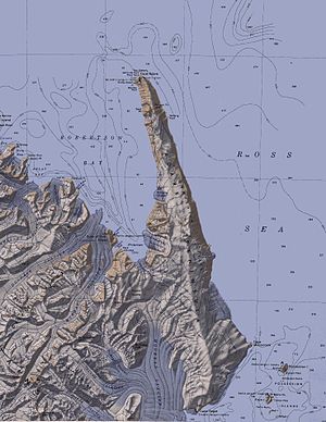
Topographic map of the Adare Peninsula with Hargreaves Peak (unnamed here and marked with an altitude of 2083 m) |
||
| height | 2083 m | |
| location | Victoria Land , East Antarctica | |
| Coordinates | 71 ° 37 '15 " S , 170 ° 33' 5" O | |
|
|
||
The Hargreaves Peak is a 2,083 m high mountain in the East Antarctic Victoria Land . It is the highest point on the Adare Peninsula and rises to the west and above the Downshire cliffs and east of Nameless Glacier .
The New Zealand Geographic Board named him in 2008 after Paul Hargreaves (1939-2014), who was a member of this body from 2001 to 2008 and from 1956 to 1957 as a cadet on board the HMNZS Hawea in New Zealand's first scientific expedition to the Antarctic.
Web links
- Hargreaves peak in the Geographic Names Information System of the United States Geological Survey (English)
- Hargreaves Peak on geographic.org (English)

