Herschel Island - Qikiqtaruk Territorial Park
|
Herschel Island - Qikiqtaruk Territorial Park
|
||
|
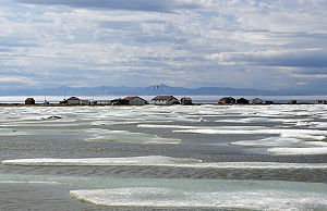
The former whaling settlement Pauline Cove on Herschel Island |
||
| location | Yukon (Canada) | |
| surface | 112.87 km² | |
| WDPA ID | 18666 | |
| Geographical location | 69 ° 35 ′ N , 139 ° 5 ′ W | |
|
|
||
| Setup date | July 30, 1987 | |
| administration | Yukon parks | |
The Herschel Island - Qikiqtaruk Territorial Park is a 112.87 km² provincial park off the coast of the Canadian Yukon Territory in the Beaufort Sea , east of the estuary of the Firth River . The park represents the northernmost point of the territory and is also the oldest of the Territorial Parks in the Yukon .
The park is an IUCN Category II ( National Park ) protected area .
Due to its remote location, the park was only visited by around 400 to 600 visitors annually from 1990 to 2005, with individual years having more or fewer visitors. The park is along with the Vuntut National Park and Ivvavik National Park on the tentative list for inclusion as World Heritage in Canada .
investment
The park is located north of the Arctic Circle on the island of Herschel Island , around 5 km off the coast of the mainland. The park takes up the entire area of the island and thus has an extension of around 18 km in length and a maximum width of around 11 km. In the former Pauline Cove settlement there is a park ranger station in the summer months. On the mainland, the island is opposite the Ivvavik National Park.
history
Like many parks in Canada, this one has a history that did not begin when it was discovered by Europeans. When the island was discovered by Sir John Franklin in 1826 and named after his friend the scientist Sir John Herschel , there were still three Inuvialuit (Kigirkenaugmiut) settlements there . With the expansion of whaling further and further north, whalers later settled on the island in the Pauline Cove settlement . Before that, traders and hunters had already settled there. A Hudson's Bay Company trading post was later added. With the closure of the branch in 1937, the island began to decline and more and more residents left it. With the establishment of the park in 1987, based on the Inuvialuit Final Agreement , the last permanent residents had to leave the island.
Flora and fauna
The landscape of the park is characterized by arctic tundra . Over 200 different plants can be found on the island. In larger mammals, a small group of caribou (Barrenground caribou ( Rangifer tarandus groenlandicus )) and occasionally musk ox can be found on the island . The island is also visited by grizzly bears and polar bears in winter . According to the park administration, there are still 94 species of birds on the island, including the snowy owl , the buzzard , the peregrine falcon and the sku .
Web links
- Official website (English).
Individual evidence
- ↑ World Database on Protected Areas - Qikiqtaruk (Herschel Island) Natural Environment Park (English)
- ↑ a b Herschel Island - Qikiqtaruk Territorial Park Management Plan. (PDF; 792.23 KB) Yukon Environment , September 2006, accessed on June 11, 2015 (English).


