Hilla
| Hilla | ||
|---|---|---|
| location | ||
|
|
||
| Coordinates | 32 ° 29 ′ N , 44 ° 26 ′ E | |
| Country |
|
|
| Governorate | Babil | |
| Basic data | ||
| height | 34 m | |
| Residents | 289,714 (2005) | |
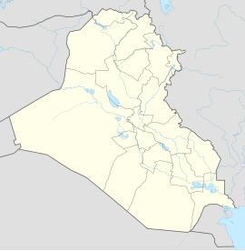
Hilla ( Arabic الحلّة, DMG al-Ḥilla ) is a city in Iraq . It is located 100 km south of Baghdad in the province of Babil and has a population of 289,714 (as of January 1, 2005). Ancient ruins such as Babylon , Borsippa , Alberes and Kiš are located near Hilla . The grave of the Jewish prophet Ezekiel is said to be in a village near Hilla.
Hilla is located in an agricultural area. Due to extensive irrigation, several types of grain, fruits and raw materials for textiles grow here.
Hilla was founded in 1101 and was an important administrative city during the Ottoman and British rule. Hilla voluntarily submitted to the Mongols in 1260 and was thus largely spared the destruction of the Mongol invasion, Hülegü even sponsored the Shiite scholars. This gave rise to a school of scholars that was outstanding in the Middle Ages, from which al-Hillī, among others, came from.
After the First World War, bloody battles against the British army took place in Hilla in 1920. 300 men of the Manchester regiment were massacred in the city.
In 2003 Hilla was a scene of the Iraq war . Since then there have been suicide attacks in the city. For example, on March 6, 2016, a car bomb exploded in the city, killing 60 people. The terrorist organization IS claimed responsibility for the attack . On November 24, 2016, a car bomb exploded in the city, killing 100 people, most of them Iranian Shiite pilgrims. The terrorist organization IS claimed responsibility for the attack .
Individual evidence
- ↑ Bertold Spuler: The Mongols in Iran. Akademie-Verlag, Berlin 1954, p. 242.
- ↑ News at de.euronews.com
- ↑ Suicide Truck Bomb Kills More Than 80 in Iraq, Most of Them Iranian Pilgrims . In: The New York Times . November 24, 2016.
