
Hobulaid
| Hobulaid | ||
|---|---|---|
| Waters | Baltic Sea | |
| Geographical location | 58 ° 56 '0 " N , 23 ° 23' 0" E | |
|
||
| surface | 75 ha | |
| Highest elevation | 6.6 m | |

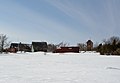
Hobulaid ( Swedish Hästholm ) is an Estonian island in the Baltic Sea .
Hobulaid is located between Vormsi Island and the Rohuküla ferry port ( Haapsalu municipality ) on the mainland. The island was first mentioned in a document in 1391. In the Middle Ages it belonged to the bishop's castle of Haapsalu.
Hobulaid has an area of 75 hectares. The highest point is 6.6 m above sea level. The northern part of the island forms an Os landscape . Alders and junipers grow on the island .
There is a 13 m high lighthouse on Hobulaid. The current structure dates from 1934.
In the vicinity of Hobulaid are the small islands of Obholmsgrunne (Swedish : Upholm ), Odrarahu and Varsarahu.

Hobulaid South Beacon
Hobulaid

