Vormsi
| Vormsi | ||
|---|---|---|
| The island church in the village of Hullo | ||
| Waters | Baltic Sea | |
| Archipelago | Moonsund Islands | |
| Geographical location | 59 ° 0 ′ N , 23 ° 13 ′ E | |
|
|
||
| length | 16.2 km | |
| width | 10.7 km | |
| surface | 91 km² | |
| Highest elevation | (Mound near Huitberg) 13 m |
|
| Residents | 350 3.8 inhabitants / km² |
|
| main place | Hullo | |
| Situation map | ||
Vormsi ( German Worms , Swedish Ormsö , Estonian Swedish Årmse ) is the fourth largest island in Estonia with 92 km² .
description
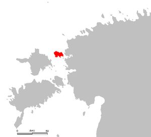
Vormsi is one of the Moonsund Islands . The island is located between the second largest Estonian island Hiiumaa and the Noarootsi peninsula . They are separated from the mainland by the three-kilometer-wide Wose Sound (Voosi kurk) .
Today Vormsi is inhabited by around 350 people. In summer, a ferry runs from the village of Sviby two to five times a day to the port of Rohulüla near Haapsalu on the Estonian mainland, ten kilometers away .
The Estonian name of the island is derived from the Swedish Ormsö ("snake island "). Swedes have settled on the island since the 13th century . By the Second World War , the number of residents rose to 3,000. In 1944, almost all of the inhabitants of Swedish descent fled the advance of the Red Army across the Baltic Sea to Sweden .
The place names still bear witness to the island's Swedish past: the fourteen island villages are called Borrby , Diby , Fällarna , Förby , Hosby , Hullo , Kersleti , Norrby , Rälby , Saxby , Sviby , Söderby and Suuremõisa (Vormsi) .
In Hullo , the island's capital, there is the church, built in 1632, and a cemetery with several centuries-old stone crosses. The island's lighthouse, built in 1864, is in Saxby in the northwest .
literature
- Wikisource: Die Gartenlaube: Auf der Insel Worms , 1878, Heft 15, S. 254. - Sources and full texts
- Madis Kanarbik: Ormsö. De estlandssvenska böndernas kamp mot godsägarna under 1700- och 1800-talet (= Nordistica Tartuensia. Vol. 9). Tartu Ülikool, Tartu 2003, ISBN 9985-4-0368-1 .
- Margareta Hammerman (Ed.): Ormsö kyrkokrönika. = Vormsi kirikukroonika. 1539-1944. Vormsi Kiriku Fond, Stockholm u. a. 2007, ISBN 978-9949-15-403-6 .


