Hootalinqua
| Hootalinqua | ||
|---|---|---|
 The Norcom |
||
| Location in Yukon | ||
|
|
||
| State : |
|
|
| Territory : | Yukon | |
| Coordinates : | 61 ° 35 ′ N , 134 ° 55 ′ W | |
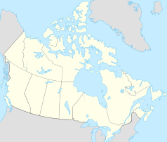
Hootalinqua is a village in the Canadian Yukon Territory at the confluence of the Teslin and Yukon Rivers . The name Hootalinqua is derived from the language of the Northern Tutchone . They called this traditional meeting and trading place for Northern and Southern Tutchone as well as Inland Tlingit Hudinlin (running against the mountain).
As with many other traditional Indian camps or settlements, this was overrun by white fortune seekers during the Klondike gold rush , who immediately set up a gold digger settlement here. The Indian families, who once went out there to fish and hunt, hired themselves out to the gold prospectors as cheap laborers, hunted for them and now felled wood for the paddle steamers traveling along the river . Today you can see restored cabins from the earlier settlement and the wood yard and there is also a camp with an outhouse for river walkers . Due to the space available, the storage space is ideal for larger groups. If you cross a small stream, you can also get to a small cemetery. There are tombs of whites and Indians.
Just below Hootalinqua is Shipyard Island , where the wreck of the paddle steamer Evelyn lies. This ship transported people on the Yukon. It was later sold and renamed Norcom . A little later the ship ran aground and the hull was damaged. Society didn't find it profitable enough to fix it, and the Evelyn has been at the shipyard ever since .
Web link
- Yukon River. Km 145 - Hootalinqua Island ( Memento of July 18, 2011 in the Internet Archive )
