Hoye Crest
| Hoye Crest | ||
|---|---|---|
|
The summit cross on the Hoye Crest |
||
| height | 1020 m | |
| location | Garrett County , Maryland | |
| Mountains | Backbone Mountain , Allegheny Mountains | |
| Coordinates | 39 ° 14 ′ 14 ″ N , 79 ° 29 ′ 9 ″ W | |
|
|
||
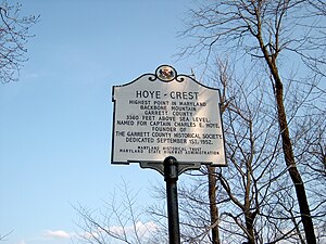
The Hoye Crest , with its 1020 meters the highest mountain of Garrett County and the State of Maryland . The mountain is located near the West Virginia border . There is a marker board on its summit , which gives precise information about the elevation.
Web links
- Hoye-Crest on Peakbagger.com (English)
- http://www.summitpost.org/backbone-mountain/152048

