Hunter Island (Tasmania)
| Hunter Island | ||
|---|---|---|
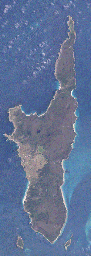
| Hunter Island satellite image | ||
| Waters | Bass Street | |
| Archipelago | Fleurieu group | |
| Geographical location | 40 ° 31 ′ S , 144 ° 45 ′ E | |
|
|
||
| length | 23 km | |
| width | 4 km | |
| surface | 71 km² | |
| Residents | uninhabited | |
Hunter Island is an island in the southwestern part of the Bass Strait between Victoria and the island of Tasmania in southeastern Australia . It is located southwest of Three Hummock Island about 5 kilometers off the northwest coast of Tasmania.
Traces of settlement have been found in the island's Cave Bay cave, estimated to be 22,800 years old. Back then, the island was connected to Tasmania because of the drop in sea levels due to the Wisconsin Ice Age .
Near the south coast of Hunter Island are the uninhabited islands of Bird Island in the west and Stack Island in the east.
swell
- ↑ Flora and Vegetation of Tasmania: Human Settlement History ( Memento from September 30, 2007 in the Internet Archive )

