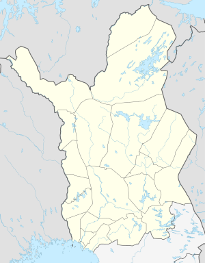
Iijärvi (Näätämöjoki)
| Iijärvi | ||
|---|---|---|
| Geographical location | Inari municipality in Lapland ( Finland ) | |
| Drain | Näätämöjoki | |
| Location close to the shore | Inari | |
| Data | ||
| Coordinates | 69 ° 28 ′ 0 ″ N , 27 ° 53 ′ 0 ″ E | |
|
|
||
| Altitude above sea level | 193.3 m | |
| surface | 36.88 km² | |
| volume | 0.303 km³ | |
| Maximum depth | 36.47 m | |
| Middle deep | 8.2 m | |
| Catchment area | 744 km² | |
The Iijärvi ( North Sami Idjajávri , Inari Sami Ijjävri , skoltsamisch Iijäu'rr ) is a lake in the municipality of Inari in Finnish landscape Lapland .
The Iijärvi is about 70 km north of Inari . The lake has an area of 36.88 km² and is at an altitude of 193.3 m. The length of the lake is 21 km, the width of the lake 2 km.
The Näätämöjoki river leaves the lake at its northern end and flows to the Varangerfjord . The Iijärvi lies on the southern edge of the Kaldoaivi wilderness area .
