Isla San Marcos
| San Marcos | ||
|---|---|---|
|
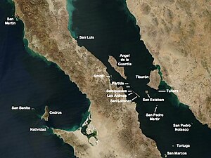
Satellite map showing the islands to the north of the Gulf of California San Marcos is the southernmost island below |
||
| Waters | Gulf of California | |
| Geographical location | 27 ° 12 '36 " N , 112 ° 4' 12" W | |
|
|
||
| length | 8 kilometers | |
| width | 4 km | |
| surface | 28.748 km² | |
| Residents | 425 (2005) 15 inhabitants / km² |
|
| main place | San Marcos | |
Isla San Marcos is a Mexican island in the Gulf of California . Administratively it belongs to the municipality ( municipio ) Mulegé of the state of Baja California Sur ("Southern Baja California ").
geography
Isla San Marcos is 25 km southeast of Santa Rosalía , the main town of the municipality on the Baja California peninsula ; the southern tip of the island is only 4.5 km off the coast of the peninsula. It is the second most northerly island of this state in the Gulf of California after the island of Tortuga, which is almost 30 km further northeast . The arid and mountainous island is 8 km long in north-south direction, up to 4 km wide in east-west direction and has an area of 28.75 km². On the southwest coast there is a mining settlement of the same name; it is located in an area where large areas of gypsum are mined by the Compañía Occidental Mexicana SA de CV (COMSA) . The settlement also includes a 366 m long, T-shaped pier for shipping the plaster, as well as an airfield privately operated by the mining company on Bahía Puerto Viejo . With 394 permanent residents (as of 2010), San Marcos is the only permanently inhabited island in the Gulf of California.
Web links
- A map of Isla San Marcos
- Homepage of the mining company with numerous pictures from the south of the island
Individual evidence
- ↑ Sailing Directions (enroute), Pub. 153 (PDF; English; 3.3 MB) (Accessed January 17, 2011)
- ↑ SEDESOL : Catálogo de Localidades (Spanish) (Accessed December 30, 2016)

