Isla San Pedro Nolasco
| San Pedro Nolasco | ||
|---|---|---|
| Isla San Pedro Nolasco | ||
| Waters | Gulf of California | |
| Geographical location | 27 ° 58 '5 " N , 111 ° 22' 44" W | |
|
|
||
| length | 4.2 km | |
| width | 1.2 km | |
| surface | 3.5 km² | |
| Highest elevation | 362 m | |
| Residents | uninhabited | |
|
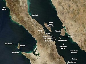
The islands to the north of the Gulf of California San Pedro Nolasco is lower right |
||
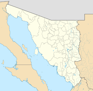
Isla San Pedro Nolasco is an uninhabited Mexican island in the Gulf of California . The island belongs administratively to the municipality ( municipio ) Guaymas of the state of Sonora . It is named after Saint Peter Nolascus ( Spanish: Pedro Nolasco ), the founder of the Mercedarian order.
geography
The island is comparatively isolated 12 km off the coast of Sonora and 52 km west of Guaymas , the main town of the municipality. San Pedro Nolasco is 4.2 km long, up to 1.2 km wide and has an area of 3.5 km². The mountainous, arid and barren island reaches a height of 362 m above sea level. It was home to the endemic and now extinct Pemberton deer vole ( Peromyscus pembertoni ).
Web links
- A photo of the island on flickr
- A photo gallery with underwater pictures in front of San Pedro Nolasco
Individual evidence
- ↑ Sailing Directions (enroute), Pub. 153 (PDF (2.49 MB); English) (Accessed January 21, 2011)


