Itarare
| Itarare | |
|---|---|
|
Coordinates: 24 ° 7 ′ S , 49 ° 20 ′ W
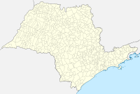
Itarare on the map of Sao Paulo
|
|
| Basic data | |
| Country | Brazil |
| State | São Paulo |
| City foundation | August 28, 1893 |
| Residents | 47,934 (IBGE / 2010) |
| City insignia | |
| Detailed data | |
| surface | 1,003.860 km² |
| height | 750 m |
| Time zone | UTC −3 |
| City Presidency | Heliton Scheidt do Valle ( MDB ) |
| Location of the municipality of Itararé in the state of São Paulo | |
Itararé is a city in the Brazilian state of São Paulo . It had an estimated 50,360 inhabitants in 2018.
geography
Itararé extends over 1005.8 km² at an altitude of 740 m and is about 340 km from São Paulo .
history
The name Itararé is derived from the Tupi language .
In 1963, Cistercian women sent by the Oberschönenfeld Monastery founded a monastery here.
economy
The region is considered the center of the paper industry .
Sons and daughters
- Marcos Guilherme (* 1995), football player
- Mário Antônio da Silva (* 1966), Catholic clergyman, Bishop of Roraima
Individual evidence
- ↑ a b IBGE to Itararé. Retrieved June 2, 2019 .


