Ituri rainforest
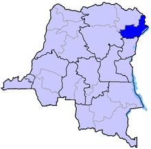
The Ituri Rainforest is a rainforest area in the Orientale Province in eastern DR Congo . The area is named after the Ituri River flowing through the rainforest , which first flows into the Aruwimi and then into the Congo .
The area covers about 63,000 km² and lies between 0 ° and 3 ° N, as well as 27 ° and 30 ° E. The Ituri rainforest is at an altitude of about 700 to 1,000 m. The average temperature is around 31 ° C and the average humidity is around 85%.
About a fifth of the forest is protected by the UNESCO World Heritage Okapi Wildlife Reserve . The easternmost foothills of the Ituri rainforest reach Uganda and are protected there by the Semliki National Park . The forest is also home to the Mbuti pygmies . It was first crossed in 1887 by a European, the Africa explorer Henry Morton Stanley on his Emin Pasha expedition.
Web links
- Ituri Forest in the Encyclopædia Britannica (English)
Coordinates: 1 ° 33'25 " N , 28 ° 26'56" E

