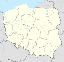
Jewish Cemetery (Kobyla Góra)
Coordinates: 51 ° 22 ′ 47.3 " N , 17 ° 49 ′ 40.1" E
The Jewish cemetery in Kobyla Góra (German Heideberg ), a Polish village in the powiat Ostrzeszowski of the Greater Poland Voivodeship , was laid out in 1803. A tahara house was built in 1866 .
The Jewish cemetery was devastated by the German occupiers during World War II .
literature
- Klaus-Dieter Alicke: Lexicon of the Jewish communities in the German-speaking area. Volume 2: Großbock - Ochtendung. Gütersloher Verlagshaus, Gütersloh 2008, ISBN 978-3-579-08078-9 ( online edition ).
Web links
Commons : Jewish Cemetery (Kobyla Góra) - Collection of images, videos and audio files
- Virtual Shtetl (accessed March 13, 2016)

