Jens Munk Island
| Jens Munk Island | ||
|---|---|---|
| Waters | Foxe Basin | |
| Archipelago | Canadian Arctic Archipelago | |
| Geographical location | 69 ° 39 ′ N , 80 ° 4 ′ W | |
|
|
||
| length | 55 km | |
| width | 32 km | |
| surface | 920 km² | |
| Highest elevation | 151 m | |
| Residents | uninhabited | |
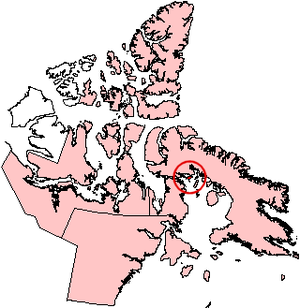
Jens Munk Island is an uninhabited island in the Canadian Arctic Archipelago in the Qikiqtaaluk Region of the Canadian Nunavut Territory .
The island is located north of the Foxe Basin , less than two kilometers off the coast of Baffin Island . It has a land area of 920 km². The island reaches a maximum height of 151 m. Murray Maxwell Bay is northwest of the island .
The island was named in honor of the Danish explorer Jens Munk , who looked for the Northwest Passage in 1619 and 1620 .
Individual evidence
- ↑ The Atlas of Canada - Sea Islands ( Memento from October 6, 2012 in the Internet Archive ) (English)
- ↑ UN SYSTEM-WIDE EARTHWATCH Web Site - Jens Munk

