Foxe Basin
| Foxe Basin | |
|---|---|
| Connects waters | Hudson Street |
| with water | Fury and Hecla Street |
| Separates land mass | Baffin Island |
| of land mass | Melville Peninsula , Southampton Island |
| Data | |
| Geographical location | 65 ° 55 '59 " N , 77 ° 55' 0" W |
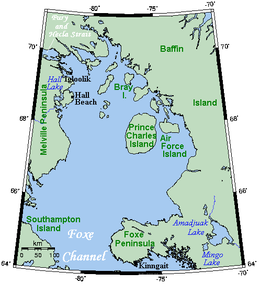
| Islands | Prince Charles Island , Air Force Island , Rowley Island , Vansittart Island , Jens Munk Island , White Island , Bray Island , Foley Island , Koch Island and more |
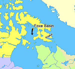
The Foxe Basin (named after the explorer Luke Foxe ) is a sea basin north of Hudson Bay in northern Canada in the Nunavut Territory . It is framed by Baffin Island , Melville Peninsula and Southampton Island .
The sea basin is in the northwest by the Fury and Hecla Strait to the Gulf of Boothia connected. The southern exit is the Foxe Channel , which lies between Southampton Island and the Foxe Peninsula . It connects the Foxe Basin with the Hudson Strait and Hudson Bay.
Most of the water is barely more than 100 meters deep. The largest island in the basin is Prince Charles Island .
The coasts are mostly rocky in the south, but flat in the north. The main settlement is Sanirajak in the northeast of the area.
The Foxe Basin is home to Canada's largest herd of walruses .

