Jezioro Otmuchowskie
| Jezioro Otmuchowskie | |||
|---|---|---|---|
| Jezioro Otmuchowskie, formerly the Ottmachau reservoir | |||
|
|||
|
|
|||
| Coordinates | 50 ° 27 '48 " N , 17 ° 7' 20" E | ||
| Data on the structure | |||
| Lock type: | dam | ||
| Construction time: | 1928-1933 | ||
| Height of the barrier structure : | 17 m | ||
| Crown length: | 6th 500 m | ||
| Power plant output: | 4.8 MW | ||
| Data on the reservoir | |||
| Water surface | 22.6 km² | ||
| Storage space | 143 million m³ | ||
| Catchment area | 2 352 km² | ||
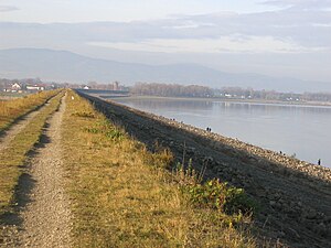
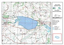
Jezioro Otmuchowskie [ jeˈʑɔrɔ‿ɔtmuˈxɔfscɛ ] (German reservoir Ottmachau ) is the first reservoir of the Glatzer Neisse after it emerged from the Glatzer basin in the Reichensteiner foothills. It lies between Paczków (Patschkau) and Otmuchów ( Ottmachau ) and is named after this town, which lies east of the bottom outlet and the dam.
history
Large areas in the area around the city were bought by the administration of the Reich Waterways during the Weimar Republic. In 1928 the construction of the Ottmachau reservoir began, which was completed in 1933. Overall, the water of the Glatzer Neisse was dammed by this structure to a height of 17 m and holds a water volume of 143 million cubic meters over 22.6 km². The reservoir is not only used for flood protection and electricity generation, but has also developed into a popular destination. It is also beneficial for the current development of Otmuchów and the neighboring communities. It is also part of the European Natura 2000 network.
Web links
- otmuchow.info (Polish)
- Ottmachau reservoir


