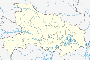
Jiangpinghe Dam
| Jiangpinghe Dam | |||||||||
|---|---|---|---|---|---|---|---|---|---|
|
|||||||||
|
|
|||||||||
| Coordinates | 29 ° 44 '19 " N , 110 ° 20' 45" E | ||||||||
| Data on the structure | |||||||||
| Lock type: | CFRD | ||||||||
| Construction time: | 2005-2010 | ||||||||
| Height of the barrier structure : | 221 m | ||||||||
| Height above valley floor: | 210 m (?) | ||||||||
| Building volume: | 7.8 million m³ | ||||||||
| Power plant output: | 450 MW | ||||||||
| Data on the reservoir | |||||||||
| Altitude (at congestion destination ) | 475 m | ||||||||
| Storage space | 1 366 m³ | ||||||||
| Catchment area | 2 140 km² | ||||||||
The Jiangpinghe Dam ( Chinese 江坪河水电站 , Pinyin Jiāngpínghé Shuǐdiànzhàn - "Jiangpinghe hydroelectric power station") is a 2010 put into operation dam for hydropower use on Loushui , a tributary of the Lishui River in the headwaters of the Yangtze , in the Chinese province of Hubei in the Cities of Yanghe and Zouma in Hefeng County .
The total installed capacity of the hydropower plant is 500 MW and is provided by two turbines. The hydropower plant strengthens Hubei's central China power grid with an average of 1005 GWh per year.
The dam was designed as a CFR dam . The normal water level of the reservoir will be 475 m above sea level, and will be lowered to 465.37 m during high tide. The operating space is 787 million m³.
See also
- List of hydropower plants in China
- List of dams in China
- List of the largest dams on earth
- List of the largest reservoirs on earth
- List of the largest hydroelectric plants in the world
Web links
swell
- ↑ a b China’s highest CFRDs. Retrieved September 7, 2013 .
