Kalapani
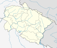
The Kalapani area is a 35 km² region on the south side of the Himalayas in the border area between Nepal and India . It is claimed by both Nepal as part of the Darchula district and by India as part of the Pithoragarh district . It is shaped by the Lipu Gad or Kalapani River , a source river of the Mahakali . The valley with the Lipulekh Pass or Lipu La at the end forms a path to Tibet that is traditionally used by the Bhotiya ethnic group of the Byangsi who live there. In the area there is also the village of Kalapani.
Border conflict
In 1816, the Mahakali was specified in a treaty as the border river between the then British-controlled India and Nepal. It is a matter of dispute which of the source rivers that meet near the village of Kalapani should form the border.
Web links
Individual evidence
- ↑ Srijan Shukla: Why Kalapani is a bone of contention between India and Nepal. In: ThePrint. November 11, 2019, accessed on July 24, 2020 .
- ↑ AE Manzardo, DR Dahal, NK Rai: The Byanshi: an ethnographic note on a trading group in far western Nepal . In: Contributions to Nepalese Studies . tape 3 , no. 2 , September 1976, ISSN 0376-7574 , p. 83–118 , PMID 12311979 (English, cam.ac.uk [PDF; accessed July 24, 2020]).
- ^ Brig BS Chauhan: Shifting Claim Lines of Nepal: Kalapani to Lampiyadhura - A historical perspective. In: Indian Defense Review. Retrieved July 24, 2020 .
- ↑ Dharvi Vaid: New road rouses territorial dispute between India and Nepal. In: Deutsche Welle (www.dw.com). May 10, 2020, accessed July 24, 2020 (UK English).

