Mahakali (river)
| Mahakali - Kali - Sharda | ||
|
Dodhara Chandani Bridge |
||
| Data | ||
| location | Nepal , India | |
| River system | Ganges | |
| Drain over | Ghaghara → Ganges → Indian Ocean | |
| source | Southern slope of the Himalayas west of Om Parvat 30 ° 14 ′ 16 ″ N , 80 ° 58 ′ 35 ″ E |
|
| Source height | 3600 m | |
| muzzle |
Ghaghara coordinates: 27 ° 40 ′ 11 " N , 81 ° 16 ′ 30" E 27 ° 40 ′ 11 " N , 81 ° 16 ′ 30" E |
|
| Mouth height | 115 m | |
| Height difference | 3485 m | |
| Bottom slope | approx. 10 ‰ | |
| length | approx. 350 km | |
| Catchment area | 18,140 km² (according to other sources: 15,216 km²) | |
| Drain |
MQ |
730 m³ / s |
| Left tributaries | Sarnaya Khola , Chameliya Khola , Ramgun | |
| Right tributaries | Kuti , Dhauli , Gori , Sarju , Ladhiya | |
| Reservoirs flowed through | Sharda reservoir | |
| Medium-sized cities | Tanakpur | |
|
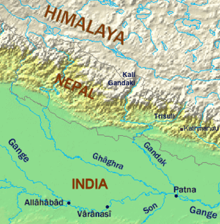
The Mahakali is the right tributary of the Ghaghara on the left of the map |
||
The Mahakali ( Nepali : महाकाली Mahakali ; the upper course also Kali , the underflow in India Sharda ) is a right tributary of Ghaghara in Nepal and in India .
course
The Mahakali rises on the southern slope of the Himalayan main ridge west of the 6191 m high Om Parvat . It flows south through the mountains along the border between the Indian state of Uttarakhand in the west and Nepal in the east. Leaving the Himalayan foothills, the river reaches Uttar Pradesh . It now flows in a south-easterly direction through the Ganges plain and finally flows into the Ghaghara. The Mahakali has a length of about 350 km. It drains an area of 18,140 km². The mean discharge is 730 m³ / s.
Hydropower
The Mahakali has great hydropower potential . There are several plans for hydropower plants along the upper and middle reaches of the river. At Tanakpur on the southern flank of the Himalayan foothills, the Mahakali is dammed up by the Sharda dam . There is a 120 MW hydropower plant there. An irrigation canal also branches off there. Another 160 km downstream is another dam, which was built mainly for irrigation purposes .
Dodhara Chandani Bridge
The Dodhara Chandani Bridge in the far west of Nepal is one of the world's longest pedestrian suspension bridges at around 1.45 km.
leisure
A 117 km long section of the Mahakali between Jauljibi and Tanakpur is suitable for rafting .

