Ghaghara
|
Ghaghara Karnali |
||
|
The Ghaghara at Faizabad |
||
| Data | ||
| location | Bihar , Uttar Pradesh ( India ) | |
| River system | Ganges | |
| Drain over | Ganges → Indian Ocean | |
| Confluence of |
Geruwa and Kauriala 28 ° 17 ′ 4 " N , 81 ° 5 ′ 11" E |
|
| muzzle | at Doriganj west of Chhapra in the Ganges Coordinates: 25 ° 44 ′ 26 " N , 84 ° 40 ′ 28" E 25 ° 44 ′ 26 " N , 84 ° 40 ′ 28" E |
|
| Mouth height |
35 m
|
|
| length | 573 km (including source rivers: 1080 km) | |
| Catchment area | 127,950 km² | |
| Drain |
MQ |
2980 m³ / s |
| Left tributaries | Rapti , Babai | |
| Right tributaries | Sharda | |
| Big cities | Faizabad , Chhapra | |
| Medium-sized cities | Ayodhya | |
|
Location of the Ghaghara |
||
The Ghaghara ( Sanskrit : "murmur of the water", Hindi : घाघरा Ghāghrā [ ˈɡʱɑːɡrɑː ]; also Ghaghra , earlier Anglicised Gogra ) is a left tributary of the Ganges in the Indian states of Uttar Pradesh and Bihar .
course
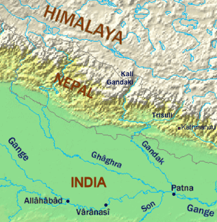
The Ghaghara arises in Uttar Pradesh not far from the Nepalese border at the confluence of the two river arms Geruwa (left) and Kauriala (right) of the Karnali , which forms the upper reaches of the Ghaghara in Nepal . The Ghaghara flows in a south-easterly direction through the Ganges plain . The Sharda flows into the Ghaghara on the right. The cities of Faizabad and Ayodhya are on the right bank of the river. The Rapti meets the lower reaches of the Ghaghara on the left. For the last 100 kilometers the Ghaghara forms the border between Uttar Pradesh in the west and Bihar in the east. The Ghaghara finally reaches the Ganges below Chhapra at Doriganj .
With a total length of 1,080 kilometers (of which 507 kilometers as Karnali in Nepal), the Ghaghara is the longest river in Nepal and, just before the Yamuna , the most water-rich tributary of the Ganges.
Animal and nature protection
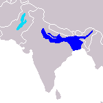
The Ghaghara is home to some of the rare Ganges dolphins , of which only 1,000 are left worldwide. The river also crosses several national parks, for example Shey Phoksundo National Park in Nepal.
use
The river is mainly used for irrigation and energy generation.
Several hydropower plants have been built along the river in recent decades. Nepal tries to make rapid progress in this area in order to make better use of the good natural conditions. An agreement between Nepal and India was concluded for the construction of power plants, in which the resettlement of several thousand people was determined and planned.


