Kangavar
| Kangavar | ||
|---|---|---|
| Kangavar (1991) | ||
|
|
||
| Basic data | ||
| Country: |
|
|
| Province : | Kermanshah | |
| Coordinates : | 34 ° 30 ' N , 47 ° 58' E | |
| Height : | 1470 m | |
| Residents : | 48,276 (2012) | |
| Time zone : | UTC +3: 30 | |
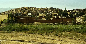
Kangavar ( Persian کنگاور; Kangāvar; in ancient times Congobar ) designates both a city and a district in the province of Kermanshah in Iran . Kangavar is the largest town in the extremely fertile Kangavar Valley. The city lies between Hamadan and Kermanshah .
The historical monument of Kangavar
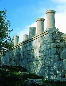
Kangavar is also the site of a historical monument, the entire area of which occupies about 4.6 hectares. The remains are located on a 224 × 209 m platform built from massive slate blocks, the area of which is up to 32 m above the uneven ground below. There were two staircases on two sides that led to the platform and from which one can still see the Kangavar valley today. A row of 3.5 m high Ionic columns once stood on three edges of the platform. There is no evidence of a roof structure on the pillars that are still in place. In the middle of the platform there was once a 93 m by 9.30 m large building, which was probably made of wood and of which only the floor plan (in the form of post holes) is recognizable.
Until the early 1980s it was generally believed that the complex was mentioned in the reports of Isidorus of Charax as the 'Temple of Artemis ' ( Mansiones Parthicae 6). In 1840 the building was visited by the two French painters ( Eugène Flandin and Pascal Coste ), who made a number of sketches and connected the ruins with the mention of Isidorus. Based on this, the system was upgraded to the 1st / 2nd Dated 17th century AD. Since Artemis is also the Greek translation of the Zoroastrian Anahita , its mention in Isidoros was interpreted as the 'Temple of Anahita'.
Systematic excavations have only been taking place since 1968. In 1972 it was made clear in preliminary summaries that the complex could not be identified as a sacred building due to the lack of certain structural and architectural features (for example the lack of a water basin, which would be absolutely necessary for an Anahita temple). In the final report from 1981, the identification of the complex as a temple was found to be extremely questionable. It was concluded that the complex mentioned by Isodorus must be somewhere else. A positive identification of the purpose of the investment was also not possible due to the deficiencies in the archaeological finds. A dating of the building to the Parthian period was also questioned; instead, the correct assignment to the Sassanid period (3rd - 7th centuries) was assumed . The dating remains unclear to this day, as coins and pottery shards from the Parthian as well as from the Sassanid and Islamic times have also been found. At one end of the platform, settlement remains from the Islamic period have been found, so that it can be assumed that at least during this time and at this point the masonry was used for residential buildings. According to the French drawings, these must have been used as such in the 19th century.
Officially, the complex is considered a "historical monument of Kangavar," and in the proposal to include the area in the UNESCO World Heritage Site , the ruins are only described as "a monument famous as the Temple of Anahita". The tourism industry continues to praise the ruins as "Temple of Anahita" or "Artemis."
Individual evidence
- ↑ Archived copy ( Memento of the original dated December 29, 2011 in the Internet Archive ) Info: The archive link was automatically inserted and not yet checked. Please check the original and archive link according to the instructions and then remove this notice.
literature
- Azarnoush, Massoud (1981) "Excavations at Kangavar," Archaeological Communications from Iran . New episode (Berlin), Volume 14, pp. 69-94.
- Kangavar . In: Ehsan Yarshater (Ed.): Encyclopædia Iranica (English, including references)
- Description of the ruin from the perspective of the tourism industry (English)
- Kangavar Historical Monument (whc.unesco.org )


