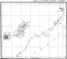
Cape Well
The Cape Well ( Portuguese Cabo de Não ; French Cap de Noun ) located on the Moroccan Atlantic coast south of Agadir , between the mouths of the Oued Noun and the Oued Güder .
History and legends
The name of the cape is said to have been derived from a queen Nuna who ruled over the hinterland of the cape in mythical prehistory. Cape Nun was particularly feared by seafarers of the late Middle Ages because of its steep cliffs in the sea and its dangerous shoals in front of it. Here, according to the general belief at the time (although not the only one at the time), the glowing zone began , in which it was too hot for people to survive here permanently, and south of the Cape Now the Mar Tenebroso (port .: Sea of Darkness ), which is too shallow and too dangerous for navigation, and where the water flows into a thickened mass and huge mountains of magnets pull all iron out of the ships. The rhyming phrase " Quem passa o Cabo de Não, ou tornero ou haben " ("Who goes around Cape Nun, returns or not") was in the minds of all sailors at this time.
Cape Nun was first (allegedly ) circumnavigated by the Portuguese in 1416 shortly after the Portuguese conquest of Cëuta (which took place on August 21, 1415). Experience soon showed that previous beliefs had been flawed.
Nothing more aptly symbolizes the fears of the medieval world about the threats that await people on the edge of the world than the fear of going beyond Cape Nun.
See also
literature
- CR Boxer, Four Centuries of Portuguese Expansion, 1415-1825: A Succint Survey , Johannesburg 1961
- Ferdinand Salentiny, Rise and Fall of the Portuguese Empire , Vienna 1977
- W. Arlett, Survey of some of the Canary Islands, and a part of the Western Coast of Africa in 1835 , The Journal of the Royal Geographical Society of London, 5 (1835) 285-310
- Map relating to previous article in: M. d'Avezac, Etudes de Géographique Critique sur une Partie de l'Afrique Septentionale , The Journal of the Royal Geographical Society of London, 6 (1836) 385-386
Web links
Individual evidence
- ↑ The transmission of this description and this saying comes from João de Barros . The horror tale of the "congealed sea" is also mentioned by Ibn Khaldun .
Coordinates: 28 ° 47 ′ 0 ″ N , 11 ° 4 ′ 0 ″ W.
