
Karl Johans gate

Karl Johans gate ( German "Karl-Johann-Straße" ), informally called "Karl Johan", is the main and boulevard of downtown Oslo . It bears its name after the Swedish-Norwegian King Karl III Johan (Jean Bernadotte) and extends from the central station in the southeast to the royal castle in the northwest. From the train station to the Norwegian Parliament, the Storting , it is a pedestrian zone. Along the "Karl Johan" there are well-known institutions such as the cathedral , the national theater , the university building and the Grand Hotel with the Grand Café .
description
The street consists of two parts with different histories. The eastern part from the Bahnhofsplatz to the Egertorg Square was within the city walls of the Danish King Christian IV and was initially not viewed as a continuous street. Parts of it were called Østre Gade , Kirkebakken and Kirkestredet , from around 1840 the entire street was called Østre Gade . The western part was an avenue planned by its architect HD Linstow as a visual axis and parade street in connection with the castle . It was built in the 1830s and was named Slotsvej in 1840 (English: " Castle Path "). In 1852, after Karl Johan's death, it was named after the late monarch. The monumental university building was already there at that time. As a result, the western part of the "Karl Johan" developed like many avenues and ring streets of the 19th century as an urban showpiece of state and civil splendor. The landowners on the north side of the new avenue bought, among other things, the land on the south side and donated them to the city, with the stipulation that today's “student park” be designed there, in which, however, the national theater was later built. During the construction of the parliament in the 1860s, the connection to the eastern part was closed at the highest point, the Egertorg ; the different character of the two road sections was retained. The part adapted to the pedestrian zone has a predominantly commercial character. With a view to the centenary of the dissolution of the union with Sweden in 2005, there were also significant changes to the "Karl Johan". The street furniture (light poles) was brought into line with that of the 1920s. As early as the 1980s, the Oslo tram disappeared from Karl Johans gate, which had initially operated there as a horse-drawn tram for almost 100 years .
photos
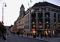
Karl Johans gate 27-31 (2005)

Egertorg, Karl Johans gate around 1880

Karl Johans gate 33-45 around 1890
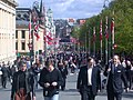
Karl Johans gate 17th May 2003


literature
- Thomas Hall: Planning Europe's Capital Cities. Aspects of 19th Century Urban Development , London 1997
Web links
- Thomas Hall: Planning Europe's Capital Cities. Aspects of 19th Century Urban Development , London 1997, p. 120 (English)
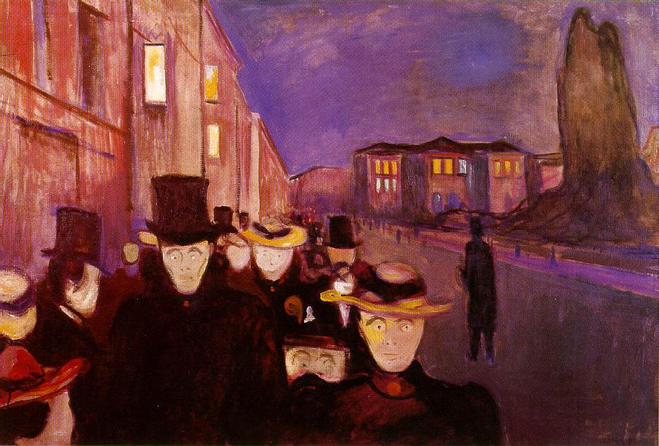
- Evening on Karl Johan painting by Edvard Munch
- Munchs egne filmopptak (1927) - Maleren med filmkamera Article about Much's narrow film activities on the Karl Johan (Norwegian)
Individual evidence
- ↑ See Thomas Hall: Planning Europe's Capital Cities. Aspects of 19th Century Urban Development , London 1997, p. 120.
Coordinates: 59 ° 54 ′ 48.9 " N , 10 ° 44 ′ 22.4" E