Keller Lake
| Keller Lake | |
|---|---|
| Geographical location | Northwest Territories (Canada) |
| Drain | to the Johnny Hoe River and Great Bear Lake |
| Data | |
| Coordinates | 63 ° 57 ′ N , 121 ° 35 ′ W |
| Altitude above sea level | 255 m |
| surface | 330 km² |
| length | 28 km |
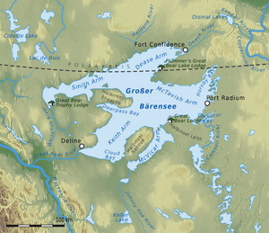
Keller Lake is a lake in the Canadian Northwest Territories . It is 85 km south of Great Bear Lake and 220 km north of Fort Simpson . It has a triangular shape with sides of 25 to 28 km. Its water surface is about 330 km². The level of Keller Lake is at an altitude of 255 m.
On the northeast bank is the outflow of the lake. This runs in a northerly direction and flows 25 km north of Keller Lake into the Johnny Hoe River , which runs east of the lake and flows to Great Bear Lake.
