Klusenberg
| Klusenberg | ||
|---|---|---|
|
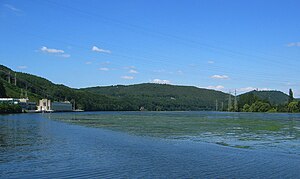
Klusenberg (center) on the Hengsteysee |
||
| height | 254.33 m above sea level NHN | |
| location | North Rhine-Westphalia , Germany | |
| Mountains | Ardey Mountains | |
| Coordinates | 51 ° 25 ′ 20 " N , 7 ° 28 ′ 15" E | |
|
|
||
| rock | Ruhr sandstone | |
| Age of the rock | Pennsylvania (Upper Carbon) | |
| Development | Roads, trails | |
| particularities | highest point in Dortmund | |
The Klusenberg is 254.33 m above sea level. NHN the highest point in the Dortmund urban area.
Located west of the Hohensyburg , the Klusenberg is part of the Ardey Mountains . To the south, its slopes drop to the Hengsteysee . The Klusenberg is forested and large parts of it belong to the nature reserve Ruhr slopes Hohensyburg .
There is residential development in the southwest area of the mountain in particular and an active quarry on the hilltop ( Ruhr sandstone , Imberg operation).
Web links
Commons : Klusenberg - collection of images, videos and audio files

