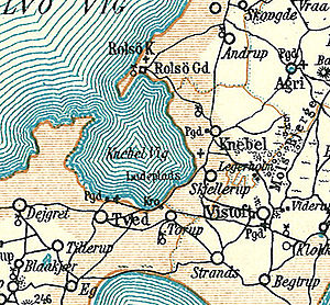
Toggle Vig
| Toggle Vig | |
|---|---|
| Waters | Kalø Vig |
| Land mass | Mols |
| Geographical location | 56 ° 12 '40 " N , 10 ° 27' 2" E |
| width | approx. 3 km |
| Greatest water depth | 14 m |
Knebel Vig is a Danish bay in the Baltic Sea . It forms an almost completely closed bay of Kalø Vig on the north bank of Århus Bay and lies on the coast of the Mols landscape of the Djursland peninsula . It is named after the place Knebel on the shore and the Danish word Vig for "small bay".
The water depth is up to 14 meters. In the south the bay is bounded by the Skødshoved peninsula . In the south of the bay is the small harbor Knebel Bro , in the east Knebel and the church of Knebel . To the north is the Rolsøgård Manor and Rolsø Ødekirke Church .


