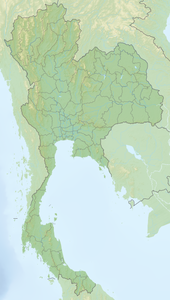
Ko Ngai
| Ko Ngai | ||
|---|---|---|
| Waters | Andaman Sea | |
| Geographical location | 7 ° 24 '40 " N , 99 ° 12' 15" E | |
|
|
||
| length | 4.1 km | |
| width | 2.1 km | |
| surface | 5 km² | |
Ko Ngai ( Thai : เกาะ ไห ง ; alternative name Ko Hai ) is an island in the southern region of Thailand in the Andaman Sea .
geography
Ko Ngai is located in the south of Krabi Province in the district ( Amphoe ) Ko Lanta , but geographically closer to the coast of Trang Province . It is located directly west of the Hat Chao Mai National Park , whose headquarters are on the beach of the same name on the opposite mainland from Trang. The island is four km long, about five km² in size, wider in the south and pointed like a wedge to the north.
Demographics
There are almost no permanent residents on the island. Only about a dozen Thais go fishing all year round and take care of smaller agricultural projects. Most of the residents are employees of the holiday resorts, who also operate the hotel facilities in the southern Thai off-season.
climate
The climate is subtropical. The rainy season (monsoon) begins around the beginning of May and ends at the end of October at the beginning of November each year. Usually the sea is rougher and the currents can make swimming dangerous. Often there are heavy rains and clouds for days. From the beginning of November to the end of April there is mostly sunshine and the Andaman Sea is calm. The temperatures in the monsoon season are 25 to 30 degrees during the day and 22 to 24 degrees at night. In the main season, the daytime temperatures reach values of 25 to 34 degrees.
Transport links
The closest mainland port is Pak Meng, about 15 km northeast of Ko Ngai in the district (Amphoe) Sikao of the province Trang. Typical Thai longtail boats ply from the small pier in Trang Province . Some of the hotel complexes have their own (speed) boats for the transfer of hotel guests. The crossing from Pak Meng Pier takes 30 to 40 minutes, depending on the type of boat.
There is also regular traffic to other islands in the area, for example Ko Lanta Yai and Ko Muk, with excursion boats or long-tail boat charter. Only in the Thai main season, which lasts from November to the end of April, does sea traffic run unrestricted. In the off-season, which falls in the monsoon season from May to October, there may be brief interruptions to the sea connections.
Attractions
Ko Ngai is primarily a bathing and diving island. The approx. Two km long beach in the east of the island is particularly beautiful. It impresses with its clear, turquoise water. Only a few corals disturb the bathing pleasure. There are also two small bays in the south of the island. The west coast is not suitable for swimming due to the falling, green cliffs. The location and surroundings of the island are fascinating due to the many small and large limestone islands. Excursion destinations in the area are small islands Ko Muk and Ko Kradan.
