Komoran
| Komoran | ||
|---|---|---|
|
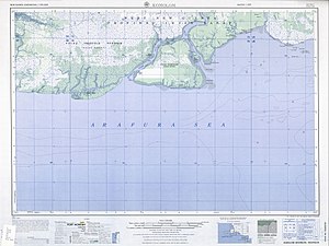
Map of the island and its surroundings ( Yos Sudarso Island in the north ) |
||
| Waters | Arafura lake | |
| Geographical location | 8 ° 18 ′ S , 138 ° 45 ′ E | |
|
|
||
| length | 40 km | |
| width | 30 km | |
| surface | 695 km² | |
| Highest elevation | 10 m | |
| Residents | 554 (2010) <1 inh / km² |
|
| main place | Komolom (Mombum, Komoran) | |
|
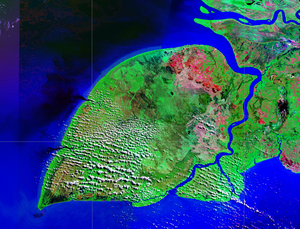
NASA Geocover 2000 satellite image (Yos Sudarso with Komoran) |
||
Komoran ( Pulau Komoran ) is an approximately 40 km long and up to 30 km wide Indonesian island with an area of about 695 km². It is located just off the southwest coast of New Guinea and belongs to the Merauke administrative district of the Papua province . Komoran is only separated from New Guinea and the much larger Yos Sudarso Island to the north by the 1.7 km wide Bensbach Creek (Buja) inlet . The flat island is mostly covered by tropical vegetation and crossed by numerous small watercourses.
Komoran is very sparsely populated with 554 inhabitants (2010 census) on 695 km². The only village is Komolom (formerly Mombum or like the island Komoran ) in the east of the south coast.
Web links
- Satellite image of the islands of Komoran and Yos-Sudarso (as of August 2009)


