
Papua (province)
| Papua | |
|---|---|
 |
|
| Basic data | |
| Area : | 365,466 km² |
| Residents : | 3,149,400 |
| Population density : | 9 inhabitants / km² |
| Capital : | Jayapura |
| governor | Luke Enembe |
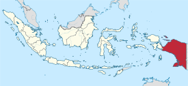
| Location in Indonesia | |
  |
|
| Website : | www.papua.go.id |
Along with Papua Barat (West Papua), Papua is one of the two provinces of Western New Guinea , the Indonesian part of the island of New Guinea .
Initially, Western New Guinea was the colony of Dutch New Guinea . After a controversial vote ( Act of Free Choice , AFC) in 1969 , the whole of Western New Guinea was incorporated into the state of Indonesia as Irian Jaya Province . The result is said to have been manipulated by forging votes against the real will of the indigenous Papuans , who saw it as an interference with their autonomy. The resulting Papuan conflict is the reason for the strong Indonesian military presence on site. In 2003 Western New Guinea / Irian Jaya was divided into the provinces of Papua and Papua Barat (West Papua).
The up to 4884 m ( Carstensz pyramid ) high central mountain range crosses the province from west to east, the south is flat and partly crossed by swamps. Most of the settlements, including the capital Jayapura , are on the north coast.
Administrative division
As in the rest of Indonesia, the number of administrative units in the province of Papua rose steadily. If the population censuses (Census, Indonesian Sensus Penduduk ) of 1971 and 1980 counted 6 Kabupaten (government districts, English Regency) - namely Merauke, Jayawijaya, Jayapura, Yapen Waropen, Biak Namfor and Paniai - ten years later there were already nine and the city (Indonesian Kota ) Jayapura. In 2000 the number 29 (including Kota Jayapura ) was reached.
The number of districts (Indonesian district ) rose from 389 to 499 between 2012 and 2015, the number of villages (Indonesian: Desa , also known as Kampung in the province of Papua ) rose from 3,619 to 4,445 in the same period. Only after the secession and formation of the West Papua province (2003) did this number decrease again slightly. The following list shows the latest status (1st half of 2017) of the subordinate administrative units in the province of Papua.

| code | Kabupaten / Kota | Administrative headquarters | Number District | Number of Desa / Kampung |
|---|---|---|---|---|
| 91.01 | Kab. Merauke | Merauke | 20th | 168 |
| 91.02 | Kab. Jayawijaya | Wamena | 39 | 331 |
| 91.03 | Kab. Jayapura | Sentani | 19th | 144 |
| 91.04 | Kab. Nabire | Nabire | 15th | 85 |
| 91.05 | Kab.Kepulauan Yapen 1 | Serui | 16 | 165 |
| 91.06 | Biak Namfor | Biak | 19th | 262 |
| 91.07 | Puncak Jaya | Mulia | 10 | 70 |
| 91.08 | Paniai | Enarotali | 26th | 302 |
| 91.09 | Facial expressions | Timika | 18th | 147 |
| 91.10 | Sarmi | Sarmi | 20th | 110 |
| 91.11 | Keerom | Arso | 15th | 162 |
| 91.12 | Pegunungan Bintang | Oksibil | 23 | 221 |
| 91.13 | Yahukimo | Dekai | 51 | 518 |
| 91.14 | Tolikara | Karubaga | 34 | 277 |
| 91.15 | Waropen | Were | 46 | 545 |
| 91.16 | Boven Digoel | Tanah Mera | 19th | 110 |
| 91.17 | Mappi | Keppi | 11 | 91 |
| 91.18 | Asmat | Agats | 12 | 117 |
| 91.19 | Supiori | Sorendiweri | 5 | 38 |
| 91.20 | Membramo Raya | Burmeso | 9 | 59 |
| 91.21 | Mamberamo Tengah | Kobakma | 32 | 248 |
| 91.22 | Yalimo | Elelim | 37 | 188 |
| 91.23 | Lanny Jaya | Tiom | 5 | 59 |
| 91.24 | Nduga | Kenyam | 5 | 27 |
| 91.25 | Puncak | ilaga | 8th | 80 |
| 91.26 | Dogiyai | Kigamani | 10 | 79 |
| 91.27 | Intan Jaya | Sugapa | 6th | 78 |
| 91.28 | Deiyai | Tigi | 5 | 67 |
| 91.71 | Kota Jayapura | Jayapura | 5 | 39 |
| 91 | PAPUA PROVINCE | Jayapura | 540 | 4,787 |
1 former name: Kepulauan Yapen Warpen
population
| code | Kabupaten / Kota | Area km² |
population | Population density (inh / km²) |
|||
|---|---|---|---|---|---|---|---|
| 2000 census | 2010 census | 2013 | 2016 | ||||
| 91.01 | Kab. Merauke | 47,406.90 | 135.192 | 195.716 | 218,884 | 221,584 | 4.7 |
| 91.02 | Kab. Jayawijaya | 2,331.19 | 83,671 | 196.085 | 257,602 | 267,334 | 114.7 |
| 91.03 | Kab. Jayapura | 14,390.16 | 86,036 | 111,943 | 158,642 | 164.909 | 11.5 |
| 91.04 | Kab. Nabire | 4,549.75 | 94.080 | 129,893 | 161,343 | 165.965 | 36.5 |
| 91.05 | Kepulauan Yapen | 4,936.37 | 58,879 | 82,951 | 105,564 | 109.203 | 22.1 |
| 91.06 | Kab.Biak Namfor | 13,017.45 | 97,564 | 126,798 | 137,662 | 140.210 | 10.8 |
| 91.07 | Kab. Puncak Jaya | 2,446.50 | 51,705 | 101.148 | 202.153 | 214,462 | 87.7 |
| 91.08 | Kab. Paniai | 20,686.54 | 59,355 | 153,432 | 107,604 | 116,247 | 5.6 |
| 91.09 | Kab.Mimika | 2,300.37 | 101.036 | 182.001 | 301.283 | 305.614 | 132.9 |
| 91.10 | Kab.Sarmi | 13,965.58 | 22,628 | 32,971 | 35,249 | 36,616 | 2.6 |
| 91.11 | Kab. Keerom | 9,015.03 | 34,856 | 48,536 | 57,736 | 59,228 | 6.6 |
| 91.12 | Cab. Pegunungan Bintang | 14,655.36 | 51,309 | 65,434 | 103,467 | 107.031 | 7.3 |
| 91.13 | Kab.Yahukimo | 15,057.90 | 117.297 | 164,512 | 307.068 | 348.364 | 23.1 |
| 91.14 | Kab. Tolikara | 6,149.67 | 35,309 | 114,427 | 223.906 | 246.119 | 40.0 |
| 91.15 | Cab. Waropen | 5,381.47 | 17,011 | 24,639 | 30.198 | 32,443 | 6.0 |
| 91.16 | Cab. Boven Digoel | 24,665.98 | 28,594 | 55,784 | 50,807 | 56,201 | 2.3 |
| 91.17 | Kab. Mappi | 23,178.45 | 58,969 | 81,658 | 100.009 | 101,807 | 4.4 |
| 91.18 | Kab. Asmat | 24,687.57 | 55,810 | 76,577 | 100,076 | 103.048 | 4.2 |
| 91.19 | Kab. Supiori | 634.24 | 12.164 | 15,874 | 20,028 | 20,951 | 33.0 |
| 91.20 | Kab. Membramo Raya | 28,034.87 | 12,545 | 18,365 | 33,272 | 34,454 | 1.2 |
| 91.21 | Kab. Mamberamo Tengah | 33.84.14 | 18,167 | 39,537 | 40.991 | 44,654 | 13.2 |
| 91.22 | Kab.Yalimo | 3,658.76 | 22,456 | 50,763 | 82.284 | 118,474 | 32.4 |
| 91.23 | Kab. Lanny Jaya | 3,439.79 | 63.008 | 148,522 | 109,763 | 196.722 | 57.2 |
| 91.24 | Kab. Nduga | 5,825.22 | 32,228 | 79.053 | 103.289 | 106.293 | 18.2 |
| 91.25 | Kab. Puncak | 5,618.84 | 47,406 | 93,218 | 148,823 | 158,342 | 28.2 |
| 91.26 | Kab. Dogiyai | 4,522.15 | 60,095 | 84,230 | 107.914 | 112.176 | 24.8 |
| 91.27 | Kab. Intan Jaya | 2,325.88 | 15,466 | 40,490 | 87,470 | 137.048 | 58.9 |
| 91.28 | Kab. Deiyai | 9,336.60 | 25,086 | 62.119 | 43,262 | 87,545 | 9.4 |
| 91.71 | Kota Jayapura | 950.38 | 186.222 | 256.705 | 411,398 | 416.243 | 438.0 |
| 91 | Prov. PAPUA | 316,553.07 | 1,684,144 | 2,833,381 | 3,847,747 | 4,229,287 | 13.4 |
Typical characteristics of the population
- Papua is the most sparsely populated Indonesian province. The greatest population density is reached on the coasts, the mountainous region is rather sparsely populated.
- The population is made up of indigenous Papuans and Javanese and other Malays who immigrated as part of the Indonesian migration policy under the former President Suharto .
- Approx. 30 percent of the population is younger than 15 years, 1.5 percent are older than 65 years.
- 20 percent of the population over 15 years old (2015: 2.19 million) is "economically inactive" - four percent of them ( unemployment rate ) are unemployed.
- There is a surplus of men across the province, with an average of 115 men for 100 women. The proportion of men is declining, in 2015 it was 111.3 and a year earlier it was 102.8.
- The majority of the population professes Christianity (64% Protestants, 25% Catholics), 21 percent profess Islam.
Others
When an Indonesian C-130 Hercules military aircraft crashed near Wamena on December 18 , 2016, all 13 crew members died.
Individual evidence
- ^ BPS: Name of Regency / City Capital. (No longer available online.) BPS Papua, archived from the original on July 29, 2017 ; Retrieved July 12, 2017 (Indonesian). Info: The archive link was inserted automatically and has not yet been checked. Please check the original and archive link according to the instructions and then remove this notice.
- ↑ a b BPS: MFD Online. BPS Papua, accessed July 12, 2017 (Indonesian, search for administrative units).
- ↑ a b BPS: Papua in Figures 2016. (No longer available online.) BPS Papua, archived from the original on July 12, 2017 ; Retrieved July 7, 2017 (Indonesian). Info: The archive link was inserted automatically and has not yet been checked. Please check the original and archive link according to the instructions and then remove this notice.
- ↑ BPS: Population by Region, Urban / Rural, and Sex. Retrieved April 4, 2017 .
- ↑ DKCS: Data Penduduk. (No longer available online.) Archived from the original on July 11, 2017 ; Retrieved July 7, 2017 (Indonesian). Info: The archive link was inserted automatically and has not yet been checked. Please check the original and archive link according to the instructions and then remove this notice.
- ↑ DKCS: Data Agregat Kependudukan Semester II Tahun 2016. (No longer available online.) Archived from the original on July 12, 2017 ; Retrieved July 7, 2017 (Indonesian). Info: The archive link was inserted automatically and has not yet been checked. Please check the original and archive link according to the instructions and then remove this notice.
- ↑ http://www.bbc.com/news/world-asia-38355451
Aceh | Bali | Bangka Belitung | Banten | Bengkulu | Gorontalo | Jakarta | Jambi | Jawa Barat | Jawa Tengah | East Java | Kalimantan Barat | Kalimantan Selatan | Kalimantan Tengah | Kalimantan Timur | Kalimantan Utara | Lampung | Maluku | Maluku Utara | Nusa Tenggara Barat | Nusa Tenggara Timur | Papua | Papua Barat | Riau | Kepulauan Riau | Sulawesi Barat | Sulawesi Selatan | Sulawesi Tengah | Sulawesi Tenggara | Sulawesi Utara | Sumatra Barat | Sumatra Selatan | Sumatra Utara | Yogyakarta
Coordinates: 4 ° 0 ′ S , 140 ° 0 ′ E