Yos Sudarso Island
| Yos Sudarso Island | ||
|---|---|---|
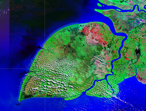
| NASA Geocover 2000 satellite image | ||
| Waters | Arafura lake | |
| Geographical location | 7 ° 55 ′ S , 138 ° 30 ′ E | |
|
|
||
| length | 180 km | |
| width | 100 km | |
| surface | 11,460 km² | |
| Highest elevation | 10 m | |
| Residents | 11,000 <1 inh / km² |
|
| main place | Kimaam | |
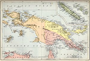
| old name Frederick Henry on map from 1884 | ||
The Yos Sudarso Island ( Pulau Yos Sudarso ) or Kimaan is an approximately 180 km long and 100 km wide Indonesian island off the southwest coast of New Guinea .
geography
The island belongs to the Merauke administrative district of the Papua province . The Yos Sudarso Island is only separated from New Guinea and the smaller island Komoran to the south by the narrow Buaya Strait ( Selat Buaya , fr. Muli ), which extends from 1.7 km in width in the south to 10 km in the Spread north. The flat island is mostly covered by tropical vegetation and crossed by numerous watercourses. The coast is home to some of the largest mangrove forests on earth.
Yos Sudarso has an area of 11,460 km² and about 11,000 inhabitants. The villages on the island include Sabon (in the interior of the island) and the coastal towns of Tor and Kladar.
The main town of the island is Kimaam (Kimaan) on the east coast (on the Buaya Strait). This name also referred to the entire island as an alternative name.
Names
Today the island is named after an officer in the Indonesian Navy . During the Dutch colonial period the island was called Frederik-Hendrik-Insel , in Germany it was called Friedrich-Heinrich-Insel. Other names are Dolak and Kolepom .
literature
- Serpenti, LM, Cultivators in the Swamps; Social Structure and Horticulture in a New Guinea Society (Frederik-Hendrik Island, West New Guinea) , Assen, 1965.
Web links
- Satellite image of the islands of Yos-Sudarso and Komoran (as of August 2009)
Individual evidence
- ↑ Angel Manembu: Sweet Potato of Kimaan, Irian Yaya. (PDF; 706 kB)


