Laconic golf
| Laconic golf | ||
|---|---|---|
|
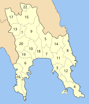
Map of Laconia (breakdown of the municipalities) and the Laconian Gulf |
||
| Waters | Ionian sea | |
| Land mass | Peloponnese | |
| Geographical location | 36 ° 31 ' N , 22 ° 43' E | |
|
|
||
| width | approx. 40 km | |
| depth | approx. 40 km | |
| Tributaries | Evrotas | |
The Laconian Gulf ( Greek Λακωνικός Κόλπος , Lakonikós Kólpos ) is located in the southeastern Ionian Sea south of the Peloponnese . The Evrotas , one of the larger rivers of the Peloponnese, drains into the Gulf in the south of the Laconic Plain . The bay lies between the Mani peninsula in the west and the Laconian peninsula ( Χερσόνησο της Λακωνίας ) in the east, which belong to the Greek prefecture of Laconia ( Νομός Λακωνίας ), which thus completely surrounds the gulf. In general, the area around the Gulf is sparsely populated, larger towns are Neapolis and Gythio . In the southeast of the gulf lies the island of Elafonisos , further south the island of Kythira forms the border between the Ionian Sea and the Aegean Sea .

