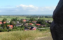
Lammefjord

The Lammefjord [ ˈlɑməfjoːʔʀ ] is an arm of the fjord in the Danish area of Odsherred , northwest of Holbæk . After 6000 hectares were dyed and drained by the beginning of the 20th century, most of it is used for agriculture today. The name Lammefjord is used both for the drained land and for the remaining bay in the Isefjord .
history
Originally Odsherred was a peninsula that was only connected to Zealand by the narrow Draget isthmus , which was guarded by Dragsholm Castle .
In 1841 the construction of a dike on the nearby Sidingefjord began and the experience was used in the Lammefjord dike.
The project was proposed by Lehnsbaron Zytphen-Adeler, who lived on Dragsholm.
Before the project began in 1873, the Lammefjord was so shallow that large parts of it could be waded through at low tide. Nevertheless, a lot of water had to be pumped out and many drainage ditches had to be dug. Everything was done by hand, and horse-drawn carts could only be used when the land was sufficiently dry.
The construction of the Audebodamm took about two years. It was later reinforced after a north-westerly storm in October 1921 threatened to hit the dam.
Today the Lammefjord is a flat piece of land, especially noticeable on the road from Gislinge to Fårevejle, which is extraordinarily long, straight and flat. However, there are also some elevations that used to be islands in the Lammefjord.
drainage
The Lammefjord got two canal systems: 1. The land canal, which surrounds the area at sea level along the former coastline and to the east into the Rest-Lammefjord and to the west into the Sejerø Bay . 2. The drainage canal, which runs through the deepest areas of the former seabed and therefore requires a pumping station at Audebo. It used to be powered by wind and steam power until an electric drive was installed in the 1920s.
For technical and economic reasons, the water level was lowered in stages. Pumping out was delayed because of the sluggish sale of land and a replacement of the pumping systems that was due in the 1930s. The Second World War also did the rest.
In 1943 the water level was finally −7 m and the last remainder of the diked water disappeared.
The drainage stages at a glance:
- January 1875: 0 m
- September 1875: −2.7 m
- 1882: −3.8 m
- 1906: −4.75 m
- 1943: −7 m
To this day, water is pumped out because rainwater is added. The pumps convey an average of 16 million m³ per year. One millimeter of rain in the Lammefjord area results in 60,000 m³ of water in the land canal.
Economic use
Reclaiming the seabed was hard work, but the result was an extraordinarily fertile piece of land. Well-known products today are potatoes and carrots, but asparagus and tulips, for example, are also grown. The Lammefjord carrot ("lammefjordsgulerod") is a registered trademark in the EU quality mark regulation.
In addition, clamshells left behind, which are used to add lime to animal feed, are dug in places.
traffic
Before the dike was dyed, the route to Odsherred was connected with a ferry crossing or the detour via Draget. The dam enabled additional road connections. The Odsherred Railway OHJ (Holbæk - Nykøbing Sj.) Also runs through the drained area.
Coordinates: 55 ° 46 ′ 41.2 " N , 11 ° 34 ′ 29.2" E
