
Long Bridge (Potsdam)
Coordinates: 52 ° 23 '34 " N , 13 ° 3' 46" E
| Long bridge | ||
|---|---|---|
 |
||
| use | Road traffic | |
| Convicted | Friedrich-Ebert-Straße across the two arms of the Havel in the city center | |
| Crossing of | Potsdam Havel | |
| place | Potsdam | |
| construction | Prestressed concrete girder bridge without pillar | |
| location | ||
|
||

The Lange Brücke in Potsdam is a road bridge over the Havel . The bridge is the oldest known inner-city crossing of the Havel. It connects the historic core of Potsdam with the Teltower suburb and Babelsberg .
history
The city of Potsdam is bounded in the east and south by the lake-like Havel , which has changed its course several times since the 10th century. Small islands and sandbanks formed over time due to the alluvial sand carried along and the settling due to the low flow speed of the river. From this emerged today's landscape forms and also the later Friendship Island and the two river arms in the city.
A first bridge over the Havel is mentioned as early as 1317. This Havelarm will later be referred to as the Alte Fahrt. The bridge was not very durable, because as early as 1375, a document that has survived only mentions a ferry as a way to cross the river. In 1416 a new bridge was built. On February 28, 1416, the Elector Friedrich I von Hohenzollern gave the city permission to build a bridge over the Teltow . The bridge toll was assigned to the citizens as income. In 1564 the river crossing was officially referred to as the Long Bridge for the first time . It is not known how long this bridge could be used. For the period of the Thirty Years' War it is mentioned that the troops of the warring parties crossed the bridge several times and finally devastated the city.
In 1662/64, another new bridge was built on behalf of the Great Elector as part of the expansion of Potsdam into a royal seat. The bridge was made of wood. It had 48 zygomatic arches and, as was common on all bridges at that time, a hinged passage through the ship. It was about 220 meters long. There was a guard house and a gatehouse on this bridge. On August 8, 1756, Frederick the Great led his troops across the bridge into the Seven Years' War . Despite constant extensive repairs, its condition deteriorated over time. There were drafts for a new building in 1770/71 by Johann Boumann and Carl von Gontard on behalf of King Friedrich II. They were never realized. In 1802 and 1815 there were plans to build new bridges. However, these were repeatedly rejected.
In 1823, work began on a new Havel crossing, which was completed after two years of construction. The cast iron parts of the bridge were supplied by the royal foundry in Malapane . In order to improve the conditions for shipping as one of the main providers of supply in the developing residential city, the old Nuthegraben on the eastern side of the Havel island has now been expanded and deepened. This island was later named Friendship Island . The Nuthegraben was a swampy branch of the tributary Nuthe. The bridge, opened to traffic in 1825, spanned the river with eight cast iron arches and also had a hinged passage for ships. At the end of the 19th century, this bridge was no longer able to cope with the steadily increasing traffic on the bridge. The waterway through Alte and Neue Fahrt, the so-called Potsdamer Havel , had meanwhile lost its importance due to the construction of the Sacrow-Paretz Canal .
.jpg)
In the years 1886 to 1888 a new stone bridge was built north of the old one as a replacement. The bridge was handed over in July 1888 without any celebrations. The reason was the death of two emperors that year. After 1901 an equestrian statue of Kaiser Wilhelm I of Ernst Herter had been erected at the bridge, it was in Kaiser Wilhelm Bridge renamed. In 1935 the National Socialists reversed the renaming. Since then it has been called the Long Bridge again . On September 2, 1907, the first electric tram drove over the bridge. On April 24, 1945, the bridge over the Neue Fahrt was blown up by the German Wehrmacht . The part of the bridge over the Alte Fahrt remained damaged. In mid-1945 a makeshift bridge with steel girders was built on the existing substructure of the bridge over the Neue Fahrt.
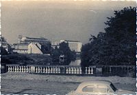
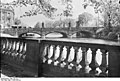
Today's bridge


New Long Bridge 1962

Junction Friedrich-Ebert-Str. (left) / Wilhelm-Külz-Str. (right) / Lange Brücke (straight ahead) 1962, before the planned traffic lights were installed
Old drive and old long bridge from the new long bridge 1962


The current bridge was built between 1958 and 1961. This makes it the verifiable sixth Havel bridge at this point. The bridge construction was related to the establishment of a new socialist center for Potsdam. The course of the new bridge was planned in such a way that traffic into the city led directly to the garden entrance of the corps de logis of the city palace . The foundation of the Kaiser Wilhelm Monument, scrapped shortly after 1945 for metal extraction, was destroyed during the move. In 1949, an attempt by the local SED to destroy the rebuildable castle ruins had failed. With the bridge building project of 1957, she was able to hold a renewed discussion about the demolition of the lock, also with traffic-related arguments. In May 1959, the SED Politburo decided to demolish the castle, which was carried out before the new bridge was completed.
Since the bridge from 1961 showed damage, especially on the north side, construction work began in April 2008 on an additional parallel bridge to replace the north carriageway and also to make room for the tram. This new bridge over the two arms of the Havel and the southern tip of the Friendship Island, north of the existing bridge, takes up wide footpaths and bike paths as well as tram and bus lines that previously ran over the old Lange Brücke. In summer 2009 the first tram passed the new bridge. The old bridge will take over the function of a southern carriageway until around 2025 and will then be rebuilt to match the design of the northern carriageway.
In 2011 the new bridge was awarded the Brandenburg Building Culture Prize in the Infrastructure category.
“In the reorganization of traffic in the historic city center, functionality played a major role on the one hand, and the expansion of the existing bridge structure was supposed to fit into the cityscape as an ensemble on the other. This was achieved with sweeping arches that became smaller towards the city, which figuratively represent a stone's throw on the surface of the water. "
Known bridge dates
| Building | Width (meter) | Length (meters) |
|---|---|---|
| Wooden bridge from 1662 | 5.00 | 220.00 |
| Cast iron bridge from 1825 | 9.50 | 183.50 |
| Solid bridges from 1888 | 18.00 | 38.00 / 37.90 |
| Prestressed concrete bridge from 1961 | 32.50 | 35.00 / 49.50 |
photos

The Long Bridge 1829

1928 during floods

1928 at normal water level
1928

Summer 1945

Summer 1945

2009, new ride

2009, old journey


.JPG)
See also
literature
- Hans-J. Uhlemann: Berlin and the Märkische Wasserstraßen transpress publishing house. Berlin various years, ISBN 3-344-00115-9 .
- Writings of the Association for European Inland Shipping and Waterways e. V. various years. WESKA (Western European Shipping and Harbor Calendar), Binnenschifffahrts-Verlag, Duisburg-Ruhrort
- Folke Stender: Editing of Sportschifffahrtskarten inland 1 . Nautical Publication Verlagsgesellschaft, ISBN 3-926376-10-4 .
Web links
Individual evidence
- ^ Artists' walks to Berlin: Before Schinkel and after. Helmut Börsch-Supan Deutscher Kunstverlag, 2001 - 359 pages p. 245 (restricted view)
- ↑ The cast-iron arch truss bridges in Germany. In: Friedrich Heinzerling: The bridges in iron . Verlag von Otto Spamer, Leipzig 1870, p. 100 ( full text in Google Book Search).
- ↑ Hans Berg: The lost center of Potsdam . Self-published, Berlin 1999, pp. 8-11
- ↑ Planning of the tram bridge over the Neue and Alte Fahrt