Tall Heinrich
| Tall Heinrich | ||
|---|---|---|
|
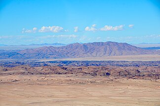
Langer Heinrich aerial photo (2017) |
||
| Highest peak | Long Heinrich ( 1153 m ) | |
| location |
|
|
|
|
||
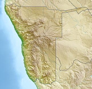
| Coordinates | 22 ° 46 ′ S , 15 ° 20 ′ E | |
The Lange Heinrich ( English Langer Heinrich Mountain (s) ), rarely also Langer Heinrichberg (e) , is a massif or mountain in the Namib in Namibia . It is located about 85 kilometers east of Swakopmund . Its highest peak is 1153 m high.
On 22 September 2005, took Langer Heinrich uranium mine , located at the foot of the mountain, as the second Namibian uranium mine in open pit operation on. The mine has been under care and maintenance since April 2018 .
A “memorial stone” commemorates the visit of Namibian President Hifikepunye Pohamba on March 15, 2007.
history
During the First World War , the German Schutztruppe operated a heliography station on the massif , which was evacuated on March 20, 1915 under enemy pressure. From here ship and troop movements of the British to the Atlantic coast could be observed.
Web links
- Page from Langer Heinrich Uranium (English)
Individual evidence
- ^ Mt. Langer Heinrich. Tracks4Africa. Retrieved December 6, 2018.
- ^ About Us - Our Company. Retrieved December 6, 2018.
- ↑ Veit Didczuneit: Sun flashes in the desert - The light telegraphy in German South West Africa 1899-1915, in: The archive - magazine for communication history. Issue 2, 2017, p. 27.

