Lawu
| Lawu Gunung Lawu |
||
|---|---|---|
|
Mount Lawu (north side) |
||
| height | 3265 m | |
| location | Java , Indonesia | |
| Coordinates | 7 ° 37 '38 " S , 111 ° 11' 40" E | |
|
|
||
The Lawu or Gunung Lawu is a 3265 m high stratovolcano near the geographic center of the Indonesian island of Java . The only documented eruption occurred in November 1885.
location
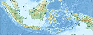
The Lawu is located on the border between the provinces of East ( Jawa Timur ) and Central Java ( Jawa Tengah ). The Merapi volcano is only about 65 km (as the crow flies) to the west. Between the two volcanoes is only about 90 m above sea level. d. M. located city of Surakarta .
geography
While the northern flank of the volcano is heavily eroded, there are numerous smaller crater lakes and smaller side craters on its east side . There are a number of fumaroles on the south side .
Culture
On the western flank of the volcano there are three historically significant temples ( candis ) from the 15th century: Ceto (approx. 1400 m), Kethek and Sukuh (approx. 900 m), which, however, under the religious dominance of Islam, retain their former cultic significance have largely lost.


