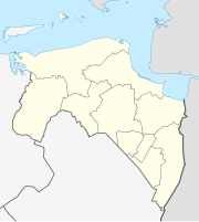
Watum lighthouse
| Watum lighthouse | ||
|---|---|---|
| Place: |
|
|
| Location: | Groningen , the Netherlands | |
| Geographical location: | 53 ° 22 '29.6 " N , 6 ° 53' 23" E | |
| Fire carrier height : | 10.5 m | |
| Fire height : | 20 m | |
|
|
||
| Construction time: | 1888 | |
| Operating time: | 1888-1945 | |
The Watum lighthouse was a lighthouse at the mouth of the Ems in the Dutch province of Groningen . The lighthouse, built in 1888, was destroyed by an English air raid in April 1945.
construction
The lighthouse was planned as one of five beacons as part of the German-Dutch project lighting the Unter-Ems and completed in 1888. Up until this point in time, the Unter-Ems was difficult to navigate at night due to the lack of beacons. The Watum lighthouse had three floors and a height of 10.5 meters. In 1895 the tower was expanded to include a service apartment for the lighthouse keeper and an assistant.
Destruction in World War II
During the Second World War, German soldiers used the lighthouse to barricade themselves there against approaching Canadian soldiers. Due to the fierceness of the German resistance to the liberation of Delfzijl , the Watum lighthouse was bombed and destroyed by English fighter planes on April 25, 1945.

