List of architectural monuments in Speldorf
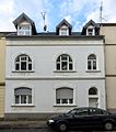
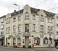
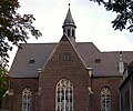
The list of architectural monuments in Speldorf contains the listed buildings in the area of Mülheim an der Ruhr-Speldorf , district Linksruhr, in North Rhine-Westphalia (as of 2016). These architectural monuments are entered in the monument list of the city of Mülheim an der Ruhr; The basis for the admission is the Monument Protection Act North Rhine-Westphalia (DSchG NRW).
| image | designation | location | description | construction time | Registered since |
Monument number |
|---|---|---|---|---|---|---|
 more pictures |
Raffelberg Park | Acacia avenue map |
1909 | 06/10/1994 | 683 |
|
 more pictures |
Raffelberger lock | Acacia avenue map |
1927-1928 | 11/08/1991 | 657 |
|
 more pictures |
Raffelberg brine bath : Kurhaus | Akazienallee 61, 63 map |
1908 | 03/17/1987 | 200 |
|
|
more pictures |
Solbad Raffelberg : bath house | Akazienallee 65, 67, 69, 71 map |
1908 | 03/17/1987 | 200 |
|
| former courtyard | Baakendorfer Strasse 44a map |
includes two half-timbered buildings, a single-storey half-timbered house and a smaller building from 1712, which was added to the north gable of a brick barn from the 19th century. The only remaining evidence of the former "Baakendorf" residential area | 1712 | 10/26/1989 | 585 |
|

|
Residential building | Blötter Weg 1 card |
1901-1902 | 08/20/1985 | 130 |
|

|
Residential building | Blötter Weg 3 map |
1901-1902 | 08/20/1985 | 130 |
|

|
Residential building | Blötter Weg 5 map |
1901-1902 | 08/20/1985 | 130 |
|

|
Residential building | Blötter Weg 7 map |
1901-1902 | 08/20/1985 | 130 |
|

|
Residential building | Blötter Weg 9 map |
1901-1902 | 08/20/1985 | 130 |
|

|
Residential building | Blötter Weg 10 map |
Early 20th century | 09/18/1989 | 27 |
|

|
Residential building | Blötter Weg 11 map |
around 1910 | 01/11/1989 | 498 |
|

|
Residential and commercial building | Duisburger Strasse 266 map |
around 1905 | 09.10.1989 | 573 |
|
 more pictures |
Evangelical Luther Church with parish hall, former parsonage and enclosure | Duisburger Strasse 278 map |
1882–1883 (nave) 1895–1896 (tower) |
January 16, 1984 | 37 |
|

|
Former tram depot Speldorf | Duisburger Strasse 283 map |
before 1914 | 01/26/1989 | 621 |
|

|
Parent company stupid | Duisburger Strasse 343 map |
1902 | 11/25/1988 | 500 |
|

|
Residential building | Duisburger Strasse 387 map |
Early 20th century | 11/03/1987 | 306 |
|

|
Residential building | Duisburger Strasse 389 map |
Early 20th century | 10/09/1987 | 312 |
|

|
villa | Duisburger Strasse 401 map |
Early 20th century | 10/09/1987 | 313 |
|

|
Residential and commercial building | Duisburger Strasse 465 map |
1st third of the 20th century | 07/24/1989 | 398 |
|

|
Headquarters Monning | Duisburger Strasse 490 map |
1789 (renewal) | 08/01/1990 | 626 |
|
 more pictures |
Wolfsburg | Falkenweg 6 map |
1906 | 02/28/1989 | 400 |
|

|
Porter's house of Wolfsburg | Falkenweg 6 map |
around 1906 | 04/16/1991 | 400 |
|
 more pictures |
former Hammann leather factory | Hansastrasse 19 map |
07/29/2014 | 659 |
||

|
Half-timbered house | Hansastrasse 22b map |
End of the 18th century | 12/18/1987 | 281 |
|
 more pictures |
Half-timbered house | Hansastrasse 29 map |
End of the 18th century | 10/28/2003 | 202 |
|
 more pictures |
Half-timbered house | Hansastrasse 33 map |
1782 | 05/04/1987 | 203 |
|

|
Half-timbered house | Hansastrasse 36 map |
1773 1788 |
02/09/1988 | 283 |
|

|
former Catholic school Speldorf | Heerstrasse 22 map |
around 1880 | December 27, 1988 | 504 |
|

|
Duplex | Hittfeldstrasse 57, 59 map |
Early 1930s | 01/20/1989 | 507 |
|

|
Kötterhaus | Hittfeldstrasse 73 map |
1st half of the 19th century | 01/14/1991 | 638 |
|

|
villa | Jägerhofstrasse 9 map |
Early 1930s | 11/25/1988 | 509 |
|

|
Residential building | Cat break 2nd card |
18th century (half-timbered) around 1900 (relocation, substructure) |
October 19, 1989 | 588 |
|

|
villa | Monningstrasse 46 map |
around 1900 | 03/30/1988 | 405 |
|

|
villa | Monningstrasse 53 map |
1899 | 12/30/1985 | 143 |
|
| Raffelberg brine bath : Children's brine bath | Platanenweg 46 map |
1908 | 03/17/1987 | 200 |
||

|
Residential building | Prinzenhöhe 3 card |
1920s | 07/24/1989 | 399 |
|

|
Residential building | Prince height 11 card |
Early 20th century | 01/27/1989 | 519 |
|
 more pictures |
villa | Prinzenhöhe 14 card |
Early 20th century | 06/03/1988 | 406 |
|
 more pictures |
Residential building | Prince height 22 card |
01/19/2016 | 687 |
||
 more pictures |
villa | Prinzenhöhe 26 card |
Early 20th century | 06/03/1988 | 407 |
|

|
Residential building | Prinzenhöhe 34 card |
Early 1920s | 03/01/1988 | 408 |
|
| villa | Prinzenhöhe 39 card |
circa 1920 | 07/29/2014 | 660 |
||

|
Raffelberg power plant | Raffelbergbrücke 8 map |
built by the architects Pfeifer and Großmann | 1925 | 05/11/1986 | 176 |

|
Catholic Church of St. Michael | Schumannstrasse 17 Mozartstrasse map |
1915-1919 | 06/07/2005 | 546 |
|
| Country villa | Uhlenhorstweg 18 map |
1937 | 03/01/1988 | 411 |
||
|
|
Factory | Weseler Strasse 120 map |
1928 | 12/18/1992 | 617 |

