List of cultural monuments in Piesport
The list of cultural monuments in Piesport contains all the cultural monuments of the Rhineland-Palatinate municipality of Piesport, including the districts of Ferres and Niederemmel (with Emmel, Reinsport and Müstert). The basis is the list of monuments of the State of Rhineland-Palatinate (as of November 14, 2017).
Piesport
Monument zones
| designation | location | Construction year | description | image |
|---|---|---|---|---|
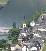
| Monument zone town center | Am Domhof 3–10, Ausoniusufer 1–14, Bachstrasse 1, 2, 3 and 5, Im Landkapitel 1–16 (without No. 6), St. Michaelstrasse 1–9, 11, 13, 15, 21 and 23 Lage |
16th to 19th century | small town center, parallel to the Moselle, with buildings from the 16th to 19th centuries; the monument zone includes the Ausoniusufer, the street Am Domhof and the St. Michaelstraße along the Moselle as well as the cross section of the Bachstraße, and as a back street the short street Im Landkapitel |

|
Individual monuments
| designation | location | Construction year | description | image |
|---|---|---|---|---|
| Rectory | Am Domhof 5 location |
1660 | former rectory; One to two-storey building with a mansard roof at the back, today's appearance from the 18th century, older in the core (marked 1660) | |
| Residential and guest house | Am Domhof 6 location |
1921 | Mansard roof construction, mixed forms of neo-Gothic and reform architecture, marked 1921 | |
| Residential building | Am Domhof 9 location |
1721 | former court of the Trier cathedral chapter; three-storey solid building, marked 1721 | |
| window | Ausoniusufer, at No. 3 location |
16th Century | two groups of coupled, late Gothic rectangular windows, probably from the 16th century; on the courtyard side of the rear part of the building on the upper floor | |
| Residential building | Ausoniusufer 5 location |
1776 | stately solid construction, slated half-timbered gable, marked 1776 | |
| Klausenhof | Ausoniusufer 6/7 location |
from 1613 | now village community center; multi-part building complex; seven-axis mansard roof, marked 1806; older house, marked 1613, partly under a half-hip roof, today's appearance from the 19th century, in essence probably older; connecting corridor on the first floor; in the courtyard a cellar built into the hillside, 18th or 19th century | |
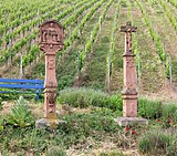
| Wayside shrine | Ausoniusufer, at No. 23 location |
1612 | Crucifixion group, pillar marked 1612, sculptures probably more recent | |
| Wayside cross | Bachstrasse, corner in Kordel location |
17th century | Shaft and cantilever of a crucifixion shrine, probably from the 17th century | |
| Wayside shrine | In the country chapter, at No. 4 location |
171 [x] | Crucifixion shrine, baroque, marked 171 [x] | |
| Residential building | In the country chapter 10 location |
18th century | Stately mansard roof building, partly half-timbered, 18th century, possibly older in core | |
| Catholic Parish Church of St. Michael | St. Michaelstraße 2 location |
1766/67 | rural rococo church, 1766/67, architect P. Miller, Tyrol |
 more pictures more pictures
|
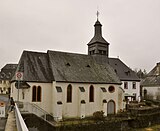
| Cemetery chapel | St. Michaelstraße, at No. 2 location |
around 1850 | neo-Gothic cemetery chapel, around 1850 | |
| Wayside shrine | St. Michaelstraße, at No. 2 in front of the Lage sacristy |
17th or 18th century | Relief of a station of the cross and the crucifixion shrine, 17th or 18th century | |
| pier | St. Michaelstraße, west of No. 2 location |
around 1780 | two portal pillars with angel figures, around 1780 | |
| Residential building | St. Michaelstraße 4 location |
18th century | Corner house; Solid construction, slated half-timbered gable, small economic part, 18th century, overformed in the 19th century | |
| Cross house | St. Michaelstraße 8 location |
1862 | Mansard roof building, marked 1862, segmented arched window from the 18th century | |
| sculpture | St. Michaelstraße, at No. 9 location |
18th century | Figure of a saint (?) On an unconventionally designed base, probably from the 18th century | |
| St. Sebastian cemetery chapel | St. Michaelstraße, behind No. 9 Lage |
around 1500 | former St. Sebastian cemetery chapel; late Gothic choir, around 1500 | |
| Residential building | St. Michaelstraße 23 location |
18th century | Stately mansard roof building, today's appearance around or after the middle of the 19th century, in essence probably from the 18th century | |
| Wayside shrine and wayside cross | north of the village on the L 50; Hallway In Olk Location |
1686 | Wayside shrine with Pietà relief, inscribed 1686; Wayside cross, marked 1668 |

|
| Piesporter Heiligenhäuschen | northwest of the place on the L 50 location |
18th century | small mansard roof building, 18th century |

|
| Holy House | northwest of the place on the L 50 location |
18th or 19th century | Holy house, round arch niche, 18th or 19th century | |
| Spoar pictures and band | northwest of the place in the forest location |
17th century | Relief pictures and inscription plate, probably from the 17th century; neo-Gothic chapel, late 19th century | |
| St. Vitus Chapel | north of the village on the L 50 location |
around 1900 | small neo-Gothic building, probably around 1900 |
Ferres
Individual monuments
| designation | location | Construction year | description | image |
|---|---|---|---|---|
| Catholic chapel | Bruder-Eberhardstrasse, next to No. 8 location |
1929 | small hall building, marked 1929 | |
| Ferreser Boor | Bruder-Eberhardstrasse, opposite No. 12, location |
1884 | Laufbrunnen, sandstone, marked 1884 |
Niederemmel
Individual monuments
| designation | location | Construction year | description | image |
|---|---|---|---|---|
| Catholic parish church of St. Martin | Location at Kirchplatz 5 |
1732 | Hall building, 1732, expanded in 1930, in the Spolien tower |

|
| Wayside shrine | At the church square, south of No. 5 location |
1661 | Crucifixion shrine, marked 1661 | |
| Catholic rectory | Location at Kirchplatz 7 |
1767 | stately mansard roof building, marked 1767 | |
| Frantzen Cross | At the Römerbrunnen, at No. 4 location |
1687 | Crucifixion shrine, marked 1687 | |
| Courtyard | On the Kaub 3 location |
16th or 17th century | Courtyard area; stately solid construction, stair tower, core from the 16th or 17th century, modified in 1786 (?), half-timbered barn, probably from the 18th century | |
| Wayside cross | On the Kaub, at No. 10 location |
1779 | stone cross in relief, inscribed 1779 | |
| Wayside chapel | On the Kaub, between No. 43 and 45 location |
19th century | small tent roof construction, probably from the 19th century; Fragment of a crucifixion shrine, 17th or 18th century | |
| Wayside chapel | Brückenstraße, corner of Unterer Wierth Lage |
small hipped roof building; inside figure niche, chronogram | ||
| Residential building | In the major 16 position |
1635 | small half-timbered house, partly massive, marked 1635 | |
| Karthäuserhof | Karthäuserplatz 6/8 location |
1742 | Main building of the former Karthäuserhof; Mansard roof building, marked 1742 | |
| Catholic All Saints Chapel | Karthäuserplatz 9 location |
1553 | three-axis hall construction with buttresses, modified in 1553, 1680 |

|
| Wayside shrine | Karthäuserplatz, at No. 9 location |
1702 | Crucifixion shrine, marked 1702 | |
| Residential and farm buildings | Karthäuserstraße 45 location |
1701 | stately mansard roof, partly half-timbered, allegedly from 1701 | |
| Residential building | Kettergasse 24 location |
16th or 17th century | stately solid construction, stair tower, 16th or 17th century | |
| Residential building | Moselstrasse 15 location |
1775 | Mansard roof building, marked 1775 | |
| Cross house | Moselstrasse 16 location |
1767 | former cross house; elongated mansard roof, marked 1767 | |
| Courtyard | St. Martinstraße 10, Am Kirchplatz 2 location |
16th or 17th century | Courtyard area; stately hipped roof building, stair tower, core from the 16th or 17th century (allegedly from 1622), partly overformed after division in the 19th century; Farm buildings; Overall system | |
| Residential building | St. Martinstrasse 21 location |
third quarter of the 19th century | Late classicist hipped roof building, quarry stone, probably from the third quarter of the 19th century | |
| Cross house | St. Martinstrasse 36 location |
1879 | Cross house; Quarry stone construction, sandstone walls, marked 1879 | |
| Courtyard | St. Martinstrasse 38 location |
1913 | Streckhof in quarry stone construction, marked 1913 | |
| Cross house | St. Martinstrasse 40 location |
1903 | Quereinhaus, marked 1903 | |
| Cross house | St. Martinstrasse, at No. 56 location |
1872 | two outer walls of the former transverse house, marked 1872 | |
| Residential building | St. Martinstrasse 61 location |
18th century | stately mansard roof, partly half-timbered, 18th century | |
| Residential building | St. Martinstrasse 67 location |
1785 | Mansard roof building, marked 1785 | |
| winery | St. Martinstrasse 87 location |
1794 | winery formerly part of the Karthäuserhof; multi-part, inconsistent building with mansard roofs, marked 1794, certainly older in the core | |
| Catholic Chapel of St. Nicholas | Steingasse 44 location |
1616 | small hall with buttresses, 1616; on the choir: Crucifixion shrine, inscribed 1618 | |
| Way of the Cross | southeast of the place on the Moselle slope opposite Minheim location |
Way of the Cross, chapel and crucifixion group visible from afar | ||
| Jagdschloss Tonnkopf | southeast of the village on the Hunsrück plateau, near the L 157 location |
first half of the 20th century | Wood-clad house, first half of the 20th century | |
| Holy House | south of the village in a meadow | 18th or 19th century | Quarry stone building with plaster residue, 18th or 19th century | |
| chapel | south of the village; Marking on Zimmet location |
1682 | small solid construction, slated half-timbered gable; Altar with cross structure, marked 1682 |
Former cultural monuments
| designation | location | Construction year | description | image |
|---|---|---|---|---|
| Mettlacher Klosterhof | Karthäuserplatz 3/5/7 location |
Main building grouped around a courtyard and two farm wings, essentially from the 18th century, several times overformed; Overall system ; deleted from list of monuments |
literature
- General Directorate for Cultural Heritage Rhineland-Palatinate (Ed.): Informational directory of cultural monuments in the Bernkastel-Wittlich district (PDF; 6.8 MB). Mainz 2017.
Web links
Commons : Cultural monuments in Piesport - Collection of images, videos and audio files
