List of cultural monuments in Wittlich
The list of cultural monuments in Wittlich includes all the cultural monuments of the Rhineland-Palatinate city of Wittlich including the districts of Bombogen , Dorf , Lüxem , Neuerburg and Wengerohr . The basis is the list of monuments of the State of Rhineland-Palatinate (as of November 14, 2017).
Wittlich
Monument zones
| designation | location | Construction year | description | image |
|---|---|---|---|---|
| Monument zone Bergweiler Weg | Bergweiler Weg 18–28 (even numbers) Location |
1920s | residential buildings built by the Reichsbahn; Couple in pairs, hipped roof buildings on a bossed square wall base, 1920s | |
| Monument zone Burgstrasse / Karrstrasse | Burgstrasse 20–30 (even numbers), Karrstrasse 2–12 (even numbers) Lage |
19th century | closed row of houses on a semicircular floor plan, which was built on the churchyard around the St. Mark's Church, which was abandoned around 1800; mostly three-storey residential and commercial buildings, 19th century; No. 20 from the end of the 19th century, No. 22 in the core from the 18th century, No. 24 and 26 from the middle of the 19th century, No. 28 in the core from the early 19th century, around 1850 and in 20th century modernized, No. 30 from 1828, reconstruction around 1900; characteristic street scene |

|
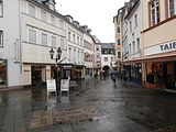
| Monument zone at Burgstrasse 3–37 | Burgstrasse 3–37 (odd numbers) location |
19th century | closed north side of the curvy Burgstrasse, two- and three-story plastered buildings, today's appearance mostly from the 19th century, in the core partly older; No. 5 and 13 from the middle of the 19th century, No. 7, 9, 15 and 21 from the end of the 19th century, No. 11 in the core from the 18th century, No. 23 1935 using older parts; defining the streetscape |
|
| Monument zone Burgstrasse 36–42 | Burgstrasse 36, 38, 40, 42 location |
Mid 19th and early 20th century | Closed row of houses on the south side of Burgstrasse, which together with the buildings on the opposite side of the street results in a characteristic street scene (No. 36 residential and commercial building, 1907/08; No. 38, neo-classical, 1912; No. 40 around 1910; No. 42 from the middle of the 19th century) | |
| Monument zone cemetery | Burgstrasse location |
1791 | Laid out in the city moat area in 1791, expanded in the middle of the 19th century and in 1918/19 as a reform cemetery by district architect Johannes Vienken , occupied until the middle of the 20th century; Tombs: group of pastors' tombs; J. Keller family, 1907 by A. Schüller, Trier; War memorial, 1880s, in the surrounding wall; War memorial 1914/18, extended by Johannes Scherl in the late 1950s ; Ehrenfriedhof, late 1950s, architect Karnatz, Trier; Cemetery chapel with glass window, by Georg Meistermann , 1950s, relief from 1921 | |
| Friedrichstrasse monument zone | Friedrichstrasse 1–15 (odd numbers) location |
1898 to 1904 | Row of high-class to upper-class historicist residential buildings on the north side of Friedrichstrasse, 1898 to 1904 | |
| Monument zone Himmeroder Straße 10–34 | Himmeroder Straße 10–34 (even numbers) location |
second half of the 19th century | Closed development on the east side of Himmeroder Straße consisting of two- and three-story narrow residential buildings, late 19th century, some of the core is older | |
| Monument zone at Himmeroder Strasse 37–51 | Himmeroder Straße 37–51 (odd numbers) location |
around 1900 | closed row of houses on the west side of Himmeroder Straße with plastered and clinker buildings, around 1900; characteristic street scene | |
| Monument zone Himmeroder Straße 52–56 | Himmeroder Strasse 52, 54, 56 location |
around 1900 | three late historic houses: No. 56 from 1895, No. 58 around 1895, No. 52 around 1900; defining the streetscape | |
| Monument zone Wittlich correctional facility | Fallerweg 1–41 (odd numbers), 30, 32 and Trierer Straße 22–62 (even numbers) location |
1897 to 1902 | Exemplary Prussian new prison building with settlement, sandstone-framed plastered brick buildings, neo-Romanesque motifs, 1897 to 1902 (secret building councilor hall, agricultural inspector Uber, agricultural director Fülles); so-called panoptic system: three-wing system with central monitoring facility, men's prison, women's prison, church; Interior fittings largely preserved; on the outer edges of the terrain, the residential buildings for the administrative officers, guards and teachers employed in the prison | |
| Kurfürstenstrasse monument zone | Kurfürstenstrasse 11–25 (odd numbers) location |
1885 to 1908 | A group of different residential and commercial buildings that characterize the square at the former cattle market, 1885 to 1908 | |
| Monument zone Marktplatz | Marktplatz 1–10, Burgstrasse 1, Neustrasse 1 and 2, location |
Closed redevelopment of the market square, in the core baroque two- and three-story town houses, town hall, former post office, electoral pharmacy |

|
|
| Monument zone Neustraße | Neustraße 13–21 (odd numbers) location |
around 1860 | development on both sides of the cul-de-sac with agricultural courtyards, around 1860; defining the streetscape | |
| Monument zone Oberstrasse | Oberstrasse 1–54, Kegelbahnstrasse 2 location |
18th century | Closed development of the Oberstraße and its connection to the bowling alley, small-scale residential and farm buildings by farmers and craftsmen, the core of which is often from the 18th century | |
| Schloßstraße monument zone | Schloßstraße 32–42 (even numbers) location |
around 1900 | Late historic group of houses on the west side of Schlossstrasse, some of them free-standing, around 1900 | |
| Monument zone Trierer Landstrasse | Trier Landstrasse 73-85 (odd numbers) location |
1924-27 | Residential buildings of the Wittlich building cooperative, combined into two blocks, plastered buildings with hipped roofs, 1924–27 | |
| Monument zone Trierer Strasse | Trierer Straße 1–15 (odd numbers) location |
18th century or earlier | Closed development on one of the oldest streets in the city, three-storey plastered buildings, today's appearance from the 19th century, essentially much older; characteristic street scene | |
| Jewish cemetery monument zone | west of the town and east of Hof Failz location |
around 1670 | created by 1670 at the latest; older weathered as well as classicist and historicist tombstones |
Individual monuments
| designation | location | Construction year | description | image |
|---|---|---|---|---|
| Residential building | Altneugasse 1 location |
Early 18th century | two-part house, early 18th century and marked 1842, half-timbered storey (1842?) | |
| villa | Altricher Weg 2 location |
1911 | stately hipped roof villa, 1911, architect Johannes Vienken; with equipment, garden | |
| Catholic parish church of St. Bernhard | Auf'm Geifen, to No. 12 location |
1953-55 | massive plastered building with bell tower, 1953–55, architect Willi Weyres with the assistance of K. Bong, Cologne | |
| House planks | Burgstrasse 1 location |
first half of the 18th century | Residential and commercial building with a mansard roof, first half of the 18th century | |
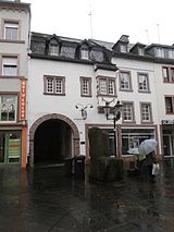
| Residential and commercial building | Burgstrasse 18 location |
1685 | Residential and commercial building, marked 1685 |
|
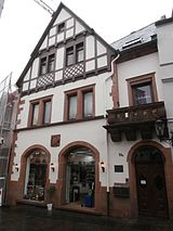
| Inn | Burgstrasse 31a location |
1907 | former inn "Zum Kurfürsten"; sandstone-integrated plastered building, half-timbered gable, 1907, architect probably Johannes Vienken; Coat of arms stone Elector Karl Kaspar von der Leyen , probably around 1666 |
|
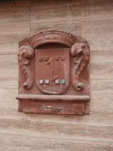
| Coat of arms stone | Burgstrasse, at No. 34 location |
Mid 17th century | Coat of arms stone; Coat of arms of Lothar Braun von Schmidtburg, mid-17th century |
|
| Residential and commercial building | Burgstrasse 36 location |
1907/08 | Two-wing residential and commercial building, plastered building with two-storey half-timbered gable, 1907/08, architect J. Friedhofen, Koblenz |

|
| hotel | Wittlich BW 2018-07-29 14-57-12.jpg location |
1906 | former Hotel Restaurant Mürtz; three-storey historicized corner residential and commercial building, new renaissance motifs, single-storey terrace extension, inscribed 1906, architect Dückeny |

|
| Courtyard | Burgstrasse 54 location |
1826 | Courtyard, 1826; three-storey house with half-hipped roof, winter garden around 1900, economy with gate drive, tobacco shed with distillery, second economy; three baroque pillars, probably from 1763 | |
| Castle gate | Burgstrasse 57 location |
1317 | Remainder of the city fortifications from 1317; Plastered building with baroque hood; Pietà relief, probably from the 17th century; Shank cross, 1703, probably from the Wolff brothers' workshop |

|
| Faller Chapel | Fallerweg location |
1718 | Saddle roof construction with roof turrets, marked 1718; Stations of the Cross: 13 stations, sandstone and clay, 1859 by August Michels , Koblenz; Wayside shrine, 1742; overall structural system | |
| villa | Friedrichstrasse 1 location |
1902/03 | stately hipped roof villa, new renaissance motifs, 1902/03, architect Fülles building inspector | |
| Residential building | Friedrichstrasse 2 location |
1904/05 | late historic corner house, 1904/05, architect Jakob Marschall ; defining the streetscape | |
| Casino | Friedrichstrasse 4 location |
1898/99 | representative plastered building with stage extension and tower; 1898/99, architect Fülles building inspector | |
| Residential building | Friedrichstrasse 21/23 location |
1906 | Sophisticated late historical double house, 1906, architect Gustav Karutz | |
| Residential building | Friedrichstrasse 25 location |
1922 | representative house with hipped roof, veranda extension, 1922, architect Johannes Vienken | |
| Residential building | Friedrichstrasse 27 location |
1922 | representative house, neo-classical hipped roof construction, expressionist influences, 1922, architect Johannes Vienken | |
| Machine factory Wintrich | Gerberstrasse location |
1828 | Hammer mill and Lohmühle, proven in 1828, expansion by 1900 at the latest; Undershot mill wheel, parts of the transmission and machines | |
| Purge burner | Himmeroder Straße, at No. 1, 1a and 1b location |
17th century | The street facade and a polygonal stair tower on the gable side have been preserved from a building from the core of the 17th century |

|
| Residential building | Himmeroder Straße 6 location |
1708 | essentially medieval plastered building, marked 1708, remodeling in the early 19th century; Groin vaulted cellar in the courtyard, around 1400 | |
| Residential houses | Himmeroder Straße 9/11 location |
1884 | Group of houses, neo-classical motifs, 1884 | |
| Residential building | Himmeroder Straße 17 location |
around 1780 | six-axis plastered building, around 1780, neo-classical renovation marked 1884 | |
| Residential and commercial building | Himmeroder Straße 19 location |
1906 | three-storey corner residential and commercial building with a mansard roof, 1906, architect Jakob Marschall; defining the townscape | |
| Hotel Eifeler Hof | Himmeroder Straße 31 location |
1905 | three-storey late historical sandstone building (plastered), marked 1905, architect probably Jakob Marschall | |
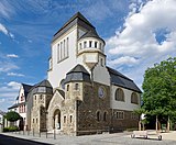
| Wittlich synagogue | Himmeroder Strasse 44 location |
1910 | monumental romanized quarry stone and plastered building, Heimatstil and Art Nouveau motifs, 1910, architect Johannes Vienken, demolished in 1938, cultural center since 1977 |
 more pictures more pictures
|
| Residential building | Himmeroder Straße 46 location |
1912 | three-axle house with hipped roof, 1912 | |
| Villa Lüttiken | Himmeroder Strasse 50 location |
1911 | representative mansard roof, 1911, architect Johannes Vienken | |
| Residential building | Kalkturmstrasse 36 location |
1913/14 | Director's residence of the wood industry built in 1913/14, neo-classicistic, additional storey in 1935, architect Wiebel, Cologne | |
| Residential building | Karrstrasse 3 location |
before 1900 | three-storey sandstone-framed clinker building, before 1900 | |
| Residential and commercial building | Karrstrasse 13 location |
around 1780 | three-storey baroque plastered building, around 1780, shop fitting in the 1920s, shell niche with figure of Mary | |
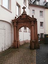
| Parish garden | Karrstrasse, at No. 14 location |
from 1700 | Cemetery portal by Conrad Wolff, Wittlich, around 1700; Trinity shrine, second half of the 18th century; Cemetery cross, 1892; baroque grave cross; two sandstone reliefs, early 20th century |
|
| House Daus | Karrstrasse 19/21 location |
early 16th century | Plastered building with twin and triple windows, the core from the early 16th century, remodeled in 1686 |

|
| Residential and commercial building | Karrstrasse 26 location |
Late 18th century | Row residential and commercial building, end of the 18th century, remodeling around 1900 |

|
| Residential building | Karrstrasse 28 location |
late 17th century | three-storey plastered building, late 17th century |

|
| Residential building | Karrstrasse 29 location |
1853 | three-storey hipped roof building, 1853; defining the streetscape | |
| Residential building | Karrstrasse 33 location |
late 17th century | Plastered building, essentially from the late 17th century | |
| Residential building | Karrstrasse 34 location |
1697 | three-storey baroque plastered building, marked 1697, conversion marked 1737, archway to No. 32 | |
| Residential building | Karrstrasse 36 location |
around 1600 | Angular building with a mansard roof, essentially around 1600, remodeling in 1753 | |
| Catholic St. Mark's Church | Kirchstrasse location |
1707 / 08-24 | late Gothic choir; Baroque pillar basilica without transepts, 1707 / 08–24, architect Philipp Honorius Ravensteyn , tower elevation and roof turret 1722, architect Johann Georg Judas ; Glass window 1952 based on designs by Maurice Rocher , Heinrich Dieckmann , Georg Meistermann and Alois Stettner ; with equipment; defining the townscape; three tombstones, 17th century |

|
| Residential building | Kirchstrasse 4 location |
1870s | three-storey sandstone / slate stone building, neo-classical motifs, 1870s | |
| Anthony Chapel | Klausener Weg, at No. 2 location |
around 1914 | Gothic cross roof building, around 1914 | |
| Residential building | Koblenzer Strasse 4 location |
1898 | Sandstone-incorporated late historical plastered building, marked 1898 | |
| Residential building | Koblenzer Straße 9/11 location |
around 1900 | Late historical double house, around 1900, architect Josef Bungert | |
| Residential building | Koblenzer Straße 14/16 location |
1904 | Late historical double house, 1904, architect Jakob Marschall | |
| Villa Else | Koblenzer Strasse 19 location |
1901 | stately late-historic house, marked 1901 | |
| Leave cross | Koblenzer Straße, at No. 91 location |
1645 | Wayside cross; Shank cross, sandstone, marked 1645 | |
| Association municipality administration | Kurfürstenstrasse 1 location |
1842 | three-storey classicist hipped roof building, marked 1842, extension 1857; rear construction around 1850; Gate, marked 1842 |

|
| Road Construction Office | Kurfürstenstrasse 3 location |
1912 | former district savings bank; representative neo-classical hipped roof building, marked 1912, architect Johannes Vienken | |
| County house | Kurfürstenstrasse 16 location |
1911-13 | Castle-like neo-baroque three-wing complex, 1911–13, architect Paul Schultze-Naumburg | |
| Inn | Kurfürstenstraße 19 location |
1903 | sophisticated inn with hipped roof, new renaissance motifs, inscribed 1903, architect probably Jakob Marschall; defining the streetscape | |
| Residential building | Kurfürstenstrasse 21 location |
1928 | New baroque mansard roof, 1928, architect Johannes Vienken | |
| school | Kurfürstenstraße 23 location |
second half of the 19th century | former city high school; Wing construction with knee floor, second half of the 19th century, in front of it a neo-baroque mansard roof, 1920, architect Johannes Vienken | |
| Alt-Wittlich inn | Kurfürstenstraße 47 location |
1925/26 | former local health insurance fund; stately hipped roof building, expressionist motifs, 1925/26, architect Johannes Vienken | |
| Residential building | Kurfürstenstrasse 57 location |
1920s | former home of a forest official; rural sandstone-framed plastered building, 1920s | |
| Chief Forester | Kurfürstenstraße 59 location |
1899 | former State Forestry Office; multi-part historicizing structure, 1899, architect building inspector Fülles | |
| Residential building | Marienstraße 10 location |
1921 | representative hipped roof building, 1921, architect Johannes Vienken | |
| Post office | Marktplatz 3 location |
after 1725 | former post office, then seat of the Prussian administration, inn, food wholesaler; three-storey, seven-axis mansard roof over a high cellar, after 1725, renovation marked 1753 |

|
| Hotel Well | Marktplatz 5 location |
Late 17th century | former Zum Wolf inn; representative three-storey mansard roof building, towards the end of the 17th century, architect Conrad Wolff |

|
| Marktschenke | Marktplatz 6 location |
around 1700 | former house Neuerburg; Two-and-a-half-storey, five-axis plastered building, probably late Gothic in the core, today's appearance around 1700 |

|
| Residential and commercial building | Marktplatz 7 location |
1910 | three-storey residential and commercial building on a trapezoidal floor plan, 1910, architects Johannes Vienken and Heinz Wiemers , Wittlich | |
| Residential and commercial building | Neustraße 1 location |
1912 | three-story baroque mansard roof building, 1912, architect Robert Tauschke |

|
| town hall | Neustraße 2 location |
1650-52 | Plastered building on an irregular floor plan, 1650–52, restored after fires in 1689 and 1707 with Baroque additions, rearward extension 1922–24, architect Johannes Vienken with the advice of Professor Jahn, Düsseldorf; Glass window, 1954 by Georg Meistermann |

|
| hotel | Neustraße 11 location |
around 1870 | former hotel; sandstone-integrated plastered building, around 1870; to the rear, tobacco barn, late 19th century |

|
| portal | Upper cord, at No. 13 position |
1797 | Skylight portal, marked 1797 | |
| Residential building | Oberstrasse 2 location |
1805 | five-axis mansard roof, marked 1805 | |
| Residential building | Oberstrasse 3 location |
1763 | Half of the house with half-timbered gable (plastered), marked 1763 | |
| Residential building | Oberstrasse 18 location |
around 1750 | three-storey, narrow plastered building, around 1750 | |
| Residential building | Oberstrasse 20 location |
first half of the 18th century | narrow plastered building, first half of the 18th century | |
| Courtyard | Oberstrasse 44 location |
18th century | One-ridge system, core from the 18th century, renovation marked 1848, outbuilding renewed around 1900; Spolia | |
| Residential building | Rommelsbach 1 location |
1900 | Cripple hip roof construction, new renaissance motifs, 1900; defining the townscape | |
| Residential building | Rommelsbach 6 location |
around 1900 | three-storey mansard roof building, Art Nouveau motifs | |
| Albertz winery | Rommelsbach 16-18 position |
late 19th century | House and cellar, late 19th century; No. 16: plastered building, in the core from 1870, reconstruction in 1905, architect Jakob Marschall, No. 18: baroque mansard roof building, 1919–21; overall structural system | |
| Residential and commercial building | Schloßplatz 9, Schloßstraße 10 location |
1895 | Corner building, today's appearance from 1895, architect Jakob Marschall; defining the streetscape | |
| Residential and commercial building | Schlossstrasse 1 location |
1912 | three-storey mansard roof building, classicist motifs, 1912, architect Johannes Vienken; defining the townscape | |
| post Office | Schlossstrasse 3 location |
1932-34 | two-part, flat-roofed system on a tiled base, 1932–34, architect, Baurat Ebner | |
| Savings bank | Schlossstrasse 4 location |
1955 | three-storey reinforced concrete skeleton construction, lower extensions, 1955, architect Stang, Düsseldorf; three bronze figures by Hanns Scherl |

|
| Residential building | Schlossstrasse 32 location |
around 1900 | Late historical sandstone-integrated brick building, around 1900 | |
| Residential building | Schloßstraße 36 location |
1905 | Plastered building with crooked hip, 1905, architect Jakob Marschall junior | |
| Residential building | Schlossstrasse 42 location |
1904 | Late historical plastered building on rubble stone plinth, 1904 | |
| Residential building | Tiergartenstrasse 16 location |
1890 | four-axis plastered building, new renaissance motifs, 1890 | |
| Gasthaus zur Kastanie | Trierer Landstrasse 1, Römerstrasse 2 location |
in the middle of the 19th century | two half-hip roof buildings, lower connecting building, mid-19th century; overall structural system | |
| Residential building | Trier Landstrasse 2 location |
1898 | sandstone-incorporated late historical plastered building, 1898 | |
| Residential building | Trier Landstrasse 7 location |
1924/25 | neo-classical hipped roof, 1924/25, architect Johannes Vienken; Window by Georg Meistermann | |
| Evangelical Christ Church | Trier Landstrasse, next to No. 11 location |
from 1858 | neo-Gothic hall construction, from 1858, municipal master builder Gerhard, Mönchengladbach with changes by building councilors Stüler, Berlin, and Hoff, Trier; Bell tower 1960, architect Heinrich Otto Vogel , Trier |
 more pictures more pictures
|
| Rectory | Trierer Landstrasse 11 location |
before 1856 | former garden pavilion; Mansard roof building, heightened in 1856 | |
| Residential building | Trier Landstrasse 12 location |
1925 | Half-hip roof building, single-storey rear building with mansard roof, 1925, architect Heinz Wiemers | |
| Residential building | Trier Landstrasse 14 location |
representative plastered building with mansard gable roof, 1912, architect Claus Mehs , Frankfurt; defining the townscape | ||
| Residential building | Trierer Landstrasse 16 location |
1896 | sandstone-integrated clinker building, neo-renaissance motifs, 1896; defining the townscape | |
| Correctional facility | Trierer Landstrasse 18 location |
1866/67 | former hospital; sandstone-integrated plastered building, 1866/67, architect building inspector Opel, Merseburg; Wing extensions, 1902, architect, district architect Köchling; Increase in the 1950s; defining the townscape | |
| Correctional facility | Trierer Landstrasse 20 location |
1945-52 | former St. Elisabeth District Hospital; Originally asymmetrical layout, chapel at the back, 1945–52, architect Johannes Vienken, younger neo-classical south wing | |
| Residential building | Trierer Landstrasse 25 location |
1905/06 | historicizing plastered building, 1905/06; rear farm building in exposed brickwork | |
| Residential building | Trierer Strasse 4 location |
17th century | Narrow three-storey row house, the core of the 17th century, increase in around 1900 | |
| Residential building | Trierer Strasse 8 location |
around 1800 | three-storey plastered building, around 1800, essentially older | |
| Residential building | Trierer Strasse 9 location |
late 18th century | three-storey plastered building, late 18th century | |
| Residential building | Trierer Strasse 10 location |
around 1785 | narrow three-story mansard roof, around 1785 | |
| Residential building | Trierer Strasse 12 location |
1763 | former tanner's house; Mansard roof building with asymmetrical facade, marked 1763, in the core probably older; defining the townscape | |
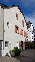
| Residential building | Trierer Strasse 14 location |
1688 | Half-hip roof building, renaissance motifs, marked 1688, renovation and expansion marked 1810 |
|
| Residential building | Trierer Strasse 31 location |
around 1900 | three-storey hipped roof building, around 1900; defining the townscape | |
| Residential building | Trierer Straße, at No. 36, 38, 40 location |
1569 | Plastered building over groin vaulted cellar, marked 1569; overall structural system | |
| Residential building | Trierer Strasse 52 location |
around 1870 | three-storey plastered building, combined from two houses around 1870; defining the townscape | |
| Residential building | Trierer Strasse 58 location |
1890 | five-axis sandstone building, 1890 | |
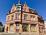
| Residential and commercial building | Trierer Strasse 60 location |
1905 | Stately corner residential and commercial building, new renaissance motifs, 1905, architect Marschall |
|
| Residential building | Lower cord 13 layers |
second half of the 19th century | three-storey plastered building, Palladio motif, probably from the second half of the 19th century | |
| Residential building | Lower cord 39 ply |
1876 | two-axis plastered building, 1876 | |
| Residential building | To Philippsburg 5 location |
1929 | Plastered building with pointed arched gable roof, late expressionist motifs, 1929, architect Heinz Wiemers | |
| Residential building | To Switzerland 1 location |
1865 | three-storey plastered building, 1865, architect Johann Musseleck | |
| Abachsmühle | north of the city on the K 21 location |
1855 | Five-axis house, mill building, economies, 1855, architect Hubert Weinand , tobacco drying shed 1883, another house around 1900 | |
| Railway bridges and tunnels | north of the city in the Stadtwaldt location |
1910 | two railway bridges (with accompanying pedestrian walkway) and two tunnels of the railway line from Wittlich to Daun, opened in 1910, all buildings with uniform, regular sandstone block facing | |
| Chapels | south of the city on the pilgrimage route to Klausen Lage |
from the middle of the 17th century | A group of religious landmarks on the ascending path:
|
|
| Failz farm | west of the city on the K 54 location |
1775 | spacious courtyard, former cloister courtyard of the St. Ursula monastery in Cologne, first mentioned in the 10th century; House, marked 1775, conversion of the second house in the middle of the 19th century, barn marked 1563 | |
| Schaeffer's chapel | west of town on a dirt road location |
1882 | also Pitter Juseps Kapäälchie ; Plastered building on a stone base, 1882 | |
| Good Blumenscheid | west of the city location |
1906-08 | Stately manor, 1906-08, house with mansard hipped roof, extension 1926/27, architect Johannes Vienken | |
| Wayside cross | north of the city on the L 52 location |
1660 | Shank cross, red sandstone, marked 1660, body from the beginning of the 20th century |
Former cultural monuments
| designation | location | Construction year | description | image |
|---|---|---|---|---|
| Residential and commercial building | Burgstrasse 17 location |
late 19th century | historicist residential and commercial building, four-storey clinker brick building integrated into the house, late 19th century; deleted from list of monuments |

|
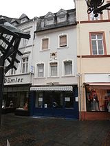
| Residential and commercial building | Burgstrasse 23 location |
1935 | Baroque-style residential and commercial building with a mansard roof, marked 1935, using older parts; deleted from list of monuments |
|
| Residential building | Hochstrasse 30 location |
around 1830 | Semi-detached house, modest plastered building with sandstone, around 1830; deleted from list of monuments |
Bow
Individual monuments
| designation | location | Construction year | description | image |
|---|---|---|---|---|
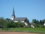
| Parish Church of the Assumption | Alberostraße 5 location |
1789-92 | late baroque hall building, 1789–92 |
|
| Wayside cross | Alberostraße, southwest of the church location |
1711 | Shank cross, marked 1711 | |
| Wayside shrine | Alberostraße, at the entrance to the church Lage |
around 1700 | Wayside shrine, around 1700 | |
| War memorial | Alberostraße, by the church Lage |
1926-28 | War memorial 1914/18, 1926–28 by Josef Monz , Trier | |
| primary school | Berlinger Strasse 1 location |
1908-10 | two-wing mansard roof, 1908–10, architect Johannes Vienken; defining the townscape | |
| Residential building | Berlinger Strasse 14 location |
1861 | smallholder dwelling house; sandstone-integrated plastered building, marked 1861 | |
| Residential building | Berlinger Strasse 23 location |
1771 | late baroque hipped roof building, 1771, older in core | |
| Courtyard | Berlinger Strasse 29 location |
1821 | Courtyard area; Five-axis house, marked 1821, barn marked 1837 | |
| Rosary Chapel | Berlinger Strasse 31 location |
1737 | Plastered building with roof turrets, marked 1737 | |
| Wayside cross | Berlinger Strasse, at No. 35 location |
1822 | Shank cross, marked 1822 | |
| Residential building | Berlinger Strasse 42 location |
Early 20th century | historicizing sandstone / slate quarry stone building, early 20th century | |
| Weiherhof | Hofstrasse 2 location |
17th century | Three-sided courtyard; Hipped roof building, 17th century, remodeling (?) Marked 1776 | |
| Holy House | Maximinstrasse at the corner of Berlinger Strasse Lage |
1936 | Heiligenhäuschen, 1936 | |
| school | Maximinstrasse 22 location |
1830-33 | former Catholic school; Five-axis hipped roof building on a high base, 1830–33 | |
| Tavern Gäßestrepper | Maximinstrasse 27 location |
around 1800 | Building ensemble consisting of a half-hip roof structure, the core probably around 1800, hall building, around 1900, tobacco shed, barn; defining the streetscape | |
| Three Kings Cross | south of the village on the L 54 (Eifelstraße) location |
1818 | Red sandstone, 1818, renovation marked 1903 | |
| Chapel eight pictures | south of the village at the end of the street Zur Acht Lage |
1880s | open plastered building, 1880s |
Village
Individual monuments
| designation | location | Construction year | description | image |
|---|---|---|---|---|
| Cross house | Alftalstrasse 25 location |
1836 | Quereinhaus, marked 1836, two tobacco sheds | |
| Courtyard | Alftalstrasse 49 location |
1844 | Einfirstanlage, marked 1844, tobacco shed with stable, around 1900 |

|
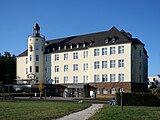
| Mission house | Arnold-Jansen-Straße 1 location |
1925/26 | formerly Mission House St. Paul; three-storey hipped roof building on a slate base, round tower, 1925/26, architect Pater Johann Beckert ; uniaxial extension 1965 |
|
| Horticulture | Arnold-Jansen-Straße, behind the Mission House Lage |
1905 | Volkspark garden restaurant, 1905, architect Jakob Marschall, renovation 1922, architect Johann Beckert |

|
Lüxem
Individual monuments
| designation | location | Construction year | description | image |
|---|---|---|---|---|
| Cross house | Bombogener Strasse 2 location |
1903 | Quereinhaus, quarry stone, 1903 | |
| Residential building | Bombogener Strasse 8 location |
after 1900 | three-axis quarry stone building with entrance annex, shortly after 1900 | |
| Residential building | Bombogener Strasse 16 location |
1925 | Quarry stone building like a house, tobacco shed, 1925 | |
| Cross house | Bombogener Strasse 19 location |
1834 | Quereinhaus with tobacco shed, marked 1834; Niche figure, 18th century | |
| Residential building | Bombogener Strasse 22 location |
1927 | three-axle residential building with business section, quarry stone buildings, 1927, tobacco shed at the rear | |
| Cross house | Bombogener Strasse 24 location |
Transverse house with adjoining stable and barn | ||
| Cross house | Bombogener Strasse 26 location |
Transverse house with adjoining stable and barn, tobacco shed | ||
| Tobacco scales | Bombogener Straße, opposite No. 39 location |
1952 | a three-and-a-half-story timber structure, 1952 and 1956, architect Leo Bastgen | |
| Wayside cross | Grünewaldstrasse, at No. 2 location |
Mid 18th century | Capital and cross of a former cross, mid-18th century | |
| Residential building | Grünewaldstrasse 7 location |
1906/07 | Plastered building with half-timbered gable, 1906/07, architect Johannes Vienken, smithy and economy, later 19th century | |
| Cross house | Im Bungert 13 location |
before 1828 | Quereinhaus, before 1828, tobacco shed at the back | |
| Residential building | Vitelliusstrasse 4 location |
18th century | sandstone-integrated plastered building, core from the 18th century, oven extension, marked 1864, knee stick probably at the same time | |
| Cross house | Vitelliusstrasse 5 location |
18th century | Quereinhaus, marked 1859, older in the core, cellar marked 1740, Stall marked 1792; defining the streetscape | |
| Courtyard | Vitelliusstraße 8 location |
before 1828 | Courtyard, before 1828; Residential house, economy, tobacco shed | |
| Catholic Church of Mary Magdalene | Vitelliusstraße 10a location |
in the core a late medieval choir tower, small hall building; octagonal extension, 1963–65, architect Peter van Stipelen ; with equipment | ||
| Crosses | Vitelliusstraße, at No. 10a on the stairway to the church Lage |
18th century | Shank cross, Pietà, mid-18th century; Pietà, early 18th century; Shank cross, Pietà, 18th century; Relief, Holy Family, 18th century | |
| kindergarten | Vitelliusstraße 14 location |
1907/08 | former girls' school; asymmetrical plastered building on rubble stone plinth, half-timbered bay, 1907/08, architect Johannes Vienken; defining the townscape | |
| Wayside cross | Wilhelm-Busch-Straße, at No. 4 location |
1845 | Gothic cross, 1845 by the sculptor Meilen, Wittlich | |
| Bernardi cross | southwest of the location |
1741 | Bernardi Cross, marked 1741 |
Neuerburg
Monument zones
| designation | location | Construction year | description | image |
|---|---|---|---|---|
| Monument zone Buchenstrasse 9 | Buchenstrasse 9 location |
1830 | former courtyard; Half-hip roof building, marked 1830 | |
| Monument zone ruin Neuerburg | south of the place on the Neuerburger head location |
1140-46 | Archbishop's castle built 1140–46, expanded 1260–68, destroyed in 1689; fragmentary remains |
Individual monuments
| designation | location | Construction year | description | image |
|---|---|---|---|---|
| Community tobacco shed | Akazienstrasse location |
1950s | Community tobacco shed, 1950s, architect Leo Bastgen | |
| Wayside cross | Akazienstraße, corner of Eichenstraße Lage |
1706 | Wayside cross; Red sandstone, 1706, probably from the Wolff brothers' workshop, Wittlich | |
| Municipal Forestry Office | Birkenstrasse 4 location |
1910-12 | single-storey plastered building with corner loggia, 1910–12, architect Johannes Vienken; Farm buildings | |
| door | Buchenstrasse, at No. 11 location |
after 1840 | drilled frame, post-classical door leaf, after 1840 | |
| Cross house | Eichenstrasse 15 location |
17th century | Quereinhaus, core from the 17th century, renovations in the second half of the 18th century, 1840, around 1900; defining the townscape; Taken system, 17th century | |
| Catholic branch church of St. Nicholas | Eichenstrasse 16a location |
1872/73 | Neo-Gothic hall building with a high tower, 1872/73, architect probably Heinrich Bruck ; with equipment | |
| Residential building | Eichenstrasse 22 location |
18th century | two-axle house, core from the 18th century, business section probably more recent, gate around 1900 | |
| Cross house | Eichenstrasse 43 location |
18th century | Quereinhaus, core from the 18th century, knee stick marked 1819, tobacco shed; Structural complex that defines the townscape with no.45 | |
| Cross house | Eichenstrasse 45 location |
1732 | Quereinhaus, marked 1732, knee stick from the 19th century, tobacco shed; The overall structure that characterizes the site with no.43 | |
| Courtyard | Eichenstrasse 57 location |
1835 | Half-hip roof building, marked 1835 and 1907; Economy with a crooked hip roof, marked 1832; next to 1997: Friedenseiche from 1815, felled in 1997 | |
| Nicholas Chapel | north of the village location |
17th century | Plaster construction; Inside the sandstone relief of Saint Nicholas, 1811 | |
| Scheuerhof | south of the village (Hofstrasse) location |
17th century | Dreiseithof, around 1840, essentially older (Renaissance and 18th century); Hipped roof building, two commercial extensions, tobacco shed | |
| Berg's picture | southwest of the place; Hallway Under Olig Location |
around 1840 | Plastered building with pyramid roof, around 1840 |
Wengerohr
Monument zones
| designation | location | Construction year | description | image |
|---|---|---|---|---|
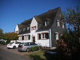
| Monument zone Reichsbahnsiedlung | On the hill 2-9 location |
1903-20 | Contiguous group of eight different houses with outbuildings, reform architecture, 1903–20 |
|
Individual monuments
| designation | location | Construction year | description | image |
|---|---|---|---|---|
| Chapel of St. John the Evangelist | Bernkasteler Straße 14 location |
1523 | Choir, marked 1523, hall 1593–96, vestibule and roof turret from the 19th century |

|
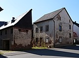
| Courtyard | Bernkasteler Straße 16 location |
early 19th century | former courtyard, probably from the early 19th century; House, oven, tobacco shed, economy |
|
| Wayside cross | Bernkasteler Strasse, next to No. 16 location |
1770 | Shank cross, marked 1770 (crucifix and Maria casts, Johannes new based on old models) |

|
| Cross house | Eifelstrasse 1 location |
around 1900 | Quereinhaus, around 1900; two-and-a-half-storey sandstone-integrated late historical residential part; defining the townscape |

|
| Wayside cross | Eifelstraße, at No. 25 location |
18th century | Wayside cross; Red sandstone, 18th century, neo-Gothic cross with metal body, around 1900 |

|
| Holy Cross cemetery chapel | Wittlicher Strasse, at the cemetery location |
1930 | house-like plastered building with roof turrets, 1930; with furnishings from the 18th century |

|
| Catholic Parish Church of St. Peter | Wittlicher Strasse 4 location |
1950s | Gable roof building with a square tower, 1950s; defining the townscape |

|
| Wayside cross | Wahlholzer Straße, at No. 1 location |
1669 | Cross from 1669, revised in 1954 |

|
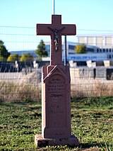
| Wayside cross | east of the village on the Roman road north of Wahlholz Lage |
1892 | Shank cross, sandstone, 1892, stoneware body from the early 20th century |
|
literature
- Ulrich Kerkhoff, Mechtild Ohnmacht (editor): Cultural monuments in Rhineland-Palatinate. Monument topography Federal Republic of Germany. Volume 4.1: Bernkastel-Wittlich district. Stadt Wittlich Schwann, Düsseldorf 1987. ISBN 3-590-31033-2 (assigned twice) and ISBN 3-590-31034-0
- General Directorate for Cultural Heritage Rhineland-Palatinate (Ed.): Informational directory of cultural monuments in the Bernkastel-Wittlich district (PDF; 6.8 MB). Mainz 2017.
Web links
Commons : Kulturdenkmäler in Wittlich - collection of pictures, videos and audio files
