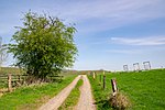
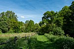
List of landscape protection areas in the Höxter district
The list of landscape protection areas in the Höxter district contains the landscape protection areas of the Höxter district in North Rhine-Westphalia .
list
| image | number | Name of the area | Area in hectares | map | Coordinates | Date of regulation |
|---|---|---|---|---|---|---|

|
LSG-4119-003 | LSG Nature Park Eggegebirge and Teutoburg Forest | 12176.0392 | location | position | 1972 |
| LSG-4122-0029 | LSG-Twiertal in the Corvey forest | 57.4106 | location | position | 2006 | |
| LSG-4122-0030 | LSG buckling in the Corvey forest | 26.6405 | location | position | 2006 | |

|
LSG-4122-0031 | LSG beech forests on the Kukenberg and Stieltalsberg | 105.5546 | location | position | 2006 |
| LSG-4122-0032 | LSG-Weseraue in the area of Große Masch | 36.9261 | location | position | 2006 | |
| LSG-4122-0033 | LSG beech forests on the east slope of the Kandel near Stahle | 64.0123 | location | position | 2006 | |

|
LSG-4122-0034 | LSG-Feldberg with loess slope zone, Orttal and Twiertal near Stahle | 92.5075 | location | position | 2006 |
| LSG-4122-0035 | LSG loess slope zone between Twiertal and Liesengrund | 106.728 | location | position | 2006 | |
| LSG-4122-0036 | LSG-Saumerbachtal with a loess slope zone adjacent to the north near Albaxen | 40.5486 | location | position | 2006 | |
| LSG-4122-0037 | LSG notched valleys with grassland and hedges on the Räuschenberg western slope | 19.7256 | location | position | 2006 | |
| LSG-4122-0038 | LSG-Schelpetal between Brenkhausen and Höxter | 68.9453 | location | position | 2006 | |

|
LSG-4220-002 | LSG-Südlicher Kreis Höxter | 22639.2355 | location | position | 1984 |

|
LSG-4221-0001 | LSG-Höxter Ost | 5052.8357 | location | position | 2006 |
| LSG-4221-0002 | LSG-Bastenberg | 26.9471 | location | position | 2006 | |

|
LSG-4221-0004 | LSG-forest-free shell limestone slope zone with valleys and gullies at Bosseborn | 167.5425 | location | position | 2006 |

|
LSG-4221-0005 | LSG loess-shaped middle slope areas of Brunsberg, Mittelberg, Lüdge Berg, Langer Berg and on Herbremer Holz | 86.3156 | location | position | 2006 |
| LSG-4221-0007 | LSG beech forests on the western slope of the Hebremer Holz | 27.5808 | location | position | 2006 | |

|
LSG-4221-0008 | LSG loess slope zone on the Stockberg | 17.112 | location | position | 2006 |
| LSG-4221-0010 | LSG flood basin of the Nethe between Ottbergen and Godelheim | 59.9833 | location | position | 2006 | |
| LSG-4222-0001 | LSG-Grubetal between Lütmarsen and Höxter | 10.0943 | location | position | 2006 | |
| LSG-4320-0001 | LSG-Südlicher Kreis Höxter and Stadtwald Brakel | 1709.4164 | location | position | 2006 | |
| LSG-4321-0001 | LSG-Eggeberg | 21.1754 | location | position | 2006 | |
| LSG-4321-0002 | LSG grassland valleys between Rothe and Dalhausen | 74.4438 | location | position | 2006 | |
| LSG-4321-0003 | LSG-Spechterberg | 23.0532 | location | position | 2006 | |

|
LSG-4321-0004 | LSG Schnegelberg | 14.8858 | location | position | 2006 |

|
LSG-4321-0005 | LSG-Krähenberg | 23.31 | location | position | 2006 |

|
LSG-4321-0006 | LSG-Gaffelntal and Kiepenberg | 40.6557 | location | position | 2006 |

|
LSG-4321-0007 | LSG Beverungen | 6065.7426 | location | position | 2006 |
| LSG-4322-0001 | LSG-Osterfeld | 30.5033 | location | position | 2006 | |
| LSG-4322-0002 | LSG Lake | 29.8141 | location | position | 2006 | |

|
LSG-4322-0003 | LSG-Roter Berg | 2.9699 | location | position | 2006 |
| LSG-4222-0002 | LSG-Solling west slope structured by notch valleys and gullies near Lüchtringen | 37.0209 | location | position | 2006 | |
| LSG-4222-0003 | LSG northern loess slope zone on the Ziegenberg | 29.7595 | location | position | 2006 | |
| LSG-4222-0004 | LSG north slope zone of the Wildberg near forester's house Laue | 17.9394 | location | position | 2006 | |
| LSG-4222-0005 | LSG-wooded Steinberg near Wehrden | 40.7617 | location | position | 2006 | |
| LSG-4222-0006 | LSG-Weseraue with soft and hardwood meadows between Stahle and Wehrden | 29,367 | location | position | 2006 | |
| LSG-4222-0007 | LSG eastern slope zone of the Heggeberges near Wehrden | 4.8412 | location | position | 2006 | |
| LSG-4222-0008 | LSG Bielenberg plateau | 10.3923 | location | position | 2006 | |
| LSG-4222-0009 | LSG loess slope zone on the east slope of Bielenberg | 30.0845 | location | position | 2006 | |

|
LSG-4222-0012 | LSG Räuschenberg plateau with loess slope zone between Höxter and Brenkhausen | 130.92 | location | position | 2006 |

|
Nieheimer Land | 6554.8 | 2018 | |||
| Emmersystem and Wolfskamp | 125.1 | 2018 | ||||

|
Mühlenbachtal and Sonnenberg | 57.8 | 2018 | |||
| Röthebachtal | 60.4 | 2018 | ||||
| Holmbach | 18.7 | 2018 |