| image
|
number
|
Name of the area (LSG ...)
|
Type
|
Municipality / city
|
Area in hectares
|
map
|
Coordinates
|
Date of
regulation
|
|
|
LSG-4419-0001
|
Edge heights between Sintfeld and Diemeltal
|
A.
|
Marsberg
|
1164.10
|
location
|
position
|
2004
|
|
|
LSG-4419-0002
|
Open spaces northeast of Westheim
|
B.
|
Marsberg
|
180.76
|
location
|
position
|
2004
|
|
|
LSG-4419-0003
|
Paderborn plateau
|
B.
|
Marsberg
|
1036.01
|
location
|
position
|
2004
|
|
|
LSG-4419-0004
|
Nuttlerfeld
|
C.
|
Marsberg
|
25.01
|
location
|
position
|
2004
|
|
|
LSG-4419-0005
|
In front of the harrow
|
B.
|
Marsberg
|
133.36
|
location
|
position
|
2004
|
|
|
LSG-4419-0006
|
At the Höleken
|
C.
|
Marsberg
|
8.22
|
location
|
position
|
2004
|
|
|
LSG-4419-0007
|
Dahlbachtal
|
C.
|
Marsberg
|
26.06
|
location
|
position
|
2004
|
|
|
LSG-4419-0008
|
Westheimer Diemeltal
|
C.
|
Marsberg
|
242.91
|
location
|
position
|
2004
|
|
|
LSG-4419-0009
|
On the Dahlberg
|
C.
|
Marsberg
|
5.33
|
location
|
position
|
2004
|

|
LSG-4513-0001
|
Arnsberg
|
A.
|
Arnsberg
|
8365.25
|
location
|
position
|
1998
|
|
|
LSG-4513-0002
|
Stockei
|
B.
|
Arnsberg
|
22.77
|
location
|
position
|
1998
|
|
|
LSG-4513-0004
|
Vosswinkel
|
B.
|
Arnsberg
|
96.84
|
location
|
position
|
1998
|
|
|
LSG-4513-0005
|
Bachum
|
B.
|
Arnsberg
|
82.19
|
location
|
position
|
1998
|
|
|
LSG-4513-0006
|
Totenberg
|
B.
|
Arnsberg
|
26.77
|
location
|
position
|
1998
|
|
|
LSG-4513-0007
|
Bellingsen
|
B.
|
Arnsberg
|
25.91
|
location
|
position
|
1998
|
|
|
LSG-4513-0008
|
Dreihausen
|
B.
|
Arnsberg
|
20.97
|
location
|
position
|
1998
|
|
|
LSG-4513-0009
|
Breloh
|
B.
|
Arnsberg
|
10.64
|
location
|
position
|
1998
|
|
|
LSG-4513-0010
|
Wiebelsheide
|
B.
|
Arnsberg
|
3.79
|
location
|
position
|
1998
|
|
|
LSG-4513-0011
|
Breitenbruch
|
|
Arnsberg
|
15.65
|
location
|
position
|
1998
|
|
|
LSG-4513-0012
|
Holzen-Mimberge
|
B.
|
Arnsberg
|
141.94
|
location
|
position
|
1998
|
|
|
LSG-4513-0013
|
Oelinghausen
|
B.
|
Arnsberg
|
26.42
|
location
|
position
|
1998
|
|
|
LSG-4513-0014
|
Herringring
|
B.
|
Arnsberg
|
87.02
|
location
|
position
|
1998
|
|
|
LSG-4513-0017
|
Hüsten-Ost
|
B.
|
Arnsberg
|
61.80
|
location
|
position
|
1998
|
|
|
LSG-4513-0018
|
Wrestling
|
B.
|
Arnsberg
|
44.04
|
location
|
position
|
1998
|
|
|
LSG-4513-0019
|
Oelinghauser Heide
|
B.
|
Arnsberg
|
84.41
|
location
|
position
|
1998
|
|
|
LSG-4513-0020
|
Gut Stiepel-Kalte Lieth
|
B.
|
Arnsberg
|
67.89
|
location
|
position
|
1998
|
|
|
LSG-4513-0021
|
Müschede
|
B.
|
Arnsberg
|
38.84
|
location
|
position
|
1998
|
|
|
LSG-4513-0022
|
Kehlsiepen
|
C.
|
Arnsberg
|
5.22
|
location
|
position
|
1998
|
|
|
LSG-4513-0023
|
Mühlenbach northwest of Vosswinkel
|
C.
|
Arnsberg
|
4.50
|
location
|
position
|
1998
|
|
|
LSG-4513-0024
|
Vosswinkel Heath
|
C.
|
Arnsberg
|
11.24
|
location
|
position
|
1998
|
|
|
LSG-4513-0025
|
Hasbach-Oestingsiepen
|
C.
|
Arnsberg
|
23.37
|
location
|
position
|
1998
|
|
|
LSG-4513-0026
|
Möhneaue
|
C.
|
Arnsberg
|
36.87
|
location
|
position
|
1998
|
|
|
LSG-4513-0027
|
Ruhraue
|
C.
|
Arnsberg
|
92.82
|
location
|
position
|
1998
|
|
|
LSG-4513-0028
|
Siefen east of Neheim
|
C.
|
Arnsberg
|
0.83
|
location
|
position
|
1998
|
|
|
LSG-4513-0030
|
Dollberg Siepen
|
C.
|
Arnsberg
|
1.56
|
location
|
position
|
1998
|
|
|
LSG-4513-0031
|
Röhraue
|
C.
|
Arnsberg
|
89.44
|
location
|
position
|
1998
|
|
|
LSG-4513-0032
|
Shield broken sirens
|
C.
|
Arnsberg
|
24.38
|
location
|
position
|
1998
|
|
|
LSG-4513-0033
|
Biberbachtal
|
C.
|
Arnsberg
|
64.88
|
location
|
position
|
1998
|
|
|
LSG-4513-0038
|
Baumbachtal
|
C.
|
Arnsberg
|
30.69
|
location
|
position
|
1998
|
|
|
LSG-4513-0039
|
Erlbach Valley
|
C.
|
Arnsberg
|
8.55
|
location
|
position
|
1998
|
|
|
LSG-4514-0001
|
Low bucket
|
|
Arnsberg
|
7.16
|
location
|
position
|
1998
|
|
|
LSG-4514-0002
|
Uentrop-Wintrop
|
|
Arnsberg
|
69.62
|
location
|
position
|
1998
|
|
|
LSG-4514-0003
|
Wicheln
|
|
Arnsberg
|
17.39
|
location
|
position
|
1998
|
|
|
LSG-4514-0004
|
Lüsenberg
|
|
Arnsberg
|
6.07
|
location
|
position
|
1994
|
|
|
LSG-4514-0005
|
Glösingen-Oeventrop
|
|
Arnsberg
|
76.39
|
location
|
position
|
1998
|
|
|
LSG-4514-0006
|
Hevensbrinktal
|
|
Arnsberg
|
2.70
|
location
|
position
|
1998
|
|
|
LSG-4514-0007
|
Wannetal
|
|
Arnsberg
|
5.86
|
location
|
position
|
1998
|
|
|
LSG-4514-0008
|
Berbketal
|
|
Arnsberg
|
7.35
|
location
|
position
|
1998
|
|
|
LSG-4515-0001
|
Lattenberg
|
|
Arnsberg
|
8.35
|
location
|
position
|
1998
|

|
LSG-4515-0002
|
Local open spaces east of Freienohl
|
|
Meschede
|
5.51
|
location
|
position
|
1994
|
|
|
LSG-4515-0003
|
Outskirts west of Eversberg
|
|
Meschede
|
81.2
|
location
|
position
|
1994
|
|
|
LSG-4515-0004
|
Holdmecke north of Wennemen
|
|
Meschede
|
14.89
|
location
|
position
|
1994
|
|
LSG-4515-0005
|
Meschede
|
|
Meschede
|
15,879.03
|
location
|
position
|
1994
|
|
|
LSG-4516-0001
|
Bestwig
|
|
Bestwig
|
4909.76
|
location
|
|
2008
|
|
|
LSG-4516-0002
|
In boxing
|
B.
|
Brilon
|
49.62
|
location
|
position
|
2008
|
|
|
LSG-4516-0003
|
Open country around Esshoff
|
B.
|
Brilon
|
17.23
|
location
|
position
|
2008
|
|
|
LSG-4516-0004
|
Escherfeld
|
C.
|
Brilon
|
10.97
|
location
|
position
|
2008
|
|
|
LSG-4516-0005
|
Wet grassland around Rixen
|
C.
|
Brilon
|
32.43
|
location
|
position
|
2008
|
|
|
LSG-4517-0002
|
Brilon plateau
|
B.
|
Brilon
|
1381.86
|
location
|
position
|
2001
|
|
|
LSG-4517-0003
|
Obermöhne- / Almewald and Almer Quellgrund
|
A.
|
Brilon
|
3040.46
|
location
|
position
|
2008
|
|
|
LSG-4517-0004
|
Upper Immental
|
B.
|
Brilon
|
18.54
|
location
|
position
|
2001
|
|
|
LSG-4517-0005
|
Open spaces around Radlinghausen and Madfeld
|
B.
|
Brilon
|
475.65
|
location
|
position
|
2001
|
|
|
LSG-4517-0006
|
Open spaces east of Thülen
|
B.
|
Brilon
|
105.65
|
location
|
position
|
2001
|
|
|
LSG-4517-0007
|
Open spaces west of Thülen
|
B.
|
Brilon
|
71.80
|
location
|
position
|
2001
|
|
|
LSG-4517-0008
|
Almerfeld
|
B.
|
Brilon
|
60.05
|
location
|
position
|
2001
|

|
LSG-4517-0009
|
Open spaces in the Lühlingsbach valley
|
B.
|
Brilon
|
128.08
|
location
|
position
|
2001
|
|
|
LSG-4517-0010
|
Upper Mill Valley
|
C.
|
Brilon
|
21.38
|
location
|
position
|
2001
|
|
|
LSG-4517-0012
|
Brilon limestone plateau and edge heights
|
A.
|
Brilon
|
1656.67
|
location
|
position
|
2008
|

|
LSG-4517-0013
|
Wintertal / Escherfeld
|
B.
|
Brilon
|
481.66
|
location
|
position
|
2008
|
|
|
LSG-4517-0014
|
Offenland on the northern outskirts of Brilon
|
B.
|
Brilon
|
137.51
|
location
|
|
2008
|
|
|
LSG-4517-0015
|
Offenland Bindel / Möhnetal
|
B.
|
Brilon
|
53.51
|
location
|
position
|
2008
|
|
|
LSG-4517-0016
|
Open country complex Rixen / Scharfenberg
|
B.
|
Brilon
|
252.58
|
location
|
position
|
2008
|
|
|
LSG-4517-0017
|
Open country on the outskirts of Alme
|
B.
|
Brilon
|
148.87
|
location
|
position
|
2008
|
|
|
LSG-4517-0018
|
Open country around Nehden
|
B.
|
Brilon
|
215.00
|
location
|
position
|
2008
|

|
LSG-4517-0019
|
Open country southeast of Brilon
|
B.
|
Brilon
|
455.97
|
location
|
position
|
2008
|
|
|
LSG-4517-0020
|
Open country complex around Wülfte / Brilon plateau
|
B.
|
Brilon
|
710.64
|
location
|
position
|
2008
|
|
|
LSG-4517-0021
|
Östenberg / Riestental
|
B.
|
Brilon
|
60.41
|
location
|
position
|
2008
|
|
|
LSG-4517-0022
|
Keffelke
|
C.
|
Brilon
|
32.98
|
location
|
position
|
2008
|
|
|
LSG-4517-0023
|
Hallerkamp
|
C.
|
Brilon
|
22.64
|
location
|
position
|
2008
|
|
|
LSG-4517-0024
|
Lower Immental
|
C.
|
Brilon
|
23.39
|
location
|
position
|
2008
|
|
|
LSG-4517-0025
|
Lean grassland on the Nehder Kopf
|
C.
|
Brilon
|
9.92
|
location
|
position
|
2008
|
|
|
LSG-4517-0026
|
Lean grassland on the Zyndelstein
|
C.
|
Brilon
|
4.15
|
location
|
position
|
2008
|
|
|
LSG-4517-0027
|
Lean grassland on Feldberg and Schaaken
|
C.
|
Brilon
|
22.50
|
location
|
position
|
2008
|

|
LSG-4517-0028
|
Grassland Association Aa
|
C.
|
Brilon
|
213.02
|
location
|
position
|
2008
|
|
|
LSG-4517-0029
|
Wet grassland breaks and forest break
|
C.
|
Brilon
|
31.02
|
location
|
position
|
2008
|
|
|
LSG-4517-0030
|
Stone slide
|
C.
|
Brilon
|
5.43
|
location
|
position
|
2008
|
|
|
LSG-4517-0031
|
Grassland complex around Alme Castle
|
C.
|
Brilon
|
15.57
|
location
|
position
|
2008
|
|
|
LSG-4517-0032
|
Hallinghausen
|
C.
|
Brilon
|
67.00
|
location
|
position
|
2008
|
|
|
LSG-4517-0033
|
Grassland complex on the outskirts of Oberalme
|
C.
|
Brilon
|
52.42
|
location
|
position
|
2008
|
|
|
LSG-4517-0034
|
Lean grassland complex south of Wülfte
|
C.
|
Brilon
|
70.17
|
location
|
position
|
2008
|
|
|
LSG-4517-0035
|
Nehdener Mühlental
|
C.
|
Brilon
|
13.72
|
location
|
position
|
2008
|
|
|
LSG-4517-0036
|
Hoppenberg / Raumberg
|
C.
|
Brilon
|
52.07
|
location
|
position
|
2008
|
|
|
LSG-4517-0037
|
Grassland gained west of the Hilbringse
|
C.
|
Brilon
|
32.57
|
location
|
position
|
2008
|
|
|
LSG-4517-0038
|
Möhneburg / Im Wenster
|
C.
|
Brilon
|
39.84
|
location
|
position
|
2008
|

|
LSG-4517-0039
|
Dumpling Siepen
|
C.
|
Brilon
|
6.13
|
location
|
position
|
2008
|
|
|
LSG-4517-0040
|
Wet grassland on Windsberg
|
C.
|
Brilon
|
7.73
|
location
|
position
|
2008
|
|
|
LSG-4517-0041
|
Kalberstert / Scheffelberg grassland complex
|
C.
|
Brilon
|
33.61
|
location
|
position
|
2008
|
|
|
LSG-4517-0042
|
Lean grassland on Heimberg
|
C.
|
Brilon
|
11.37
|
location
|
position
|
2008
|
|
|
LSG-4518-0001
|
Open spaces on the Raumberg
|
B.
|
Marsberg
|
26.11
|
location
|
position
|
2001
|
|
|
LSG-4518-0002
|
Open spaces between Helminghausen and Padberg
|
B.
|
Marsberg
|
105.61
|
location
|
position
|
2001
|
|
|
LSG-4518-0003
|
Open spaces near Beringhofen
|
B.
|
Marsberg
|
15.87
|
location
|
position
|
2001
|
|
|
LSG-4518-0004
|
Open spaces east of Padberg
|
B.
|
Marsberg
|
10.78
|
location
|
position
|
2001
|
|
|
LSG-4518-0005
|
Open spaces southwest of Beringhausen
|
B.
|
Marsberg
|
34.40
|
location
|
position
|
2001
|
|
|
LSG-4518-0006
|
Open spaces between Forstenberg and Schafbruch
|
B.
|
Brilon
|
137.31
|
location
|
position
|
2001
|
|
|
LSG-4518-0007
|
Open spaces north of Bredelar
|
B.
|
Marsberg
|
44.69
|
location
|
position
|
2001
|
|
|
LSG-4518-0008
|
Open spaces on the Aabach
|
B.
|
Brilon
|
45.58
|
location
|
position
|
2001
|
|
|
LSG-4518-0009
|
Rotten Bruch / Hemmeker Bruch
|
C.
|
Brilon
|
96.55
|
location
|
position
|
2001
|
|
|
LSG-4518-0010
|
Upper Aabach
|
C.
|
Brilon
|
52.48
|
location
|
position
|
2001
|
|
|
LSG-4518-0011
|
Grassland valley north of Rösenbeck
|
C.
|
Brilon
|
8.82
|
location
|
position
|
2001
|
|
|
LSG-4518-0012
|
Grassland valley southeast of Rösenbeck
|
C.
|
Brilon
|
7.81
|
location
|
position
|
2001
|
|
|
LSG-4518-0013
|
Altenfilstal
|
C.
|
Brilon
|
12.71
|
location
|
position
|
2001
|
|
|
LSG-4518-0014
|
Grassland valley north of the Forstenberg
|
C.
|
Marsberg
|
15.13
|
location
|
position
|
2001
|
|
|
LSG-4518-0015
|
Leiental
|
C.
|
Marsberg
|
3.99
|
location
|
position
|
2001
|
|
|
LSG-4518-0016
|
Hoppecketal south of Beringhausen
|
C.
|
Marsberg
|
10.79
|
location
|
position
|
2001
|
|
|
LSG-4518-0017
|
Twerswecke
|
C.
|
Marsberg
|
17.15
|
location
|
position
|
2001
|
|
|
LSG-4518-0018
|
Enkenberg
|
C.
|
Marsberg
|
48.07
|
location
|
position
|
2001
|

|
LSG-4518-0019
|
Hoppecke - Diemel - Bergland
|
A.
|
Brilon
|
7790.64
|
location
|
position
|
2001
|
|
|
LSG-4518-0021
|
Bredelar Chamber-Fürstenberg Forest
|
A.
|
Marsberg
|
1421.70
|
location
|
|
2004
|
|
|
LSG-4518-0022
|
Open spaces around Erlinghausen / Auf der Sandkuhle
|
B.
|
Marsberg
|
548.26
|
location
|
|
2004
|
|
|
LSG-4518-0023
|
Mill Valley
|
C.
|
Marsberg
|
3.95
|
location
|
position
|
2004
|
|
|
LSG-4518-0024
|
Klustal
|
C.
|
Marsberg
|
17.71
|
location
|
position
|
2004
|
|
|
LSG-4518-0025
|
Erlenbachtal
|
C.
|
Marsberg
|
1.49
|
location
|
position
|
2004
|
|
|
LSG-4518-0026
|
Momecketal
|
C.
|
Marsberg
|
14.52
|
location
|
position
|
2004
|
|
|
LSG-4518-0027
|
At the Rennebusch
|
C.
|
Marsberg
|
39.84
|
location
|
position
|
2004
|
|
|
LSG-4519-0001
|
Red country
|
A.
|
Marsberg
|
2033.40
|
location
|
position
|
2004
|
|
|
LSG-4519-0002
|
Schweingründchen / Berghagen / Unter der Königsseite
|
B.
|
Marsberg
|
23.47
|
location
|
position
|
2004
|
|
|
LSG-4519-0003
|
Kuckengrund / Helmberg
|
B.
|
Marsberg
|
139.42
|
location
|
position
|
2004
|
|
|
LSG-4519-0004
|
Open spaces around Leitmar
|
B.
|
Marsberg
|
209.75
|
location
|
|
2004
|
|
|
LSG-4519-0005
|
Open spaces near Oesdorf / Westheim and Krähengrund
|
B.
|
Marsberg
|
192.66
|
location
|
|
2004
|
|
|
LSG-4519-0006
|
Heidenpost / Steintwisten and Niedernfeld
|
B.
|
Marsberg
|
40.12
|
location
|
|
2004
|
|
|
LSG-4519-0007
|
Diemel valley flanks around Niedermarsberg
|
B.
|
Marsberg
|
100.10
|
location
|
position
|
2004
|
|
|
LSG-4519-0008
|
Open spaces around Canstein
|
B.
|
Marsberg
|
96.97
|
location
|
|
2004
|
|
|
LSG-4519-0009
|
Open spaces around Giershagen
|
B.
|
Marsberg
|
784.29
|
location
|
|
2004
|
|
|
LSG-4519-0010
|
Open spaces west of Udorf
|
B.
|
Marsberg
|
195.36
|
location
|
|
2004
|
|
|
LSG-4519-0011
|
Echeloles
|
B.
|
Marsberg
|
128.41
|
location
|
|
2004
|
|
|
LSG-4519-0012
|
Lower Orpe Valley
|
B.
|
Marsberg
|
67.56
|
location
|
|
2004
|
|
|
LSG-4519-0013
|
Prierberg
|
B.
|
Marsberg
|
25.95
|
location
|
|
2004
|
|
|
LSG-4519-0014
|
Open spaces around Heddinghausen
|
B.
|
Marsberg
|
200.68
|
location
|
|
2004
|
|
|
LSG-4519-0015
|
Staupketal
|
C.
|
Marsberg
|
15.85
|
location
|
position
|
2004
|
|
|
LSG-4519-0016
|
Outskirts of Obermarsberg
|
C.
|
Marsberg
|
4.04
|
location
|
position
|
2004
|
|
|
LSG-4519-0018
|
Sauerlandgraben
|
C.
|
Marsberg
|
19.90
|
location
|
position
|
2004
|
|
|
LSG-4519-0019
|
Hamecketal
|
C.
|
Marsberg
|
6.13
|
location
|
position
|
2004
|
|
|
LSG-4519-0020
|
Bensloh and Sieke
|
C.
|
Marsberg
|
91.02
|
location
|
position
|
2004
|
|
|
LSG-4519-0021
|
Düwel / Wortknäppe
|
C.
|
Marsberg
|
41.67
|
location
|
position
|
2004
|
|
|
LSG-4519-0023
|
Frohental
|
C.
|
Marsberg
|
57.76
|
location
|
position
|
2004
|
|
|
LSG-4519-0024
|
Hasselbicketal
|
C.
|
Marsberg
|
20.03
|
location
|
position
|
2004
|
|
|
LSG-4519-0025
|
Bauernscheid
|
C.
|
Marsberg
|
7.09
|
location
|
position
|
2004
|

|
LSG-4519-0026
|
Upper Orpe Valley
|
C.
|
Marsberg
|
24.66
|
location
|
position
|
2004
|

|
LSG-4519-0027
|
Wait
|
C.
|
Marsberg
|
36.02
|
location
|
position
|
2004
|
|
|
LSG-4519-0028
|
On the larch
|
C.
|
Marsberg
|
5.55
|
location
|
position
|
2004
|
|
|
LSG-4519-0029
|
Margarethenhof
|
C.
|
Marsberg
|
32.62
|
location
|
position
|
2004
|
|
|
LSG-4519-0030
|
At Leitmarscher Bruch
|
C.
|
Marsberg
|
14.16
|
location
|
position
|
2004
|
|
|
LSG-4519-0031
|
Lean grassland on the Glockengrund
|
C.
|
Marsberg
|
21.76
|
location
|
position
|
2004
|
|
|
LSG-4519-0032
|
plate
|
C.
|
Marsberg
|
82.14
|
location
|
position
|
2004
|
|
|
LSG-4613-0001
|
Sundern
|
|
Sundern
|
14,344.51
|
location
|
position
|
1993
|
|
|
LSG-4613-0007
|
Deinstrop-Klinksberg
|
|
Arnsberg
|
30.50
|
location
|
position
|
1998
|
|
|
LSG-4613-0008
|
Wenningen-Kirchlinde
|
|
Arnsberg
|
58.91
|
location
|
position
|
1998
|
|
|
LSG-4613-0009
|
Betting marsens
|
|
Arnsberg
|
13.21
|
location
|
position
|
1998
|
|
|
LSG-4613-0010
|
Ainkhausen-Katterhof
|
|
Arnsberg
|
25.58
|
location
|
position
|
1998
|
|
|
LSG-4613-0011
|
Wenninger and Wettmarsener Bachtal
|
|
Arnsberg
|
35.11
|
location
|
position
|
1998
|
|
|
LSG-4613-0012
|
Devil's Siepen
|
|
Arnsberg
|
2.28
|
location
|
position
|
1998
|
|
|
LSG-4613-0013
|
Dittmecke
|
|
Arnsberg
|
9.32
|
location
|
position
|
1998
|
|
|
LSG-4613-0014
|
Klingsschlade
|
|
Arnsberg
|
1.72
|
location
|
position
|
1998
|
|
|
LSG-4613-0015
|
Hohe Hahn west of Hövel
|
|
Sundern
|
58.39
|
location
|
position
|
1993
|
|
|
LSG-4613-0016
|
Crow's cage east of Hövel
|
|
Sundern
|
68.12
|
location
|
position
|
1993
|
|
|
LSG-4613-0017
|
Echterfeld north of Langscheid
|
|
Sundern
|
34.79
|
location
|
position
|
1993
|
|
|
LSG-4613-0018
|
Three partial areas in the landscape between Amecke, Bruchhausen, Allendorf and Stockum
|
|
Sundern
|
247.01
|
location
|
position
|
1993
|
|
|
LSG-4613-0019
|
Heavily structured fields north of Enkhausen
|
|
Sundern
|
39.95
|
location
|
position
|
1993
|
|
|
LSG-4613-0020
|
Outskirts between Enkhausen and around Tiefenhagen
|
|
Sundern
|
13.53
|
location
|
position
|
1993
|
|
|
LSG-4613-0021
|
Slope to the Röhrtal in the northern outskirts of Hachen
|
|
Sundern
|
10.70
|
location
|
position
|
1993
|
|
|
LSG-4613-0022
|
Eastern outskirts of Hachen
|
|
Sundern
|
7.12
|
location
|
position
|
1993
|
|
|
LSG-4613-0023
|
Lower slope to the Flamecke valley north of Sundern
|
|
Sundern
|
4.48
|
location
|
position
|
1993
|
|
|
LSG-4613-0024
|
Local open spaces north of Hachen
|
|
Sundern
|
12.40
|
location
|
position
|
1993
|
|
|
LSG-4613-0025
|
Grassland complex north of Hövel
|
|
Sundern
|
19.90
|
location
|
position
|
1993
|
|
|
LSG-4613-0026
|
Beckumer Bachtal southwest of Hövel
|
|
Sundern
|
20.69
|
location
|
position
|
1993
|
|
|
LSG-4613-0027
|
Melscheder Mühlenbachtal southwest of Melschede
|
|
Sundern
|
26.69
|
location
|
position
|
1993
|
|
|
LSG-4613-0028
|
Valley area in the Kritmecke west of Wulfringhausen
|
|
Sundern
|
23.20
|
location
|
position
|
1993
|
|
|
LSG-4613-0029
|
Hespetal above Bruchhausen
|
|
Sundern
|
32.13
|
location
|
position
|
1993
|
|
|
LSG-4613-0030
|
Grassland complex north of Estinghausen
|
|
Sundern
|
19.81
|
location
|
position
|
1993
|
|
|
LSG-4613-0031
|
Enkhauser Bachtal south and north of the B 229
|
|
Sundern
|
69.22
|
location
|
position
|
1993
|
|
|
LSG-4613-0032
|
Flasmecketal north of Langscheid
|
|
Sundern
|
10.57
|
location
|
position
|
1993
|
|
|
LSG-4613-0033
|
The Röhr valley near Stemel
|
|
Sundern
|
43.27
|
location
|
position
|
1993
|
|
|
LSG-4613-0034
|
Sorpewiesen "Erlenkamp" south of Tiefenhagen
|
|
Sundern
|
13.66
|
location
|
position
|
1993
|
|
|
LSG-4613-0035
|
Valley area (lower course) of the Selmecker brook
|
|
Sundern
|
5.99
|
location
|
position
|
1993
|
|
|
LSG-4613-0036
|
Valley area of the Settmecke between Settmecke and Seidfeld
|
|
Sundern
|
35.14
|
location
|
position
|
1993
|
|
|
LSG-4613-0037
|
Stockumer Bachtal between Seidfeld and Stockum including adjacent moist grassland areas
|
|
Sundern
|
25.09
|
location
|
position
|
1993
|
|
|
LSG-4613-0038
|
Flamecke valley east of Sundern
|
|
Sundern
|
26.43
|
location
|
position
|
1993
|
|
|
LSG-4613-0039
|
Asmecke valley east of Seidfeld
|
|
Sundern
|
12.61
|
location
|
position
|
1993
|
|
|
LSG-4613-0040
|
Röhrtal north of Hachen
|
|
Sundern
|
27.05
|
location
|
position
|
1993
|
|
|
LSG-4613-0041
|
Wet grassland to the northwest of the Sauerland Clinic
|
|
Sundern
|
3.93
|
location
|
position
|
1993
|
|
|
LSG-4613-0042
|
Valley meadow in Röhrtal between Obergraben and Röhr
|
|
Sundern
|
3.95
|
location
|
position
|
1993
|
|
|
LSG-4613-0043
|
Talwiese in the course of a side simmering to the Röhr east of Hachen
|
|
Sundern
|
2.54
|
location
|
position
|
1993
|
|
|
LSG-4614-0001
|
Kreuzberg-Eisenberg
|
|
Arnsberg
|
7.88
|
location
|
position
|
1998
|
|
|
LSG-4614-0002
|
Wennigloh-Boenkhausen
|
|
Arnsberg
|
114.24
|
location
|
position
|
1998
|
|
|
LSG-4614-0003
|
Thickness fraction
|
|
Arnsberg
|
6.71
|
location
|
position
|
1998
|
|
|
LSG-4614-0004
|
Rumbeck
|
|
Arnsberg
|
89.16
|
location
|
position
|
1998
|

|
LSG-4614-0005
|
Mühlenbachtal
|
|
Arnsberg
|
1.51
|
location
|
position
|
1998
|
|
|
LSG-4614-0006
|
Ennecker break
|
|
Arnsberg
|
3.86
|
location
|
position
|
1998
|
|
|
LSG-4614-0007
|
Valley train northeast of Wennigloh
|
|
Arnsberg
|
5.71
|
location
|
position
|
1998
|
|
|
LSG-4614-0008
|
Lower Hellefelder Bachtal
|
|
Arnsberg
|
2.74
|
location
|
position
|
1998
|
|
|
LSG-4614-0009
|
Eslohe
|
A.
|
Eslohe
|
7582.13
|
location
|
|
2008
|
|
|
LSG-4614-0010
|
Good Blessenohl
|
B.
|
Eslohe
|
23.57
|
location
|
|
2008
|

|
LSG-4614-0011
|
Wennetal from south Wenholthausen to south Gut Blessenohl
|
C.
|
Eslohe
|
28.41
|
location
|
position
|
2008
|
|
|
LSG-4614-0012
|
Cultural landscape complex northwest of Wenholthausen
|
C.
|
Eslohe
|
23.57
|
location
|
|
2008
|
|
|
LSG-4614-0013
|
Himmenhagen northwest of Freienohl
|
|
Meschede
|
10.13
|
location
|
position
|
1994
|
|
|
LSG-4614-0014
|
In the Giesmecke
|
|
Meschede
|
28.09
|
location
|
position
|
1994
|
|
|
LSG-4614-0015
|
Outskirts to the south and east of Olpe
|
|
Meschede
|
53.40
|
location
|
position
|
1994
|
|
|
LSG-4614-0016
|
Western outskirts of Olpe
|
|
Meschede
|
64.86
|
location
|
position
|
1994
|
|
|
LSG-4614-0017
|
Local open spaces north of Visbeck
|
|
Meschede
|
13.76
|
location
|
position
|
1994
|
|
|
LSG-4614-0018
|
Local open spaces south of Visbeck
|
|
Meschede
|
71.23
|
location
|
position
|
1994
|
|
|
LSG-4614-0019
|
Local open spaces north of the mountains
|
|
Meschede
|
19.29
|
location
|
position
|
1994
|
|
|
LSG-4614-0020
|
Local open spaces south of the mountains
|
|
Meschede
|
23.44
|
location
|
position
|
1994
|
|
|
LSG-4614-0021
|
Local open spaces northwest of Grevenstein
|
|
Meschede
|
16.43
|
location
|
position
|
1994
|
|
|
LSG-4614-0022
|
Local open spaces west of Grevenstein
|
|
Meschede
|
46.81
|
location
|
position
|
1994
|
|
|
LSG-4614-0023
|
Erlenbruch valley northwest of Freienohl
|
|
Meschede
|
13.56
|
location
|
position
|
1994
|
|
|
LSG-4614-0024
|
Ruhr valley north of Freienohl
|
|
Meschede
|
45.37
|
location
|
position
|
1994
|
|
|
LSG-4614-0025
|
Rümmecke valley area
|
|
Meschede
|
2.18
|
location
|
position
|
1994
|

|
LSG-4614-0026
|
Ruhr valley west of Freienohl
|
|
Meschede
|
14.48
|
location
|
position
|
1994
|

|
LSG-4614-0027
|
Ruhrtal and Wennetal near Wennemen
|
|
Meschede
|
224.24
|
location
|
position
|
1994
|
|
|
LSG-4614-0028
|
Valley area of the Kesselbach
|
|
Meschede
|
38.00
|
location
|
position
|
1994
|
|
|
LSG-4614-0029
|
Valley area north of the mountains
|
|
Meschede
|
27.03
|
location
|
position
|
1994
|
|
|
LSG-4614-0030
|
Valley of the Resmecke
|
|
Meschede
|
60.45
|
location
|
position
|
1994
|
|
|
LSG-4614-0031
|
Valley area of the Kisbeck brook
|
|
Meschede
|
28.78
|
location
|
|
1994
|
|
|
LSG-4614-0032
|
Arpebach valley area
|
|
Meschede
|
28.89
|
location
|
position
|
1994
|
|
|
LSG-4614-0033
|
Valley area of the Enscheider brook
|
|
Meschede
|
61.66
|
location
|
position
|
1994
|
|
|
LSG-4614-0034
|
Selscheder Berg south of Sundern / Erfthagen
|
|
Sundern
|
32.28
|
location
|
position
|
1993
|
|
|
LSG-4614-0035
|
Selschede
|
|
Sundern
|
28.57
|
location
|
position
|
1993
|
|
|
LSG-4614-0036
|
Hellefeld Valley
|
|
Sundern
|
176.04
|
location
|
position
|
1993
|
|
|
LSG-4614-0037
|
Outskirts of Altenhellefeld
|
|
Sundern
|
36.51
|
location
|
position
|
1993
|
|
|
LSG-4614-0038
|
East exposed hillside meadow east of Altenhellefeld
|
|
Sundern
|
1.20
|
location
|
position
|
1993
|
|
|
LSG-4614-0039
|
Field fields in the northern outskirts of Linnepe to the Rumketal
|
|
Sundern
|
5.16
|
location
|
position
|
1993
|
|
|
LSG-4614-0040
|
Field corridor south of the Linnepetal northwest. Linnepe including the Weninghausen location
|
|
Sundern
|
38.52
|
location
|
position
|
1993
|
|
|
LSG-4614-0041
|
Eastern outskirts below the Kreuzberg
|
|
Sundern
|
15.41
|
location
|
position
|
1993
|
|
|
LSG-4614-0042
|
Eastern outskirts of Niederroehre
|
|
Sundern
|
2.44
|
location
|
position
|
1993
|
|
|
LSG-4614-0043
|
Southern outskirts of Hellefeld
|
|
Sundern
|
3.99
|
location
|
position
|
1993
|
|
|
LSG-4614-0044
|
North exposed hillside meadow to the Rumketal south of Hellefeld
|
|
Sundern
|
3.16
|
location
|
position
|
1993
|
|
|
LSG-4614-0045
|
Green slopes within a side of the Linnepe in the outskirts of Erfthagen
|
|
Sundern
|
2.44
|
location
|
position
|
1993
|
|
|
LSG-4614-0046
|
Bönkhauser Bachtal between Bönkhausen and Recklinghausen
|
|
Sundern
|
27.78
|
location
|
position
|
1993
|
|
|
LSG-4614-0047
|
The valley of the Linnepe between Erfthagen and Gut Schnellenhaus
|
|
Sundern
|
13.18
|
location
|
position
|
1993
|
|
|
LSG-4614-0048
|
Lower Mettmecketal north of Schnellenhaus
|
|
Sundern
|
13.26
|
location
|
position
|
1993
|
|
|
LSG-4614-0049
|
Siepentälchen north of Bruch
|
|
Sundern
|
4.96
|
location
|
position
|
1993
|
|
|
LSG-4614-0050
|
The Bärmecke valley area to Weninghausen
|
|
Sundern
|
4.32
|
|
|
1993
|
|
|
LSG-4614-0051
|
The Bärmecke valley area to Weninghausen
|
|
Sundern
|
25.97
|
location
|
|
1993
|
|
|
LSG-4614-0052
|
Röhrtal between Recklinghausen and Endorfer Mühle
|
|
Sundern
|
16.54
|
location
|
position
|
1993
|
|
|
LSG-4614-0053
|
Röhrtal east of Endorf
|
|
Sundern
|
31.27
|
location
|
position
|
1993
|
|
|
LSG-4614-0054
|
The Milmke valley east of Westenfeld
|
|
Sundern
|
25.79
|
location
|
position
|
1993
|
|
|
LSG-4614-0055
|
Linnepetal between Linnepe and Westenfeld
|
|
Sundern
|
37.44
|
location
|
position
|
1993
|
|
|
LSG-4614-0056
|
Linnepetal between Linnepe and the southern plan border
|
|
Sundern
|
49.59
|
location
|
position
|
1993
|
|
|
LSG-4614-0057
|
Upper Frenkhauser Bachtal west of Herblinghausen
|
|
Sundern
|
83.11
|
location
|
position
|
1993
|
|
|
LSG-4614-0058
|
Rumketal south of Hellefeld
|
|
Sundern
|
31.43
|
location
|
position
|
1993
|
|
|
LSG-4614-0059
|
Rumketal including Altenhellefelder Bach
|
|
Sundern
|
29.51
|
location
|
position
|
1993
|
|
|
LSG-4614-0060
|
Weistebachtal west of Westenfeld
|
|
Sundern
|
5.61
|
location
|
|
1993
|
|
|
LSG-4614-0061
|
Grassland areas in the course of a Siepen between Weninghausen and Linnepe
|
|
Sundern
|
9.23
|
location
|
position
|
1993
|
|
|
LSG-4614-0062
|
Valley meadow along the L 840 east of Altenhellefeld
|
|
Sundern
|
3.44
|
location
|
position
|
1993
|
|
|
LSG-4615-0001
|
Grassland complex around Oesterberge
|
C.
|
Eslohe
|
65.98
|
location
|
|
2008
|
|
|
LSG-4615-0002
|
Upper course of the Kelbke east of the Oesterberge
|
C.
|
Eslohe
|
10.60
|
location
|
|
2008
|
|
|
LSG-4615-0003
|
Slopes east of the Bockum courtyard
|
|
Meschede
|
26.15
|
location
|
position
|
1994
|
|
|
LSG-4615-0004
|
Hay field south of Wennemen
|
|
Meschede
|
16.07
|
location
|
position
|
1994
|
|
|
LSG-4615-0005
|
Outskirts south of Wennemann
|
|
Meschede
|
12.23
|
location
|
|
1994
|
|
|
LSG-4615-0006
|
Open spaces east of Meschede
|
|
Meschede
|
42.10
|
location
|
|
1994
|
|
|
LSG-4615-0007
|
Open spaces southwest of Heinrichsthal
|
|
Meschede
|
1.24
|
location
|
|
1994
|
|
|
LSG-4615-0008
|
Drüerberg east of Meschede
|
|
Meschede
|
6.91
|
location
|
position
|
1994
|
|
|
LSG-4615-0009
|
Outskirts to the west of Wehrstapel
|
|
Meschede
|
4.63
|
location
|
position
|
1994
|
|
|
LSG-4615-0010
|
Outskirts east of Heinrichsthal
|
|
Meschede
|
4.78
|
location
|
position
|
1994
|
|
|
LSG-4615-0011
|
Berlaschlade south of Wehrstapel
|
|
Meschede
|
7.33
|
location
|
position
|
1994
|
|
|
LSG-4615-0012
|
Hemfeld east of the mountains
|
|
Meschede
|
3.57
|
location
|
position
|
1994
|
|
|
LSG-4615-0013
|
Open spaces south of Remblinghausen
|
|
Meschede
|
39.90
|
location
|
|
1994
|
|
|
LSG-4615-0014
|
Local open spaces near Wallen
|
|
Meschede
|
239.87
|
location
|
position
|
1994
|
|
|
LSG-4615-0015
|
Bones south of calle
|
|
Meschede
|
26.72
|
location
|
position
|
1994
|
|
|
LSG-4615-0016
|
Local open spaces east of the Calle
|
|
Meschede
|
5.64
|
location
|
position
|
1994
|

Landscape protection area north of Mülsborn
|
LSG-4615-0017
|
Local open space north and south of Mülsborn
|
|
Meschede
|
33.99
|
location
|
position
|
1994
|
|
|
LSG-4615-0018
|
Local open space south of Meschede
|
|
Meschede
|
3.18
|
location
|
position
|
1994
|
|
|
LSG-4615-0019
|
Elm corner
|
|
Meschede
|
12.35
|
location
|
position
|
1994
|
|
|
LSG-4615-0020
|
Local open spaces between Löttmaringhausen and Beringhausen
|
|
Meschede
|
41.23
|
location
|
position
|
1994
|
|
|
LSG-4615-0021
|
Local open spaces between Vellinghausen and Remblinghausen
|
|
Meschede
|
99.28
|
location
|
position
|
1994
|
|
|
LSG-4615-0022
|
Rade east of Löllinghausen
|
|
Meschede
|
9.55
|
location
|
position
|
1994
|
|
|
LSG-4615-0023
|
Local open spaces near Enste
|
|
Meschede
|
107.34
|
location
|
position
|
1994
|
|
|
LSG-4615-0024
|
Local open spaces near Schüren
|
|
Meschede
|
85.23
|
location
|
position
|
1994
|
|
|
LSG-4615-0025
|
Valley area south of Wildshausen
|
|
Meschede
|
11.49
|
location
|
position
|
1994
|
|
|
LSG-4615-0026
|
Ruhr valley east of Freienohl
|
|
Meschede
|
3.99
|
location
|
position
|
1994
|

|
LSG-4615-0027
|
The valley of the Kleine Steinmecke
|
|
Meschede
|
25.83
|
location
|
position
|
1994
|
|
|
LSG-4615-0028
|
Valley area of the Kohlweder Bach
|
|
Meschede
|
20.48
|
location
|
position
|
1994
|
|
LSG-4615-0029
|
Ruhr valley east of Meschede and valley area east of Eversberg
|
|
Meschede
|
90.05
|
location
|
position
|
1994
|
|
|
LSG-4615-0030
|
The Gebke valley between Wennemen and Stockhausen
|
|
Meschede
|
9.73
|
location
|
position
|
1994
|
|
|
LSG-4615-0031
|
Ruhr valley south of Stockhausen
|
|
Meschede
|
18.31
|
location
|
position
|
1994
|
|
|
LSG-4615-0032
|
Ruhr valley south of Ensthof
|
|
Meschede
|
19.27
|
location
|
position
|
1994
|
|
|
LSG-4615-0033
|
Ensterbachtal between Enste and L 743
|
|
Meschede
|
8.97
|
location
|
position
|
1994
|
|
|
LSG-4615-0034
|
Ruhr valley near the Laer farm complex
|
|
Meschede
|
13.58
|
location
|
position
|
1994
|

|
LSG-4615-0035
|
Birmecke valley area
|
|
Meschede
|
5.52
|
location
|
position
|
1994
|
|
LSG-4615-0036
|
Valley area of the Berkeybach south of Eversberg
|
|
Meschede
|
3.17
|
location
|
position
|
1994
|

|
LSG-4615-0037
|
Valley area of the Surmecke south of Heinrichsthal
|
|
Meschede
|
5.68
|
location
|
position
|
1994
|
|
|
LSG-4615-0038
|
Stesser Wiese north of Calle
|
|
Meschede
|
23.48
|
location
|
position
|
1994
|
|
LSG-4615-0039
|
The valley area of the Schürenbach between Calle and Mülsborn
|
|
Meschede
|
18.6
|
location
|
position
|
1994
|

|
LSG-4615-0040
|
Valley area of the Kelbkebach south of Calle
|
|
Meschede
|
59.5
|
location
|
position
|
1994
|
|
|
LSG-4615-0041
|
The valley area of the Schürenbach and side valley between Mülsborn and Schüren
|
|
Meschede
|
47.99
|
location
|
|
1994
|
|
|
LSG-4615-0042
|
Valley area southwest of Meschede
|
|
Meschede
|
6.00
|
location
|
position
|
1994
|
|
|
LSG-4615-0043
|
The valley of the Kleine Henne between Meschede and Löttmaringhausen
|
|
Meschede
|
8.97
|
location
|
position
|
1994
|
|
|
LSG-4615-0044
|
Valley areas of the Kleiner Henne and side valleys between Löttmaringhausen and Löllinghausen
|
|
Meschede
|
136.84
|
location
|
position
|
1994
|
|
|
LSG-4615-0045
|
Valley areas of the Kleine Henne between Löttmaringhausen and Remblinghausen
|
|
Meschede
|
30.79
|
location
|
position
|
1994
|

|
LSG-4615-0046
|
Volkenborn valley areas south of Wallen
|
|
Meschede
|
12.76
|
location
|
position
|
1994
|
|
|
LSG-4615-0047
|
Valley areas of the Horbach and side valleys south of Remblinghausen
|
|
Meschede
|
105.07
|
location
|
position
|
1994
|
|
|
LSG-4615-0048
|
Salmensiepen valley area south of Remblinghausen
|
|
Meschede
|
12.75
|
location
|
position
|
1994
|
|
|
LSG-4615-0049
|
The valley of the Kleine Henne between Drasenbeck and Höringhausen
|
|
Meschede
|
38.30
|
location
|
position
|
1994
|
|
|
LSG-4615-0050
|
Laer
|
|
Meschede
|
151.25
|
location
|
position
|
1994
|
|
|
LSG-4615-0051
|
Larmecke west of Bremscheid
|
C.
|
Eslohe
|
9.11
|
location
|
|
2008
|
|
LSG-4616-0001
|
Olsberg
|
|
Olsberg
|
7940.90
|
location
|
position
|
1984
|
|
|
LSG-4616-0002
|
Cultural landscape complex Gevelinghausen-Helmeringhausen-Bigge-Olsberg / Southeast
|
|
Olsberg
|
275.57
|
location
|
position
|
2004
|
|
|
LSG-4616-0003
|
Open landscape complex Antfeld
|
|
Olsberg
|
101.35
|
location
|
position
|
2004
|
|
|
LSG-4616-0004
|
Cultural and open landscape complex Wulmeringhausen
|
|
Olsberg
|
45.25
|
location
|
position
|
2004
|
|
|
LSG-4616-0005
|
Open landscape complex Olsberg-Ost
|
|
Olsberg
|
64.62
|
location
|
position
|
2004
|
|
|
LSG-4616-0006
|
Elmerborg / Desmecke
|
B.
|
Brilon
|
131.44
|
location
|
position
|
2008
|
|
|
LSG-4616-0007
|
Upper Desmecke
|
C.
|
Brilon
|
23.33
|
location
|
position
|
2008
|
|
|
LSG-4616-0012
|
Outskirts north and east of Eversberg
|
|
Meschede
|
61.35
|
location
|
position
|
1994
|
|
|
LSG-4616-0013
|
Open spaces east of Eversberg
|
|
Meschede
|
21.03
|
location
|
position
|
1994
|
|
|
LSG-4616-0014
|
Burghagen south of Eversberg
|
|
Meschede
|
5.20
|
location
|
position
|
1994
|
|
|
LSG-4616-0015
|
Local open spaces Schederberge
|
|
Meschede
|
29.25
|
location
|
position
|
1994
|
|
|
LSG-4616-0016
|
Local open spaces between Klause and Mosebolle
|
|
Meschede
|
46.72
|
location
|
position
|
1994
|
|
|
LSG-4616-0017
|
Hergottsohl east of Eversberg
|
|
Meschede
|
12.38
|
location
|
position
|
1994
|
|
|
LSG-4616-0018
|
Valley area of the Nierbach south of Wehrstapel
|
|
Meschede
|
14.06
|
location
|
position
|
1994
|
|
|
LSG-4616-0019
|
Valley of the Nierbach east of the Schederberge
|
|
Meschede
|
1.29
|
location
|
position
|
1994
|
|
|
LSG-4616-0020
|
The valley areas of the Nierbach and side valleys near Blüggelscheid
|
|
Meschede
|
89.50
|
location
|
position
|
1994
|
|
|
LSG-4616-0022
|
Foeckinghausen clearing island
|
|
Bestwig
|
6.52
|
location
|
|
2008
|
|
|
LSG-4616-0023
|
Open country around Grimlinghausen
|
|
Bestwig
|
32.90
|
location
|
|
2008
|
|
|
LSG-4616-0024
|
Open land around the main settlement axis Velmede to Nuttlar
|
|
Bestwig
|
200.77
|
location
|
|
2008
|
|
|
LSG-4616-0025
|
Open country complex around waterfall
|
|
Bestwig
|
59.62
|
location
|
|
2008
|
|
|
LSG-4616-0026
|
Plateau around Halbeswig
|
|
Bestwig
|
29.90
|
location
|
|
2008
|
|
|
LSG-4616-0027
|
Open country around Ramsbeck and Andreasberg
|
|
Bestwig
|
99.93
|
location
|
|
2008
|
|
|
LSG-4616-0028
|
Grassland slopes of the Valmetal
|
|
Bestwig
|
46.56
|
location
|
|
2008
|
|
|
LSG-4616-0029
|
Schlebornbach valley system
|
|
Bestwig
|
17.79
|
location
|
|
2008
|
|
|
LSG-4616-0030
|
Valme valley system
|
|
Bestwig
|
49.70
|
location
|
|
2008
|
|
|
LSG-4616-0031
|
Berlar Bach / Nierbach
|
|
Bestwig
|
21.39
|
location
|
|
2008
|
|
|
LSG-4616-0032
|
Lower Elpe Valley
|
C.
|
Bestwig
|
2.66
|
location
|
position
|
2008
|
|
|
LSG-4616-0033
|
Lean grassland on the Ruhr and Valme
|
|
Bestwig
|
3.64
|
location
|
|
2008
|
|
|
LSG-4616-0034
|
Grassland around the Plästerlegge
|
|
Bestwig
|
4.94
|
location
|
|
2008
|
|
|
LSG-4616-0038
|
Valley area of the Nierbach south of Wehrstapel
|
|
Meschede
|
13.18
|
location
|
|
1994
|
|
|
LSG-4617-0001
|
Elleringhausen open landscape complex
|
|
Olsberg
|
63.30
|
location
|
position
|
2004
|
|
|
LSG-4617-0002
|
Bruchhausen cultural and open landscape complex
|
|
Olsberg
|
182.61
|
location
|
position
|
2004
|
|
|
LSG-4617-0003
|
Cultural and open landscape complex Assinghausen-Wiemeringhausen
|
B.
|
Olsberg
|
202.11
|
location
|
|
1984
|
|
|
LSG-4617-0004
|
Südfeld
|
B.
|
Brilon
|
131.01
|
location
|
position
|
2008
|
|
|
LSG-4617-0005
|
Open spaces around Gudenhagen
|
B.
|
Brilon
|
33.21
|
location
|
position
|
2001
|
|
|
LSG-4617-0006
|
Open spaces west of Hoppecke
|
B.
|
Brilon
|
11.64
|
location
|
position
|
2001
|
|
|
LSG-4617-0007
|
Open spaces east of Hoppecke
|
B.
|
Brilon
|
76.33
|
location
|
position
|
2001
|
|
|
LSG-4617-0008
|
Open spaces southeast of the Great Buttenberg
|
B.
|
Brilon
|
24.72
|
location
|
position
|
2001
|
|
|
LSG-4617-0009
|
Open spaces east of Bontkirchen
|
B.
|
Brilon
|
11.23
|
location
|
position
|
2001
|
|
|
LSG-4617-0010
|
Open spaces Bontkirchen - Huckeshohl
|
B.
|
Brilon
|
34.40
|
location
|
position
|
2001
|
|
|
LSG-4617-0011
|
Plattenberg open spaces
|
B.
|
Brilon
|
36.17
|
location
|
position
|
2001
|
|
|
LSG-4617-0012
|
Infidelity side valley
|
C.
|
Brilon
|
29.87
|
location
|
position
|
2001
|
|
|
LSG-4617-0013
|
Hoppecketal west of Messinghausen
|
C.
|
Brilon
|
5.85
|
location
|
position
|
2001
|
|
|
LSG-4617-0014
|
Valley system south of Messinghausen
|
C.
|
Brilon
|
28.52
|
location
|
position
|
2001
|
|
|
LSG-4617-0015
|
Grassland north of Bontkirchen
|
C.
|
Brilon
|
9.58
|
location
|
position
|
2001
|
|
|
LSG-4617-0016
|
Grassland valley west of Bontkirchen
|
C.
|
Brilon
|
4.91
|
location
|
position
|
2001
|
|
|
LSG-4617-0017
|
Hudebach Valley
|
C.
|
Brilon
|
5.77
|
location
|
position
|
2001
|
|
|
LSG-4617-0018
|
Grassland valley west of Hoppecke
|
C.
|
Brilon
|
3.82
|
location
|
position
|
2001
|
|
|
LSG-4617-0019
|
Lüttmecke / Hoppecketal
|
C.
|
Brilon
|
9.37
|
location
|
position
|
2001
|
|
|
LSG-4617-0020
|
Open land areas southwest of Brilon
|
B.
|
Brilon
|
37.36
|
location
|
position
|
2008
|
|
|
LSG-4617-0021
|
Untreuetal
|
C.
|
Brilon
|
1.85
|
location
|
position
|
2008
|
|
|
LSG-4617-0022
|
Grassland complex at the Mennenkreuz
|
C.
|
Brilon
|
18.16
|
location
|
position
|
2008
|
|
|
LSG-4617-0023
|
Grassland complex at Kirchloh
|
C.
|
Brilon
|
53.79
|
location
|
position
|
2008
|

|
LSG-4617-0024
|
Grassland belt on the Südfeld
|
C.
|
Brilon
|
54.77
|
location
|
position
|
2008
|
|
|
LSG-4617-0025
|
Einsel / Mückenborn
|
C.
|
Brilon
|
20.84
|
location
|
position
|
2008
|
|
|
LSG-4617-0026
|
Burhagen / Drei Steine grassland complex
|
C.
|
Brilon
|
22.09
|
location
|
position
|
2008
|
|
|
LSG-4617-0027
|
Vosskuhle
|
C.
|
Brilon
|
52.74
|
location
|
position
|
2008
|
|
|
LSG-4617-0028
|
Hilbringhusen / Wolfsbruch
|
C.
|
Brilon
|
4.30
|
location
|
position
|
2008
|
|
|
LSG-4617-0029
|
Grassland complex on Frettholz
|
C.
|
Brilon
|
29.03
|
location
|
position
|
2008
|
|
|
LSG-4618-0001
|
Open spaces Remstoss
|
B.
|
Brilon
|
71.63
|
location
|
position
|
2001
|
|
|
LSG-4618-0002
|
Open space near Hessinghausen
|
B.
|
Marsberg
|
24.95
|
location
|
position
|
2001
|
|
|
LSG-4618-0003
|
Open spaces on the Arnstein
|
B.
|
Marsberg
|
14.14
|
location
|
position
|
2001
|
|
|
LSG-4618-0004
|
Open spaces west of Helminghausen
|
B.
|
Marsberg
|
10.59
|
location
|
position
|
2001
|
|
|
LSG-4618-0005
|
Valley system northwest of Helminghausen
|
C.
|
Marsberg
|
22.79
|
location
|
position
|
2001
|
|
|
LSG-4618-0006
|
Grassland valley north of Buchhagen
|
C.
|
Marsberg
|
4.55
|
location
|
position
|
2001
|
|
|
LSG-4618-0007
|
Düsmecke / Kümecke
|
C.
|
Brilon
|
30.50
|
location
|
position
|
2001
|
|
|
LSG-4618-0008
|
Grassland valley west of Kotthausen
|
C.
|
Brilon
|
9.74
|
location
|
position
|
2001
|
|
|
LSG-4618-0009
|
Forest meadows Hansenberg and Wiedenknapp
|
C.
|
Brilon
|
6.64
|
location
|
position
|
2001
|
|
|
LSG-4618-0010
|
Ittertal
|
C.
|
Brilon
|
13.99
|
location
|
position
|
2001
|
|
|
LSG-4618-0011
|
Radensberg
|
C.
|
Marsberg
|
18.38
|
location
|
position
|
2004
|
|
|
LSG-4619-0001
|
Open spaces around Borntosten
|
B.
|
Marsberg
|
138.21
|
location
|
|
2004
|
|
|
LSG-4619-0002
|
Kleppe
|
C.
|
Marsberg
|
4.63
|
location
|
position
|
2004
|
|
|
LSG-4619-0003
|
Lean grassland west of Borntosten
|
C.
|
Marsberg
|
3.99
|
location
|
position
|
2004
|
|
|
LSG-4713-0002
|
Wild meadow
|
|
Sundern
|
38.53
|
location
|
position
|
1993
|
|
|
LSG-4713-0003
|
Southern and eastern outskirts of Hagen
|
|
Sundern
|
8.04
|
location
|
position
|
1993
|
|
|
LSG-4713-0004
|
Five partial areas on the Lennegebirgskamm near Lenscheid
|
|
Sundern
|
25.07
|
location
|
position
|
1993
|
|
|
LSG-4713-0005
|
Outskirts of Stockum
|
|
Sundern
|
5.29
|
location
|
position
|
1993
|
|
|
LSG-4713-0006
|
The valley area of the Kolmecke and the Krähe south-west of Allendorf including adjacent grassland areas
|
|
Sundern
|
76.22
|
location
|
position
|
1993
|
|
|
LSG-4713-0007
|
Sorpetal between Hagen and Allendorf including an eastern side Siepens
|
|
Sundern
|
38.61
|
location
|
position
|
1993
|
|
|
LSG-4713-0008
|
Selbecke, Königswasser and Schlöterbach valley areas southwest of Hagen
|
|
Sundern
|
57.06
|
location
|
position
|
1993
|
|
|
LSG-4713-0009
|
Stockumer Bachtal south of Dörnholthausen
|
|
Sundern
|
12.77
|
location
|
position
|
1993
|
|
|
LSG-4713-0010
|
Echler- and Rohrsiepen valley area southeast of Hagen
|
|
Sundern
|
30.95
|
location
|
position
|
1993
|
|
|
LSG-4713-0011
|
Upper Sorpe Valley between Hagen and Wildewiese
|
|
Sundern
|
35.92
|
location
|
position
|
1993
|
|
|
LSG-4713-0012
|
Small grassland valley southwest of Stockum
|
|
Sundern
|
1.34
|
location
|
position
|
1993
|
|
|
LSG-4713-0713
|
Sorpe and Stockmecketal south of Amecke and east of Allendorf
|
|
Sundern
|
46.08
|
location
|
position
|
1993
|
|
|
LSG-4713-0014
|
Valley west of Allendorf
|
|
Sundern
|
36.88
|
location
|
position
|
1993
|
|
|
LSG-4713-0015
|
Grassland areas at the Felberhof
|
|
Sundern
|
2.72
|
location
|
position
|
1993
|
|
|
LSG-4713-0017
|
Wet meadows on the Fichtenbrauck west of Hüttebruchten
|
|
Sundern
|
4.97
|
location
|
position
|
1993
|
|
|
LSG-4714-0001
|
Cultural landscape complex west of Wenholthausen
|
B.
|
Eslohe
|
140.17
|
location
|
|
2008
|
|
|
LSG-4714-0002
|
Slopes of the Salwey valley
|
B.
|
Eslohe
|
251.13
|
location
|
|
2008
|
|
|
LSG-4714-0003
|
Local open spaces south of Grevenstein
|
|
Meschede
|
7.65
|
location
|
position
|
1994
|
|
|
LSG-4714-0004
|
Slopes to the east and south of Sieperting
|
B.
|
Eslohe
|
1.19
|
location
|
|
2008
|
|
|
LSG-4714-0005
|
Lower slopes of the Marpetal between Sieperting and Kückelheim
|
B.
|
Eslohe
|
14.87
|
location
|
|
2008
|
|
|
LSG-4714-0006
|
Open land areas north and south of Nieder-Marpe
|
B.
|
Eslohe
|
40.76
|
location
|
|
2008
|
|
|
LSG-4714-0007
|
Slopes of the Esselbach valley near Bremscheid, Isingheim, Bockheim and north of Cobbenrode
|
B.
|
Eslohe
|
57.36
|
location
|
|
2008
|
|
|
LSG-4714-0008
|
Open land areas around Obermarpe
|
B.
|
Eslohe
|
38.66
|
location
|
|
2008
|
|
|
LSG-4714-0009
|
Outskirts of Cobbenrode
|
B.
|
Eslohe
|
25.67
|
location
|
|
2008
|
|
|
LSG-4714-0010
|
Outskirts and free slope areas near Kückelheim
|
B.
|
Eslohe
|
13.54
|
location
|
|
2008
|
|
|
LSG-4714-0011
|
Slopes of the Hengsbeck Bachtal southeast of Bremscheid
|
B.
|
Eslohe
|
41.42
|
location
|
|
2008
|
|
|
LSG-4714-0012
|
Open country around Larmecke
|
B.
|
Eslohe
|
19.94
|
location
|
|
2008
|
|
|
LSG-4714-0013
|
Open land remnants on the lower slope of the Dormecketales south of Dormecke
|
B.
|
Eslohe
|
1.60
|
location
|
|
2008
|
|
|
LSG-4714-0014
|
Slopes of the Dormecke valley around Dormecke
|
B.
|
Eslohe
|
27.91
|
location
|
|
2008
|
|
|
LSG-4714-0015
|
Mathmeckebach west of Wenholthausen
|
C.
|
Eslohe
|
7.91
|
location
|
|
2008
|
|
|
LSG-4714-0016
|
Henninghauser Bach and tributary between the source area at Herscheid and Bockheim
|
C.
|
Eslohe
|
38.77
|
location
|
|
2008
|
|
|
LSG-4714-0017
|
Salwey from the west of Ketten Wulf to Sallinghausen with the mouth of the Esselbach
|
C.
|
Eslohe
|
20.57
|
location
|
position
|
2008
|
|
|
LSG-4714-0018
|
Salwey from the plan area boundary at Schliprüthener Mühle to the east of Sieperting
|
C.
|
Eslohe
|
55.32
|
location
|
position
|
2008
|
|
|
LSG-4714-0019
|
Esselbach and tributaries between Eslohe and Bremscheid
|
C.
|
Eslohe
|
24.00
|
location
|
|
2008
|
|
|
LSG-4714-0020
|
Marpebach between Sieperting and Kückelheim
|
C.
|
Eslohe
|
24.76
|
location
|
|
2008
|
|
|
LSG-4714-0021
|
Marpebach from south of Nieder-Marpe to Kückelheim with adjoining lean grassland
|
C.
|
Eslohe
|
33.45
|
location
|
|
2008
|
|
|
LSG-4714-0022
|
Open Siepental areas north of Niedersalwey
|
C.
|
Eslohe
|
2.75
|
location
|
|
2008
|
|
|
LSG-4714-0023
|
Romkebach south of Obersalwey
|
C.
|
Eslohe
|
12.20
|
location
|
|
2008
|
|
|
LSG-4714-0024
|
Wickenbruch and open valley sections on the northern slope of the Homert
|
C.
|
Eslohe
|
4.30
|
location
|
position
|
2008
|
|
|
LSG-4714-0025
|
Source region with tributaries and the upper reaches of the Marpe around Obermarpe
|
C.
|
Eslohe
|
32.57
|
location
|
|
2008
|
|
|
LSG-4714-0026
|
Kuelmecke northwest of Kückelheim
|
C.
|
Eslohe
|
5.14
|
location
|
|
2008
|
|
|
LSG-4714-0027
|
Ramscheid west of Kückelheim
|
C.
|
Eslohe
|
12.74
|
location
|
|
2008
|
|
|
LSG-4714-0028
|
Dormecke and tributary from the west of Dormecke to Kückelheim
|
C.
|
Eslohe
|
13.34
|
location
|
|
2008
|
|
|
LSG-4714-0030
|
Esselbach between Cobbenrode and Bremscheid
|
C.
|
Eslohe
|
33.29
|
location
|
|
2008
|
|
|
LSG-4714-0031
|
At the Eimberg
|
|
Meschede
|
1.95
|
location
|
position
|
1994
|
|
|
LSG-4714-0032
|
Valley area southwest of Grevenstein
|
|
Meschede
|
8.54
|
location
|
position
|
1994
|
|
|
LSG-4714-0033
|
Valley area south of Grevenstein
|
|
Meschede
|
2.59
|
location
|
position
|
1994
|
|
|
LSG-4714-0034
|
Valley area of the Seilbach
|
|
Meschede
|
3.05
|
location
|
position
|
1994
|
|
|
LSG-4714-0035
|
Tube jump
|
|
Sundern
|
19.41
|
location
|
position
|
1993
|
|
|
LSG-4714-0036
|
Outskirts of Meinkenbracht
|
|
Sundern
|
12.14
|
location
|
|
1993
|
|
|
LSG-4714-0037
|
Outskirts of Endorf
|
|
Sundern
|
46.41
|
location
|
position
|
1993
|
|
|
LSG-4714-0038
|
Outskirts of Bönkhausen
|
|
Sundern
|
6.68
|
location
|
position
|
1993
|
|
|
LSG-4714-0039
|
Upper Waldbachtal between Endorf and the hiking car park north of Haus Gehren
|
|
Sundern
|
35.03
|
location
|
position
|
1993
|
|
|
LSG-4714-0040
|
Rackenbachtal west of Meinkenbracht
|
|
Sundern
|
10.75
|
location
|
position
|
1993
|
|
|
LSG-4714-0041
|
Röhrtal below Brenschede
|
|
Sundern
|
10.50
|
location
|
position
|
1993
|
|
|
LSG-4714-0042
|
Upper course of the Seilbachtal east of Meinkenbracht
|
|
Sundern
|
12.26
|
location
|
position
|
1993
|
|
|
LSG-4714-0043
|
Romecketal southeast of Meinkenbracht
|
|
Sundern
|
18.05
|
location
|
position
|
1993
|
|
|
LSG-4714-0044
|
Valley meadow northeast of Röhrenspring
|
|
Sundern
|
1.38
|
location
|
position
|
1993
|
|
|
LSG-4714-0045
|
Hohlenbrucher Bach west of Cobbenrode
|
B.
|
Eslohe
|
2.04
|
location
|
|
2008
|
|
|
LSG-4715-0001
|
Pamecke south of Kirchrarbach
|
C.
|
Schmallenberg
|
3.05
|
location
|
position
|
2008
|
|
|
LSG-4715-0002
|
Outskirts of Bad Fredeburg
|
B.
|
Schmallenberg
|
73.76
|
location
|
position
|
2005
|
|
|
LSG-4715-0003
|
Schmallenberg northwest
|
A.
|
Schmallenberg
|
7162.87
|
location
|
position
|
2008
|
|
|
LSG-4715-0004
|
Outskirts of Mönekind
|
B.
|
Schmallenberg
|
13.13
|
location
|
position
|
2008
|
|
|
LSG-4715-0005
|
Steimel open land area north of Kirchrarbach
|
B.
|
Schmallenberg
|
18.39
|
location
|
position
|
2008
|
|
|
LSG-4715-0006
|
Open land areas around Sögtrop
|
B.
|
Schmallenberg
|
29.68
|
location
|
position
|
2008
|
|
|
LSG-4715-0007
|
Open land area Twismecke northwest of Nierentrop
|
B.
|
Schmallenberg
|
33.47
|
location
|
position
|
2008
|
|
|
LSG-4715-0008
|
Outskirts of Kirchrarbach
|
B.
|
Schmallenberg
|
50.65
|
location
|
position
|
2008
|
|
|
LSG-4715-0009
|
Outskirts of Nierentrop
|
B.
|
Schmallenberg
|
49.10
|
location
|
position
|
2008
|
|
|
LSG-4715-0010
|
Open land areas around Niederhenneborn
|
B.
|
Schmallenberg
|
84.34
|
location
|
position
|
2008
|
|
|
LSG-4715-0011
|
Outskirts of Hanxleden
|
B.
|
Schmallenberg
|
4.41
|
location
|
position
|
2008
|
|
|
LSG-4715-0012
|
Outskirts of Föckinghausen
|
B.
|
Schmallenberg
|
22.43
|
location
|
position
|
2008
|
|
|
LSG-4715-0013
|
Open land area southeast of Föckinghausen
|
B.
|
Schmallenberg
|
11.15
|
location
|
position
|
2008
|
|
|
LSG-4715-0014
|
Open land areas around Oberrarbach
|
B.
|
Schmallenberg
|
35.70
|
location
|
position
|
2008
|
|
|
LSG-4715-0015
|
Open country near Sellmecke
|
B.
|
Schmallenberg
|
37.61
|
location
|
position
|
2008
|
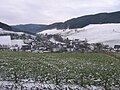
|
LSG-4715-0016
|
Open land areas around Oberhenneborn
|
B.
|
Schmallenberg
|
131.91
|
location
|
position
|
2008
|
|
|
LSG-4715-0017
|
Open land areas around Altenilpe
|
B.
|
Schmallenberg
|
87.25
|
location
|
position
|
2008
|
|
|
LSG-4715-0018
|
Outskirts of Sellinghausen
|
B.
|
Schmallenberg
|
35.27
|
location
|
position
|
2008
|
|
|
LSG-4715-0019
|
Lehmke open land area northwest of Altenilpe
|
B.
|
Schmallenberg
|
17.16
|
location
|
position
|
2008
|
|
|
LSG-4715-0020
|
Open land area Kleinsorge east of Nierentrop
|
B.
|
Schmallenberg
|
27.74
|
location
|
position
|
2008
|
|
|
LSG-4715-0021
|
Hengsiepen open land area north of Altenilpe
|
B.
|
Schmallenberg
|
1.23
|
location
|
position
|
2008
|
|
|
LSG-4715-0022
|
Open country island near the source area of the Kleine Ilpe, southwest of Niederhenneborn
|
B.
|
Schmallenberg
|
7.59
|
location
|
position
|
2008
|
|
|
LSG-4715-0023
|
Open land areas around Kirchilpe
|
B.
|
Schmallenberg
|
51.59
|
location
|
position
|
2008
|
|
|
LSG-4715-0024
|
Kuhberg open land area northwest of Dorlar
|
B.
|
Schmallenberg
|
4.72
|
location
|
position
|
2008
|
|
|
LSG-4715-0025
|
Outskirts of Dorlar
|
B.
|
Schmallenberg
|
94.46
|
location
|
position
|
2008
|
|
|
LSG-4715-0026
|
Open land areas around Mailar
|
B.
|
Schmallenberg
|
97.36
|
location
|
position
|
2008
|
|
|
LSG-4715-0027
|
Open land areas around Grimminghausen
|
B.
|
Schmallenberg
|
57.93
|
location
|
position
|
2008
|
|
|
LSG-4715-0028
|
Open country around Menkhausen
|
B.
|
Schmallenberg
|
68.42
|
location
|
position
|
2008
|
|
|
LSG-4715-0029
|
Open land areas around Niederberndorf
|
B.
|
Schmallenberg
|
126.85
|
location
|
position
|
2008
|
|
|
LSG-4715-0030
|
Open land areas around Heiminghausen
|
B.
|
Schmallenberg
|
63.40
|
location
|
position
|
2008
|
|
|
LSG-4715-0031
|
The water system of the Willohsiepens and the Rosentalsiepens with an unnamed tributary north-east of Mönekind with adjacent lean grassland north of Mönekind
|
C.
|
Schmallenberg
|
31.75
|
location
|
position
|
2008
|
|
|
LSG-4715-0032
|
Schwormecke and section of the Rarbach stream to the north and west of Sögtrop with adjacent lean grassland
|
C.
|
Schmallenberg
|
18.99
|
location
|
position
|
2008
|
|
|
LSG-4715-0033
|
Stockeisiepen between Mönekind and Sögtrop
|
C.
|
Schmallenberg
|
6.03
|
location
|
position
|
2008
|
|
|
LSG-4715-0034
|
Sections of the Rarbach from Hanxleden to the south of Oberrarbach
|
C.
|
Schmallenberg
|
29.89
|
location
|
position
|
2008
|

|
LSG-4715-0035
|
Upper course of the Henne southeast of Oberhenneborn
|
C.
|
Schmallenberg
|
22.84
|
location
|
position
|
2008
|
|
|
LSG-4715-0036
|
Buchhagener Bach south of Oberhenneborn
|
C.
|
Schmallenberg
|
17.10
|
location
|
position
|
2008
|
|
|
LSG-4715-0037
|
Sections of the Henne from Oberhenneborn to the north of Niederhenneborn
|
C.
|
Schmallenberg
|
18.75
|
location
|
position
|
2008
|
|
|
LSG-4715-0038
|
Sellmecke south of Kirchrarbach
|
C.
|
Schmallenberg
|
16.34
|
location
|
position
|
2008
|
|
|
LSG-4715-0039
|
Source area of the Hengsbeck brook
|
C.
|
Schmallenberg
|
3.42
|
location
|
position
|
2008
|
|
|
LSG-4715-0040
|
Bermecke
|
C.
|
Schmallenberg
|
9.67
|
location
|
position
|
2008
|
|
|
LSG-4715-0041
|
Spring basin of the Kleine Ilpe south-east of Kirchilpe
|
C.
|
Schmallenberg
|
7.56
|
location
|
position
|
2008
|
|
|
LSG-4715-0042
|
Section of the Ilpe with Kleiner Ilpe, Hengsiepen and Hallebach from the source to the border of the community Eslohe with adjoining lean grassland near Nierentrop
|
C.
|
Schmallenberg
|
69.38
|
location
|
position
|
2008
|
|
|
LSG-4715-0043
|
Leiße with nameless tributaries and Landenbeck Siepen
|
C.
|
Schmallenberg
|
108.07
|
location
|
position
|
2008
|
|
|
LSG-4715-0044
|
Teipeln Siepen east of Dorlar
|
C.
|
Schmallenberg
|
7.86
|
location
|
position
|
2008
|
|
|
LSG-4715-0045
|
Wenneaue from Niederberndorf to north of Grimminghausen
|
C.
|
Schmallenberg
|
43.76
|
location
|
position
|
2008
|
|
|
LSG-4715-0046
|
Siepenoberlauf with source areas east of Mailar
|
C.
|
Schmallenberg
|
3.16
|
location
|
position
|
2008
|
|
|
LSG-4715-0047
|
Spring-rich grassland complex northeast of Altenilpe
|
C.
|
Schmallenberg
|
25.29
|
location
|
position
|
2008
|
|
|
LSG-4715-0048
|
Won Passel northeast of Wenholthausen
|
B.
|
Eslohe
|
6.49
|
location
|
|
2008
|
|
|
LSG-4715-0049
|
Cultural landscape complex east of Wenholthausen
|
B.
|
Eslohe
|
93.86
|
location
|
|
2008
|
|
|
LSG-4715-0050
|
Open spaces Thülener Bruch / Schwarzes Haupt / Rösenbeck
|
|
Brilon
|
403.45
|
location
|
position
|
2001
|
|
|
LSG-4715-0051
|
Outskirts of Sallinghausen
|
B.
|
Eslohe
|
8.31
|
location
|
|
2008
|
|
|
LSG-4715-0052
|
Open land areas around Henninghausen
|
B.
|
Eslohe
|
27.92
|
location
|
|
2008
|
|
|
LSG-4715-0053
|
Outskirts of Eslohe
|
B.
|
Eslohe
|
64.87
|
location
|
|
2008
|
|
|
LSG-4715-0054
|
Outskirts of Lüdingheim and the adjacent lower slopes of the Kränzkenbach valley
|
B.
|
Eslohe
|
30.22
|
location
|
|
2008
|
|
|
LSG-4715-0055
|
Local open spaces near Erflinghausen
|
|
Meschede
|
23.58
|
location
|
position
|
1994
|
|
|
LSG-4715-0056
|
Bruch valley area south of Schüren
|
|
Meschede
|
20.19
|
location
|
position
|
1994
|
|
|
LSG-4715-0057
|
Rosental valley south of Einhaus
|
|
Meschede
|
5.01
|
location
|
position
|
1994
|
|
|
LSG-4715-0058
|
Valley area south of Köttinghausen
|
|
Meschede
|
17.99
|
location
|
position
|
1994
|
|
|
LSG-4715-0059
|
Illmecke and Bieke valleys
|
|
Meschede
|
21.09
|
location
|
position
|
1994
|
|
|
LSG-4715-0060
|
Valley areas between Mielinghausen and Erflinghausen
|
|
Meschede
|
32.46
|
location
|
position
|
1994
|
|
|
LSG-4715-0061
|
Open spaces west of Horbach
|
|
Meschede
|
57.98
|
location
|
position
|
1994
|
|
|
LSG-4715-0062
|
Ennert
|
|
Meschede
|
15.98
|
location
|
position
|
1994
|
|
|
LSG-4715-0063
|
Trebusch south of Wulstern
|
|
Meschede
|
18.07
|
location
|
position
|
1994
|
|
|
LSG-4715-0064
|
Star fracture east of Wulstern
|
|
Meschede
|
13.93
|
location
|
position
|
1994
|
|
|
LSG-4715-0065
|
Open spaces at Einhaus
|
|
Meschede
|
2.30
|
location
|
position
|
1994
|
|
|
LSG-4715-0066
|
Open spaces west of Bonacker
|
|
Meschede
|
17.59
|
location
|
position
|
1994
|
|
|
LSG-4715-0067
|
Open land areas around Oberlandenbeck
|
B.
|
Eslohe
|
36.65
|
location
|
|
2008
|
|
|
LSG-4715-0068
|
Outskirts of Hengsbeck with free slopes of the Hengsbeck Bachtal
|
B.
|
Eslohe
|
37.28
|
location
|
|
2008
|
|
|
LSG-4715-0069
|
Plateau between Büenfeld and Oesterberge
|
B.
|
Eslohe
|
92.87
|
location
|
|
2008
|
|
|
LSG-4715-0070
|
Büenfeld open land area
|
B.
|
Eslohe
|
120.30
|
location
|
|
2008
|
|
|
LSG-4715-0071
|
Open land areas around Friedrichstal
|
B.
|
Eslohe
|
16.13
|
location
|
|
2008
|
|
|
LSG-4715-0072
|
Büemke open land area
|
B.
|
Eslohe
|
54.33
|
location
|
|
2008
|
|
|
LSG-4715-0073
|
Outskirts with slopes of the Hennetal around Nichtinghausen and Herhagen
|
B.
|
Eslohe
|
145.10
|
location
|
|
2008
|
|
|
LSG-4715-0074
|
Landenbeck outskirts
|
B.
|
Eslohe
|
25.96
|
location
|
|
2008
|
|
|
LSG-4715-0075
|
Reister valley between Reiste and Bremke
|
B.
|
Eslohe
|
279.03
|
location
|
|
2008
|
|
|
LSG-4715-0076
|
Open land area between Bremke and Frielinghausen
|
B.
|
Eslohe
|
30.45
|
location
|
|
2008
|
|
|
LSG-4715-0077
|
Open land areas at Twismecke
|
B.
|
Eslohe
|
4.45
|
location
|
|
2008
|
|
|
LSG-4715-0078
|
Open land areas to the west and south of Lochtrop
|
B.
|
Eslohe
|
4.45
|
location
|
|
2008
|
|
|
LSG-4715-0079
|
Open slope areas north and west of the Netherlandsbeck
|
B.
|
Eslohe
|
31.20
|
location
|
|
2008
|
|
|
LSG-4715-0080
|
Büemker Bachtal on the eastern outskirts of Wenholthausen
|
C.
|
Eslohe
|
1.97
|
location
|
|
2008
|
|
|
LSG-4715-0081
|
Lean grassland on slopes east of Wenholthausen
|
C.
|
Eslohe
|
12.48
|
location
|
|
2008
|
|
|
LSG-4715-0082
|
The headwaters and the upper reaches of the Habbeck Siepens southwest of Wenholthausen
|
C.
|
Eslohe
|
4.59
|
location
|
|
2008
|
|
|
LSG-4715-0083
|
Silpke east of Wenholthausen
|
C.
|
Eslohe
|
4.45
|
location
|
|
2008
|
|
|
LSG-4715-0084
|
Kerbtal northeast of Friedrichstal
|
C.
|
Eslohe
|
1.66
|
location
|
|
2008
|
|
|
LSG-4715-0085
|
Upper course of the Büemker Bach
|
C.
|
Eslohe
|
6.04
|
location
|
|
2008
|
|
|
LSG-4715-0086
|
Wenne with inflow at Haus Wenne
|
C.
|
Eslohe
|
25.81
|
location
|
position
|
2008
|
|
|
LSG-4715-0087
|
Wenne between Frielinghausen and the Bremke sewage treatment plant
|
C.
|
Eslohe
|
12.93
|
location
|
position
|
2008
|
|
|
LSG-4715-0088
|
Düpke northwest of Frielinghausen
|
C.
|
Eslohe
|
4.62
|
location
|
|
2008
|
|
|
LSG-4715-0089
|
Leiße southeast of Frielinghausen
|
C.
|
Eslohe
|
5.41
|
location
|
|
2008
|
|
|
LSG-4715-0090
|
Ilpe east of Frielinghausen
|
C.
|
Eslohe
|
18.31
|
location
|
|
2008
|
|
|
LSG-4715-0091
|
Reismecke and small tributaries from east of Reiste to Bremke
|
C.
|
Eslohe
|
32.50
|
location
|
|
2008
|
|
|
LSG-4715-0092
|
Henne and tributaries from south of Landenbeck to Herhagen
|
C.
|
Eslohe
|
42.44
|
location
|
|
2008
|
|
|
LSG-4715-0093
|
Henne and tributaries from Herhagen to the north of Nichtinghausen
|
C.
|
Eslohe
|
35.44
|
location
|
|
2008
|
|
|
LSG-4715-0094
|
Hengsbecker Bach from the source area north of Landenbeckerbruch to Bremscheid
|
C.
|
Eslohe
|
87.71
|
location
|
|
2008
|
|
|
LSG-4715-0095
|
Wenne and tributary at Lochtrop
|
B.
|
Eslohe
|
16.37
|
location
|
position
|
2008
|
|
|
LSG-4715-0096
|
Kränzgenbach from the headwaters south of Oberlandenbeck to Isingheim
|
C.
|
Eslohe
|
29.91
|
location
|
|
2008
|
|
|
LSG-4716-0001
|
Schmallenberg south-east
|
A.
|
Schmallenberg
|
11,293.85
|
location
|
position
|
2005
|
|
|
LSG-4716-0002
|
Open country around Brabecke
|
B.
|
Schmallenberg
|
152.22
|
location
|
position
|
2005
|
|
|
LSG-4716-0003
|
Remaining grassland around Gellinghausen and open land islands south of Gellinghausen to Rimberg
|
B.
|
Schmallenberg
|
43.19
|
location
|
position
|
2005
|
|
|
LSG-4716-0004
|
Offenland Island Osterwald
|
B.
|
Schmallenberg
|
59.24
|
location
|
position
|
2005
|
|
|
LSG-4716-0005
|
Slope grassland in the Sorpe valley
|
B.
|
Schmallenberg
|
163.07
|
location
|
position
|
2005
|
|
|
LSG-4716-0006
|
Bödefelder Mulde
|
B.
|
Schmallenberg
|
499.21
|
location
|
position
|
2005
|
|
|
LSG-4716-0007
|
Hillside grassland in Valmetal
|
B.
|
Schmallenberg
|
1.99
|
location
|
position
|
2005
|
|
|
LSG-4716-0008
|
Brabecke and Gellinghauser Bach with side valleys from north Brabecke to Osterwald and south Bödefeld
|
C.
|
Schmallenberg
|
101.48
|
location
|
position
|
2005
|
|
|
LSG-4716-0009
|
Valmetal north and Lanfert south
|
C.
|
Schmallenberg
|
35.08
|
location
|
position
|
2005
|
|
|
LSG-4716-0010
|
Walbeck valley south of Walbeck
|
C.
|
Schmallenberg
|
8.65
|
location
|
position
|
2005
|
|
|
LSG-4716-0011
|
Sorpe valley with side valleys
|
C.
|
Schmallenberg
|
82.38
|
location
|
position
|
2005
|

|
LSG-4716-0012
|
Upper course of the Kleine Henne northwest of Westernbödefeld
|
C.
|
Schmallenberg
|
11.75
|
location
|
position
|
2005
|
|
|
LSG-4716-0013
|
Lean grassland parcels on slopes in the Sorpe Valley
|
C.
|
Schmallenberg
|
7.12
|
location
|
position
|
2005
|
|
|
LSG-4716-0014
|
Open land areas around Dornheim
|
B.
|
Schmallenberg
|
60.06
|
location
|
position
|
2008
|
|
|
LSG-4716-0015
|
Rimberg open land area
|
B.
|
Schmallenberg
|
4.64
|
location
|
position
|
2008
|
|
|
LSG-4716-0016
|
Dornheimer Bach north and south of Dornheim
|
C.
|
Schmallenberg
|
15.94
|
location
|
position
|
2008
|
|
|
LSG-4716-0017
|
Valley system of the negroes
|
C.
|
Winterberg
|
26.53
|
location
|
position
|
2005
|
|
|
LSG-4716-0018
|
Valley area Kleine Henne south of Höringhausen
|
|
Meschede
|
7.13
|
location
|
position
|
1994
|
|
|
LSG-4716-0019
|
Valley areas of the Bieke and the Kleine Henne near Bonacker
|
|
Meschede
|
21.20
|
location
|
position
|
1994
|
|
|
LSG-4716-0020
|
Twilmecker field
|
|
Bestwig
|
7.54
|
location
|
|
2008
|
|
|
LSG-4716-0021
|
Clearing islands between Scheidt and Hohenstein
|
|
Bestwig
|
15.91
|
location
|
|
2008
|
|
|
LSG-4716-0022
|
Bödefelder Mulde
|
B.
|
Winterberg
|
454.27
|
location
|
|
2005
|
|
|
LSG-4716-0023
|
Grassland slopes and plateaus around Altastenberg - Neuastenberg - Langewiese - Hoheleye - Mollseifen
|
B.
|
Winterberg
|
140.23
|
location
|
|
2005
|
|
|
LSG-4716-0024
|
Elpe valley system
|
C.
|
Winterberg
|
20.98
|
location
|
position
|
2005
|
|
|
LSG-4716-0025
|
Winterberg
|
A.
|
Winterberg
|
8779.91
|
location
|
position
|
2005
|
|
|
LSG-4716-0026
|
Cultural and open landscape complex Brunskappel
|
|
Olsberg
|
89.84
|
location
|
position
|
1984
|
|
|
LSG-4716-0027
|
Open landscape complex Elpe
|
|
Olsberg
|
184.43
|
location
|
position
|
1984
|
|
|
LSG-4716-0028
|
Heinrichsdorf open landscape complex
|
|
Olsberg
|
25.17
|
location
|
position
|
1984
|
|
|
LSG-4717-0001
|
Medebach
|
|
Medebach
|
4461.14
|
location
|
position
|
1983
|
|
|
LSG-4717-0002
|
Küstelberg cultural landscape complex
|
|
Medebach
|
107.56
|
location
|
position
|
1983
|
|
|
LSG-4717-0003
|
Deifeld-Wissinghausen cultural landscape complex
|
|
Medebach
|
89.76
|
location
|
position
|
1983
|
|
|
LSG-4717-0004
|
Rennefeld clearing island
|
|
Medebach
|
18.94
|
location
|
position
|
1983
|
|
|
LSG-4717-0005
|
North of Medebach: Düdinghauser Hochmulde, valley areas and slopes
|
|
Medebach
|
926.19
|
location
|
position
|
1983
|
|
|
LSG-4717-0006
|
Sperrenberg clearing island
|
B.
|
Olsberg
|
9.11
|
location
|
position
|
1984
|
|
|
LSG-4717-0007
|
Open country around Niedersfeld
|
B.
|
Winterberg
|
86.88
|
location
|
|
2005
|
|
|
LSG-4717-0008
|
Cultural landscape complex Grönebach - Hildfeld
|
B.
|
Winterberg
|
293.36
|
location
|
|
2005
|
|
|
LSG-4717-0009
|
Slopes and high areas around Winterberg and Elkeringhausen
|
B.
|
Winterberg
|
115.17
|
location
|
|
2005
|
|
|
LSG-4717-0010
|
Ellenberg
|
C.
|
Winterberg
|
9.38
|
location
|
position
|
2005
|
|
|
LSG-4717-0011
|
Lower fields Ruhr and side valleys
|
C.
|
Winterberg
|
31.70
|
location
|
position
|
2005
|
|
|
LSG-4717-0012
|
Hillebach inlets and grassland complex near Hildfeld
|
C.
|
Winterberg
|
48.60
|
location
|
position
|
2005
|
|
|
LSG-4717-0013
|
Eschenberg
|
C.
|
Winterberg
|
17.49
|
location
|
position
|
2005
|
|
|
LSG-4717-0014
|
Stallion head
|
C.
|
Winterberg
|
4.96
|
location
|
position
|
2005
|
|
|
LSG-4717-0015
|
Grassland islands around Winterberg
|
C.
|
Winterberg
|
99.66
|
location
|
position
|
2005
|
|
|
LSG-4718-0001
|
Cultural landscape complex on the Wede north of Düdinghausen
|
|
Medebach
|
39.79
|
location
|
position
|
1983
|
|
|
LSG-4718-0002
|
Open landscape complex Düdinghausen - Referinghausen - Oberschledorn
|
|
Medebach
|
239.43
|
location
|
position
|
1983
|
|
|
LSG-4718-0003
|
Cultural landscape complex Medebach
|
|
Medebach
|
620.35
|
location
|
position
|
1983
|
|
|
LSG-4814-0001
|
Open land areas around Gleierhaus south of Bracht
|
B.
|
Schmallenberg
|
20.38
|
location
|
position
|
2008
|

|
LSG-4814-0002
|
Outskirts of Bracht
|
B.
|
Schmallenberg
|
99.19
|
location
|
position
|
2008
|
|
|
LSG-4814-0003
|
Open land areas around Hebbecke and Rotbusch southwest of Bracht
|
B.
|
Schmallenberg
|
19.98
|
location
|
position
|
2008
|
|
|
LSG-4814-0004
|
Elsmecke and the adjoining spring basin northwest of Bracht
|
C.
|
Schmallenberg
|
22.02
|
location
|
position
|
2008
|
|
|
LSG-4814-0005
|
Open land areas around Schwartmecke and Leckmart
|
B.
|
Eslohe
|
78.35
|
location
|
|
2008
|
|
|
LSG-4814-0006
|
Source area of the Gleierbach and nameless tributary near Gleierhaus south of Bracht
|
C.
|
Schmallenberg
|
8.94
|
location
|
position
|
2008
|
|
|
LSG-4814-0007
|
Sections of the Hebbecker Siepen southwest of Bracht
|
C.
|
Schmallenberg
|
7.78
|
location
|
position
|
2008
|
|
|
LSG-4814-0008
|
Source area of the Lehmkuhler Siepen near the Fleper residential area
|
B.
|
Eslohe
|
6.23
|
location
|
|
2008
|
|
|
LSG-4814-0009
|
Vossel with tributaries south of Cobbenrode
|
B.
|
Eslohe
|
45.98
|
location
|
|
2008
|
|
|
LSG-4814-0010
|
Source region and upper reaches of the Schwartmecke west of the Schwartmecke residential area
|
A.
|
Eslohe
|
9.33
|
location
|
|
2008
|
|
|
LSG-4815-0001
|
Open country slopes around Gleidorf
|
B.
|
Schmallenberg
|
73.81
|
location
|
position
|
2005
|
|
|
LSG-4815-0002
|
Outskirts and open land areas around Schmallenberg
|
B.
|
Schmallenberg
|
143.52
|
location
|
position
|
2005
|
|
|
LSG-4815-0003
|
Cultural landscape and open land complex around Holthausen
|
B.
|
Schmallenberg
|
316.11
|
location
|
position
|
2005
|

|
LSG-4815-0004
|
Offenlandmulde Grafschaft - Almert
|
B.
|
Schmallenberg
|
241.80
|
location
|
position
|
2005
|
|
|
LSG-4815-0005
|
Outskirts of the village Hundesossen
|
B.
|
Schmallenberg
|
23.44
|
location
|
position
|
2005
|
|
|
LSG-4815-0006
|
Outskirts and remaining grassland around Lenne
|
B.
|
Schmallenberg
|
39.80
|
location
|
position
|
2005
|

|
LSG-4815-0007
|
Clearing island hunting lodge
|
B.
|
Schmallenberg
|
17.26
|
location
|
position
|
2005
|
|
|
LSG-4815-0008
|
Summer side and outskirts of Latrop
|
B.
|
Schmallenberg
|
61.03
|
location
|
position
|
2005
|
|
|
LSG-4815-0009
|
Outskirts and hillside grassland around Winkhausen and Oberkirchen
|
B.
|
Schmallenberg
|
109.06
|
location
|
position
|
2005
|
|
|
LSG-4815-0010
|
Agricultural priority area between Schmallenberg and Fleckenberg
|
B.
|
Schmallenberg
|
133.07
|
location
|
position
|
2005
|
|
|
LSG-4815-0011
|
Outskirts of Fleckenberg
|
C.
|
Schmallenberg
|
47.74
|
location
|
position
|
2005
|
|
|
LSG-4815-0012
|
Outskirts of Werpe
|
B.
|
Schmallenberg
|
7.00
|
location
|
position
|
2005
|
|
|
LSG-4815-0013
|
Leisse with side valleys west of Bad Fredeburg
|
C.
|
Schmallenberg
|
22.92
|
location
|
position
|
2005
|
|
|
LSG-4815-0014
|
Lenne side valleys between Hundesossen and Latrop
|
C.
|
Schmallenberg
|
40.20
|
location
|
position
|
2005
|
|
|
LSG-4815-0015
|
County's valley and side valleys
|
C.
|
Schmallenberg
|
104.09
|
location
|
position
|
2005
|
|
|
LSG-4815-0016
|
Lennetal from east of Westfeld to west of Hundesossen
|
C.
|
Schmallenberg
|
198.63
|
location
|
position
|
2005
|
|
|
LSG-4815-0017
|
Lean grassland complex west of Schmallenberg
|
C.
|
Schmallenberg
|
25.04
|
location
|
position
|
2005
|
|
|
LSG-4815-0018
|
Extensive grassland on the lower slopes of the Beerenberg north of Fleckenberg
|
C.
|
Schmallenberg
|
4.14
|
location
|
position
|
2005
|
|
|
LSG-4815-0019
|
Open land areas around Harbecke
|
B.
|
Schmallenberg
|
36.21
|
location
|
position
|
2008
|
|
|
LSG-4815-0020
|
Outskirts of Werpe
|
B.
|
Schmallenberg
|
101.92
|
location
|
|
2008
|
|
|
LSG-4815-0021
|
Remaining open land to the west and east of Kückelheim
|
B.
|
Schmallenberg
|
5.13
|
location
|
position
|
2008
|
|
|
LSG-4815-0022
|
Werntrop / Selkentrop / Felbecke open country complex
|
B.
|
Schmallenberg
|
386.82
|
location
|
position
|
2008
|
|
|
LSG-4815-0023
|
Open land areas Keppel / Silberg / Landenbeckerbruch north of Arpe
|
B.
|
Schmallenberg
|
42.44
|
location
|
position
|
2008
|
|
|
LSG-4815-0024
|
Open land areas north and east of Arpe
|
B.
|
Schmallenberg
|
34.40
|
location
|
position
|
2008
|

|
LSG-4815-0025
|
Open land areas around Oberberndorf
|
B.
|
Schmallenberg
|
61.42
|
location
|
position
|
2008
|
|
|
LSG-4815-0026
|
Open land areas around Wormbach
|
B.
|
Schmallenberg
|
75.66
|
location
|
position
|
2008
|
|
|
LSG-4815-0027
|
Open country around Berghausen
|
B.
|
Schmallenberg
|
135.76
|
location
|
position
|
2008
|

|
LSG-4815-0028
|
Open land areas around Herschede north of Bracht
|
B.
|
Schmallenberg
|
45.22
|
location
|
position
|
2008
|
|
|
LSG-4815-0029
|
Habichtshof open land area northwest of Ebbinghof
|
B.
|
Schmallenberg
|
9.54
|
location
|
position
|
2008
|

|
LSG-4815-0030
|
Open country around Ebbinghof
|
B.
|
Schmallenberg
|
64.96
|
location
|
position
|
2008
|
|
|
LSG-4815-0031
|
Open land between Ebbinghof and Wormbacher Mühle
|
B.
|
Schmallenberg
|
43.14
|
location
|
position
|
2008
|

|
LSG-4815-0032
|
Open land areas around Obringhausen
|
B.
|
Schmallenberg
|
99.38
|
location
|
position
|
2008
|
|
|
LSG-4815-0033
|
Confluence of the Eimecker Siepen and Burbecke southwest of Harbecke
|
C.
|
Schmallenberg
|
1.44
|
location
|
position
|
2008
|
|
|
LSG-4815-0034
|
Grassland complexes south of Arpe
|
C.
|
Schmallenberg
|
54.47
|
location
|
position
|
2008
|
|
|
LSG-4815-0035
|
Harbecker Siepen to the southwest and the source area to the north of Harbecke with adjoining lean grassland
|
C.
|
Schmallenberg
|
6.88
|
location
|
position
|
2008
|
|
|
LSG-4815-0036
|
Bruchbach and Witmecke west of Werntrop
|
C.
|
Schmallenberg
|
29.82
|
location
|
position
|
2008
|
|
|
LSG-4815-0037
|
Brachter Bach east of Bracht
|
C.
|
Schmallenberg
|
13.29
|
location
|
position
|
2008
|
|
|
LSG-4815-0038
|
Wenne tributaries west of Berghausen
|
C.
|
Schmallenberg
|
24.68
|
location
|
position
|
2008
|

|
LSG-4815-0039
|
Werde, Selkentrop Bach and Wehrsiepen between Werpe and Selkentrop and Oberberndorf
|
C.
|
Schmallenberg
|
83.65
|
location
|
position
|
2008
|

|
LSG-4815-0040
|
Vossmecke and Wennetal between Obringhausen and Niederberndorf
|
C.
|
Schmallenberg
|
76.15
|
location
|
position
|
2008
|

|
LSG-4815-0041
|
Wurmbach northwest of Wormbach
|
C.
|
Schmallenberg
|
20.10
|
location
|
position
|
2008
|
|
|
LSG-4815-0042
|
Arpetal between Arpe and Niederberndorf
|
C.
|
Schmallenberg
|
26.95
|
location
|
position
|
2008
|
|
|
LSG-4815-0043
|
Upper reaches of the Silbecke, the Papenschlade and the Hardtsiepens north of Arpe
|
C.
|
Schmallenberg
|
24.15
|
location
|
position
|
2008
|
|
|
LSG-4815-0044
|
Arpetal and Seismecke with spring tributaries west and south-west of Arpe
|
C.
|
Schmallenberg
|
25.36
|
location
|
position
|
2008
|
|
|
LSG-4815-0045
|
Mühlenbach from north of Werntrop to Arpe
|
C.
|
Schmallenberg
|
27.98
|
location
|
position
|
2008
|
|
|
LSG-4815-0046
|
Heimke south of Arpe
|
C.
|
Schmallenberg
|
5.79
|
location
|
position
|
2008
|
|
|
LSG-4815-0047
|
Herschede Siepen north of Bracht
|
C.
|
Schmallenberg
|
13.16
|
location
|
position
|
2008
|
|
|
LSG-4815-0048
|
Open land area north of Landenbeckerbruch
|
B.
|
Eslohe
|
3.34
|
location
|
|
2008
|
|
|
LSG-4815-0049
|
The source area of the Hardtsiepen near Landenbeckerbruch
|
B.
|
Schmallenberg
|
1.07
|
location
|
|
2008
|
|
|
LSG-4816-0002
|
Clearing island Schanze
|
B.
|
Schmallenberg
|
27.06
|
location
|
position
|
2005
|
|
|
LSG-4816-0003
|
Grassland islands in the Rothaargebirge between Esmecke residential area and Vorwald
|
B.
|
Schmallenberg
|
52.32
|
location
|
position
|
2005
|
|
|
LSG-4816-0004
|
Westfeld-Ohlenbach open land complex
|
B.
|
Schmallenberg
|
158.62
|
location
|
position
|
2005
|
|
|
LSG-4816-0005
|
Western outskirts of Langewiese
|
B.
|
Schmallenberg
|
8.15
|
location
|
position
|
2005
|
|
|
LSG-4816-0006
|
Open country slopes around Inderlenne and Lengenbeck
|
B.
|
Schmallenberg
|
5.94
|
location
|
position
|
2005
|

|
LSG-4816-0007
|
Cultural landscape complex Nordenau - Nesselbach
|
B.
|
Schmallenberg
|
112.75
|
location
|
position
|
2005
|
|
|
LSG-4816-0008
|
Valley systems of Gleierbach (with adjacent lean grassland) and Westernahbach with Jübecke and of Schmalnau with Siepen between Gleidorf and Huxel and Holthausen
|
C.
|
Schmallenberg
|
65.96
|
location
|
position
|
2005
|
|
|
LSG-4816-0009
|
Stream valleys from Hartmecke and Lüttmecke south and from Waldsiepen and Großer Bellmecke east of Oberkirchen
|
C.
|
Schmallenberg
|
28.71
|
location
|
position
|
2005
|
|
|
LSG-4816-0010
|
Schmittmecke south of Westfeld
|
C.
|
Schmallenberg
|
8.34
|
location
|
position
|
2005
|
|
|
LSG-4816-0011
|
Black Siepen stream valley between Westfeld and northeast Ohlenbach
|
C.
|
Schmallenberg
|
14.71
|
location
|
position
|
2005
|
|
|
LSG-4816-0012
|
Nesselbach, Basemicke, Schauerte and Albers Siepen and valley sections of the Lengenbeck
|
C.
|
Schmallenberg
|
46.37
|
location
|
position
|
2005
|
|
|
LSG-4816-0013
|
Lean hillside grassland around Lengenbeck
|
C.
|
Schmallenberg
|
11.99
|
location
|
position
|
2005
|
|
|
LSG-4816-0014
|
Ohlmecke in Ohlenbach
|
C.
|
Schmallenberg
|
5.26
|
location
|
position
|
2005
|
|
|
LSG-4816-0015
|
Esenbecktal north of Inderlenne
|
C.
|
Schmallenberg
|
4.35
|
location
|
position
|
2005
|
|
|
LSG-4816-0016
|
Lean grassland island southeast of Westfeld
|
C.
|
Schmallenberg
|
1.27
|
location
|
position
|
2005
|
|
|
LSG-4816-0017
|
Kahler Asten ski area
|
C.
|
Winterberg
|
4.63
|
location
|
position
|
2005
|
|
|
LSG-4816-0018
|
Post meadow and lean grassland near Neuastenberg
|
C.
|
Winterberg
|
46.89
|
location
|
position
|
2005
|
|
|
LSG-4816-0020
|
Open spaces and clearing islands in the Rothaar Mountains
|
B.
|
Winterberg
|
41.15
|
location
|
|
2005
|

|
LSG-4816-0021
|
Westfalenhang
|
C.
|
Winterberg
|
25.19
|
location
|
position
|
2005
|

|
LSG-4817-0001
|
Glindfeld forest clearing
|
|
Medebach
|
36.30
|
location
|
position
|
1983
|
|
|
LSG-4817-0002
|
Cultural landscape complex mountains - Dreislar
|
|
Medebach
|
119.15
|
location
|
position
|
1983
|
|
|
LSG-4817-0003
|
Medelon Cultural Landscape Complex
|
|
Medebach
|
82.34
|
location
|
position
|
1983
|
|
|
LSG-4817-0004
|
Medebacher south: valley areas and slopes around mountains and Dreislar
|
|
Medebach
|
664.81
|
location
|
position
|
1983
|
|
|
LSG-4817-0005
|
Medebacher core area: spring troughs, low areas and flat slopes
|
|
Medebach
|
891.25
|
location
|
position
|
1983
|
|
|
LSG-4817-0006
|
Grassland at the kipper
|
C.
|
Hallenberg
|
20.52
|
location
|
position
|
2004
|
|
|
LSG-4817-0007
|
Grassland complex north and south of the Mahlbach
|
C.
|
Hallenberg
|
69.74
|
location
|
position
|
2004
|
|
|
LSG-4817-0008
|
Grassland west of Hesborn
|
C.
|
Hallenberg
|
43.62
|
location
|
position
|
2004
|
|
|
LSG-4817-0009
|
Mertenshorn grassland area west of the Liesetal
|
C.
|
Hallenberg
|
22.16
|
location
|
position
|
2004
|
|
|
LSG-4817-0010
|
Grassland south of Hesborn
|
C.
|
Hallenberg
|
28.24
|
location
|
position
|
2004
|
|
|
LSG-4817-0011
|
Liesetal north of Liesen
|
C.
|
Hallenberg
|
4.33
|
location
|
position
|
2004
|
|
|
LSG-4817-0012
|
Hedge-grassland complex on Galgenberg
|
C.
|
Hallenberg
|
85.82
|
location
|
position
|
2004
|
|
|
LSG-4817-0013
|
Hallenberg forest landscape
|
A.
|
Hallenberg
|
2322.31
|
location
|
position
|
2004
|
|
|
LSG-4817-0014
|
Grassland at Freie Stein
|
C.
|
Hallenberg
|
55.73
|
location
|
position
|
2004
|
|
|
LSG-4817-0015
|
Liesetal
|
C.
|
Hallenberg
|
20.04
|
location
|
position
|
2004
|
|
|
LSG-4817-0016
|
Wehlenbachtal and Heidebachtal
|
C.
|
Hallenberg
|
75.89
|
location
|
position
|
2004
|
|
|
LSG-4817-0017
|
Grassland between Hallenberg and Braunshausen
|
C.
|
Hallenberg
|
233.31
|
location
|
position
|
2004
|
|
|
LSG-4817-0018
|
Grassland west of Hallenberg
|
C.
|
Hallenberg
|
35.7
|
location
|
position
|
2004
|
|
|
LSG-4817-0019
|
Lower Weifetal
|
C.
|
Hallenberg
|
18.75
|
location
|
position
|
2004
|

|
LSG-4817-0020
|
Lean grassland south of Hallenberg
|
C.
|
Hallenberg
|
46.47
|
location
|
position
|
2004
|
|
|
LSG-4817-0021
|
Grassland south of the guard
|
C.
|
Hallenberg
|
47.72
|
location
|
position
|
2004
|
|
|
LSG-4817-0022
|
Grassland southwest of Braunshausen
|
C.
|
Hallenberg
|
53.64
|
location
|
position
|
2004
|
|
|
LSG-4817-0023
|
Upper Nuhnetal
|
C.
|
Hallenberg
|
1.76
|
location
|
position
|
2004
|
|
|
LSG-4817-0024
|
Hallenberg hill country
|
B.
|
Hallenberg
|
1038.85
|
location
|
position
|
2004
|
|
|
LSG-4817-0025
|
Open country around Züschen
|
B.
|
Winterberg
|
102.40
|
location
|
position
|
2005
|
|
|
LSG-4817-0026
|
Lower Berkmecke
|
C.
|
Winterberg
|
16.37
|
location
|
position
|
2005
|
|
|
LSG-4817-0027
|
Homberg and poor grassland near Züschen
|
C.
|
Winterberg
|
38.65
|
location
|
position
|
2005
|
|
|
LSG-4818-0001
|
Grassland north and east of the Heideknipp
|
C.
|
Hallenberg
|
44.56
|
location
|
position
|
2004
|
|
|
LSG-4818-0002
|
Grassland east of the plant mountain
|
C.
|
Hallenberg
|
22.59
|
location
|
position
|
2004
|
|
|
LSG-4818-0003
|
Grassland northwest of the Wasserlehne
|
C.
|
Hallenberg
|
32.32
|
location
|
position
|
2004
|
|
|
LSG-4818-0004
|
Crown Hill
|
C.
|
Hallenberg
|
2.64
|
location
|
position
|
2004
|


.jpg)


.jpg)


.JPG)
.jpg)


.jpg)
.jpg)
.jpg)
.jpg)
.jpg)


.jpg)


.jpg)
.jpg)
